
Quick report
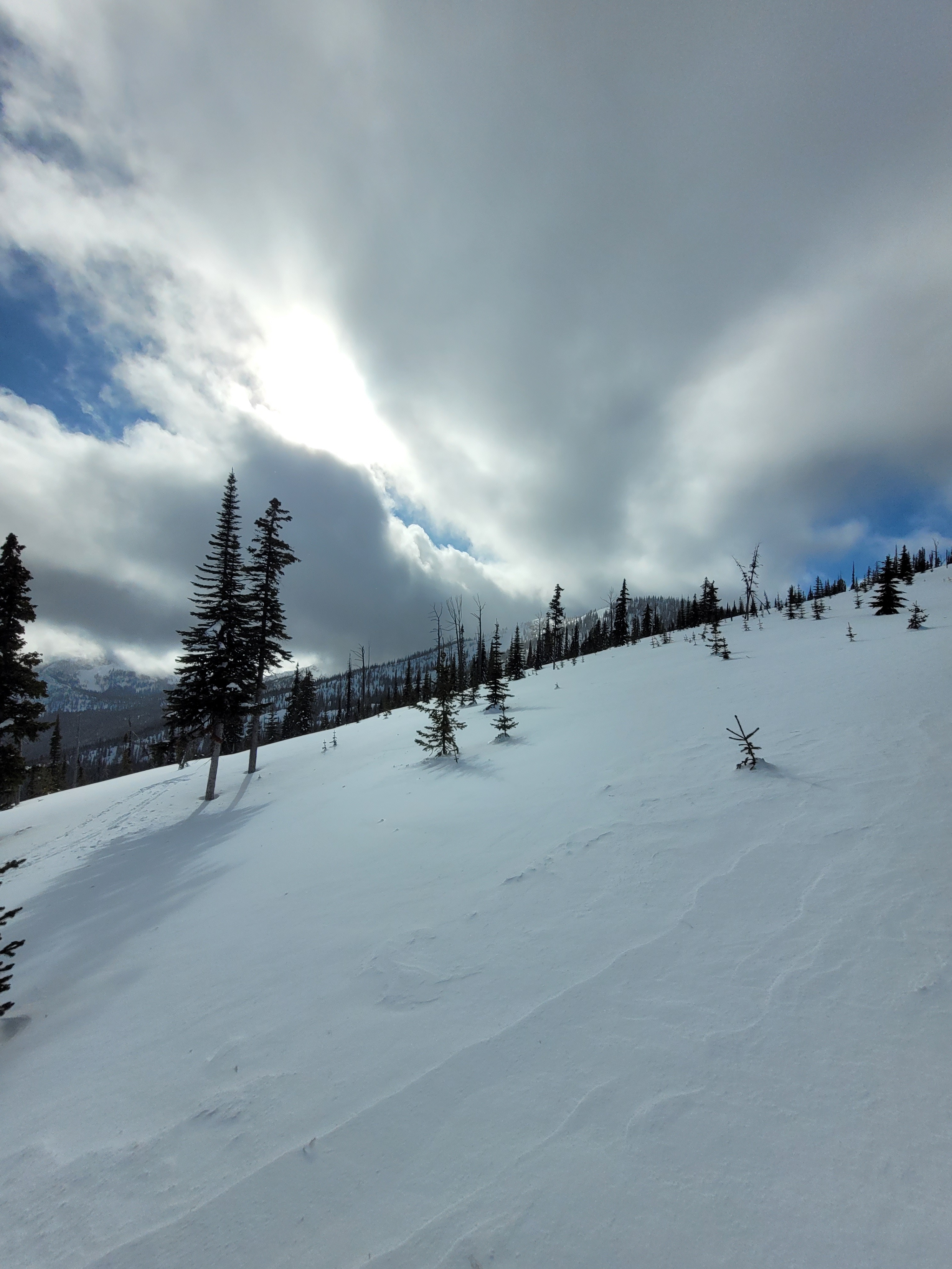
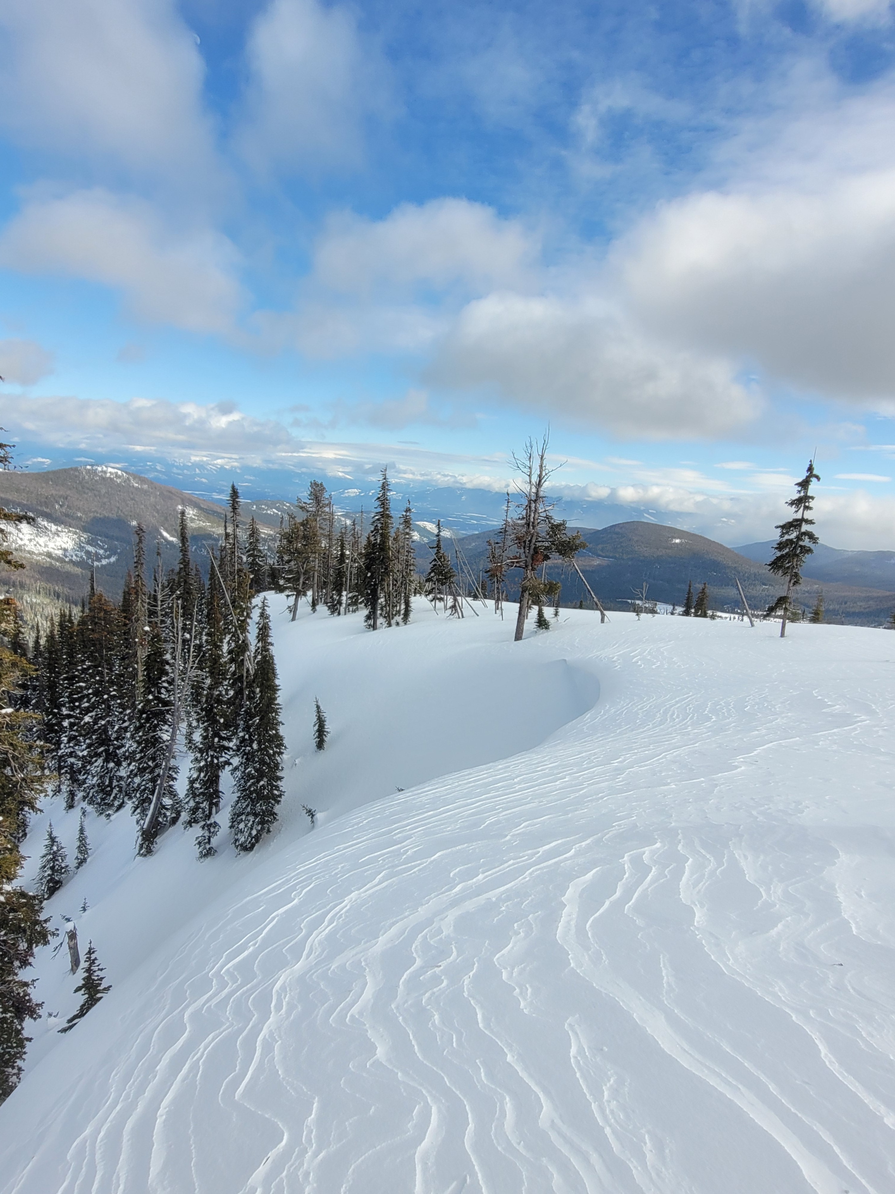
The weather continues to change the snowpack and today gusty south winds were affecting surfaces, transporting snow onto northerly aspects, and strong enough to cross load terrain features in between.
Weather
- Cloud Cover
- broken
- Wind Loading
- moderate
- Snow Avail For Transport
- moderate amounts
Broken sky cover transitioned to overcast skies with fast moving upper cloud breaks. Steady south winds increased in the afternoon along exposed ridgeline. Gusts were moderate and actively transporting snow.
Snowpack
While traveling on foot we observed inconsistent changes underfoot due to wind affect. Ski surface penetration varied but was about 5cm on average. There was enough snow available on the surface and strong enough south winds to activity transport onto north aspects. We observed very isolated cracking between tracks in varied wind pillowed locations.
At 6250 feet on a Northeast aspect we observed a snowpack height of 300cm. The top 20cm was wind affected and firmer over softer snow below. Snowpack test results on this hand hardness step change showed CT11 SP and ECTN 10 down 20cm from the surface. No other test results were observed at this location. Below the the top wind affected snow we observed a right side up snowpack hardness profile with 1F- hard small (0.5mm average) facets above the mid January crust. The mid January crust (consistent Knife hard throughout, 15cm thick) was down120cm from the surface.
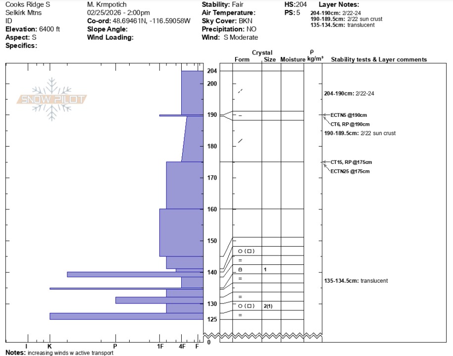
On a nearby South aspect at 6400 feet we observed a snowpack height of 204cm. The top 15cm was wind affected 4F hard snow on top of a (1F hard, 0.5cm thick) sun crust from 3 days ago on February 22. We observed ECTN 5 and CT 6 RP on top of the 2/22 sun crust. Deeper, on a storm snow hardness change down 30 cm we observed CT 15 RP and ECTN 25. No other test results were observed at this pit location. A notable difference at this location verse the north aspect was the sandwich of crusts - decomposing melt forms and small facets (<1mm) - from early February and mid-January crusts. These crusts ranged from 65 to 80cm below the surface. The attached snowpilot shows more details. A thin sun crust formed on todays snow surface in the afternoon from the morning to mid-day sun.