
Quick report
- Aspect
- Northeast
- Elevation
- 2713 m
- Slope Angle
- 19°
- Red Flags Comment
- <p>No red flags today, although there are still plenty of facets at the base of the snowpack which is always a little concerning.</p>
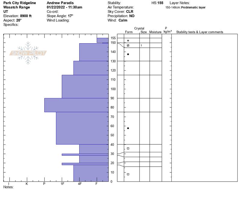
There were two snow items I was interested in today. The first was if faceted snow from the recent dry spell was preserved below the most recent small amount of new snow. In protected north facing areas, I was able to find near surface facets that have been preserved under the new snow. I could also see a slight density change in the most recent new snow (see photo below). It looks like another week of dry weather, so it all may facet by the time it snows again.
The second item was the strength of the facets and slab above them. Looking back at snow pits from prior years in this location, the current snow pack is really quite strong. The snow in late December/early January fell quickly and built a strong cohesive slab. The facets were still pretty loose and sugary to the touch.
Friday was a bit foggy and appears to have created widespread surface hoar. There is a good chance that this will be destroyed before it snows but interesting anyway.
Snowpack
- Instability Comment
- <p>Mid pack is really strong and thick, effectively capping the facets. The new snow was pretty insignificant from an avalanche point of view where we were. This combined to make for pretty safe conditions. </p>
The small amount of new snow went a long ways to improving the snow surface. Old tracks were still visible and you could feel them a little but not nearly as much as before. South aspects were getting warm and maybe would have softened later in the day.