
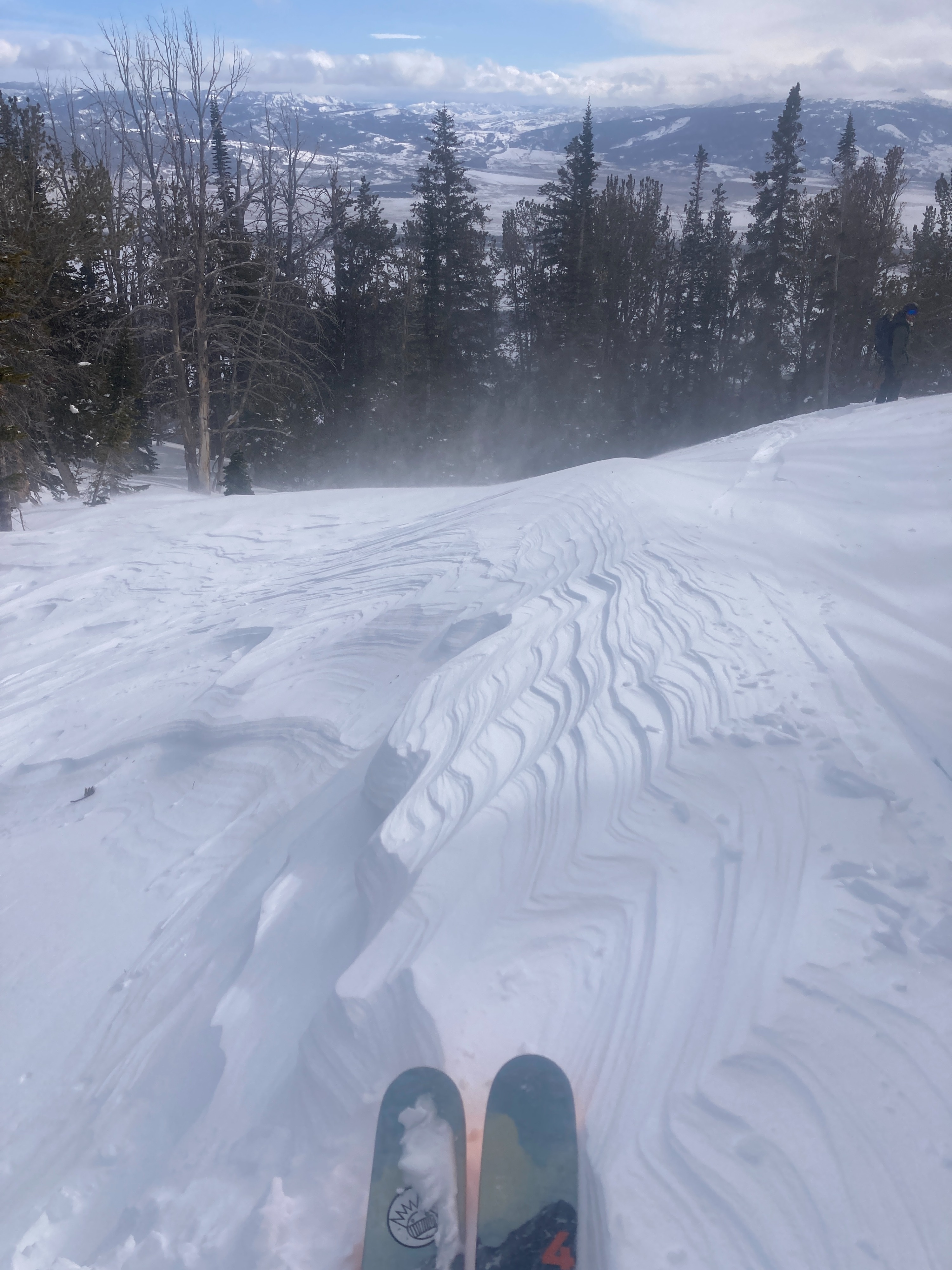
Quick report
We dug two pits to investigate the interface between recent snow and the January Drought:
9,400' NE Aspect: HS 104" ECTN22 down 20" (50 cm) just above the drought interface on fragmented particles. The slab above the January Drought Layer was right side up going from fist hard at the surface to four finger hard snow about halfway down. Below the interface was mostly 1 finger hard snow that was made up of 0.5mm rounding facets/mixed forms. Overall assessment of the snowpack stability in this area was encouraging. Moderate strength, fair structure (1-2 Lemons out of 5), no propagation propensity, low continuity in weak layer development in this area.
8600' ENE: HS 70 inches ECTN17 down 16" (40cm) at the drought interface. One difference here (compared to the above observation) was that immediately below the drought interface, there was noticeably weaker snow - about 10 cm of 4 finger minus/fist plus 1mm facets. And while there was still no propagation, as the snow continues to settle and we receive more of a snow load later this week, it could become more of a problem. As it is now, there just isn't much in the way of a cohesive slab above the interface. This could change soon. Moderate strength, poor structure (4 out of 5 lemons), no propagation propensity, better continuity of weak layer development at this aspect/elevation band.
The continuing message is that there is a lot of spatial variability in the snowpack right now with regard to weak layer distribution, and it is prudent to continue digging down to investigate this interface before committing to steep slopes as the snowpack adjusts to the current (and incoming) load. Even though the east side of GTNP seems to have a stronger snowpack than surrounding areas such as Teton Pass and the west side of the Tetons, there are still areas of weak snow capable of producing large avalanches.
We did not see and cracking or hear any collapsing. Surface snow was sluffing easily on steep, shady slopes above 8,400 feet.Weather
- Cloud Cover
- scattered
- Snow Avail For Transport
- moderate amounts
Quite windy from the valley floor up to the weather station. There was some reprieve along the ascent, but there was a wind effect in many areas. Light snow (and very gusty valley winds) this morning gave way to overcast skies and then mostly sunny in the park. A dynamic day for sure, and many areas to the north and south remained cloudy.
Snowpack
4-6 new inches of snow in the last 24 hours was getting transported in many areas. New drifts from gusty valley winds had formed at low elevations in exposed areas. Middle elevation snow surfaces were mostly wind-pressed with drifts in exposed areas. We found shallow but stiff wind slab on exposed slopes down to about 9,300 feet. In exposed areas, new snow has been blown off exposing old crusts. Old tracks and crusts at lower elevations with only a few inches of new snow could be easily felt.
Surprise Interval board: 17" snow, 2.4" SWE, HS 98 inches (Last cleared 2/5)
Avalanche
We saw what looked like a shallow (~35 cm) D1 wind slab on the SE face of Dissapointment Peak at approximately 10,800 feet (technically above our forecast zone).