
Quick report
Snowy, Windy, and Wet
A common theme this season during storms. Heavy snowfall of 1"/hour. Strong SW wind forming fresh slabs by the afternoon primarily in upper elevations and covering tracks rapidly within the hour. Right-side up new snow in the morning, although temps were warming upon departure (13:30) and rain developed in Jackson. Recent snow depths vary drastically due to all the strong wind events. Completely scoured to 50-70cm above the rain crust in middle-upper elevations. No storm slab character due to temperature.
3-4" of SWE has fallen on the rain crust formed 12/10 and buried 12/17. Although widespread, there's a lot of variability in this rain crust based on elevation and aspect (See Snowpack section). The fact of the matter is right now this storm is putting a lot of weight rapidly on a cohesive bed surface. Avalanches could be capable of breaking on this interface even without weak, persistent grains if enough snow falls. It's also worth noting all the storm interfaces and density changes that have formed above the crust.
Poor visible with no signs of recent avalanches. Did not travel into heavily wind loaded terrain and did not experience any shooting cracks.
Snowpack
As mentioned above, you can find a lot of variability of the rain crust buried 12/17 by simply probing and feeling the difference in hardness. Temperature, wind, and snowfall influenced how this crust was initially buried and how it will remain buried (except windward, scoured slopes).
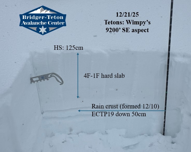
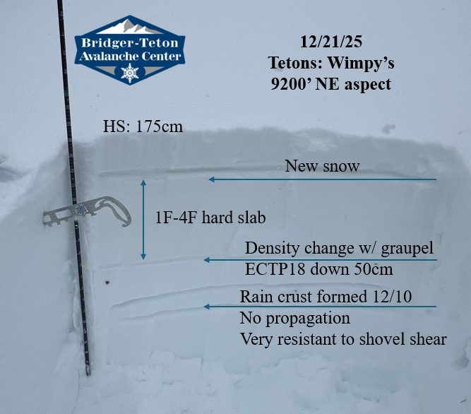
To articulate this, I dug two snowpits within a few hundred yards of each other to compare changes in aspect at the same elevation, 9200'.
SE aspect HS: 125cm ECTP19 on small facets and graupel above the rain crust down 50cm. The overlying slab sheared quickly and forcefully when it collapsed.
ENE aspect HS: 175cm ECTP18 on a storm interface (graupel) down 50cm. No propagation on the rain crust buried 70cm. The overlying slab stayed connected to the crust with a shovel shear test. Impressive cohesion.