
Quick report
We rode towards the T trail from CD (trying to reach F from CD towards Buckskin Knoll, but encountered a bulldozed section that did not make for very fun riding). Winds over the past week have worked the snow surface. Better riding can be found on protected slopes, but finding snow that was not wind-effected was difficult. Lava Mountain was stripped almost entirely of snow. Sadly, I did not take more photos of the day due to cold temps and an inability to see anything through all the snow being stripped in the wind.
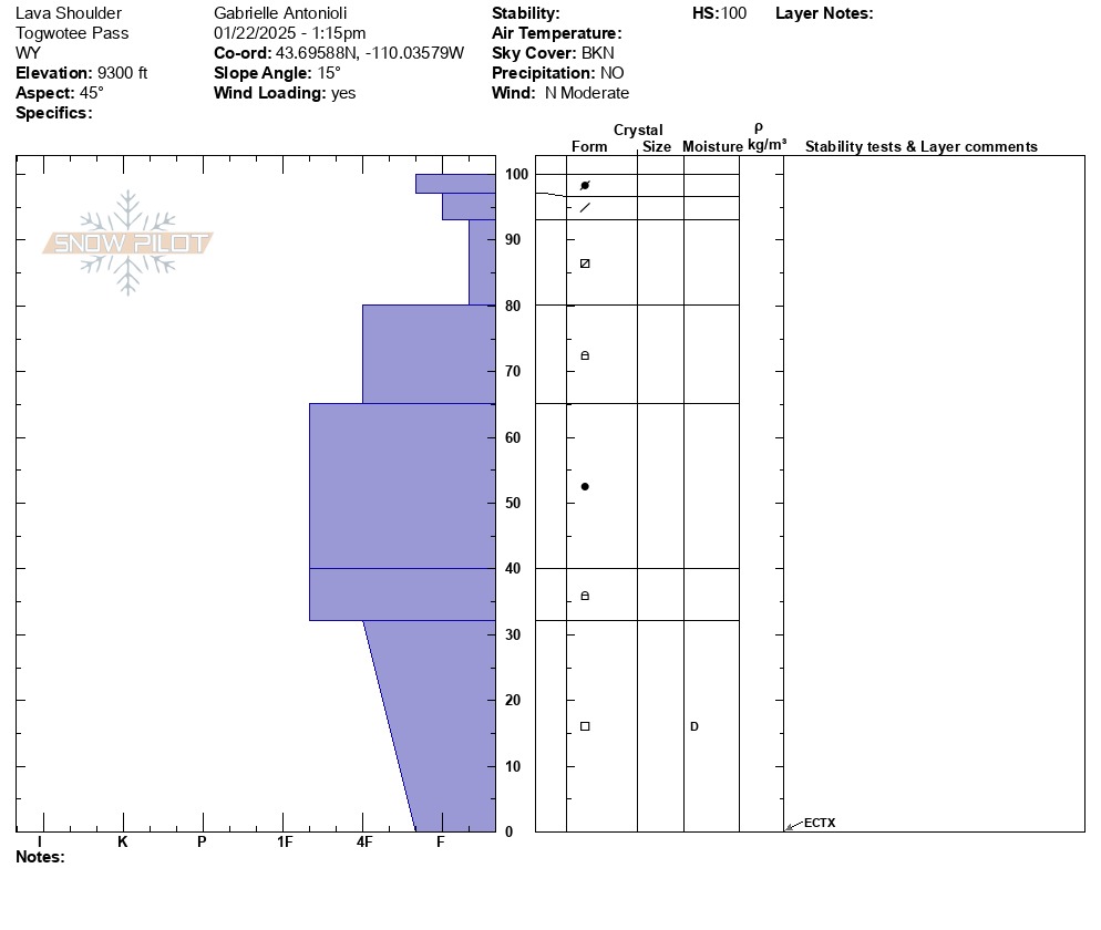
The riding has improved over the past two weeks in that now it's easier to get to more places with a supportable slab above weak snow at the base. This weak snow is still widespread. However, it is becoming more difficult to trigger a larger avalanche as time passes without much change in the weather. This side of Togwotee has a slightly shallower snowpack, averaging 2-3.5 feet to 9,000 feet. Weak snow composes the bottom 8 inches of the snowpack. We dug one snowpit test on a NE aspect around 9,300 feet, revealing two things: 1) weak surface snow will be reactive upon the next significant storm. Dry weather = weak snow that will be buried. 2) Snow at the base of the snowpack will trend unreactive without significant changes to the weather (ECTX result). As triggering a large avalanche becomes more unlikely with stable weather, this is a low-probability, high-consequence scenario. There are still places, mainly where the snowpack is shallower but well-connected, where the odds of triggering a consequential avalanche are higher.
One roadside avalanche was noted that occurred on weak snow near the ground and was sizeable.
Weather
- Air Temp
- 5
- Wind Loading
- moderate
- Snow Avail For Transport
- none
Strong W/NW winds