
Logging Lake
Quick report
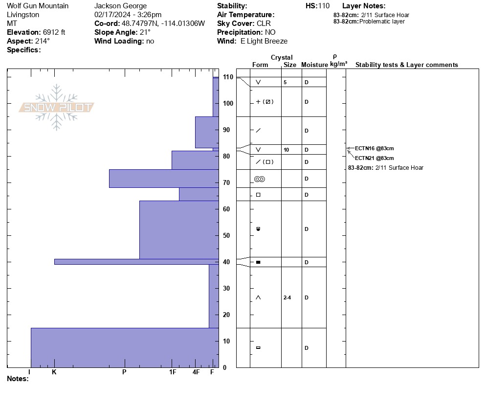
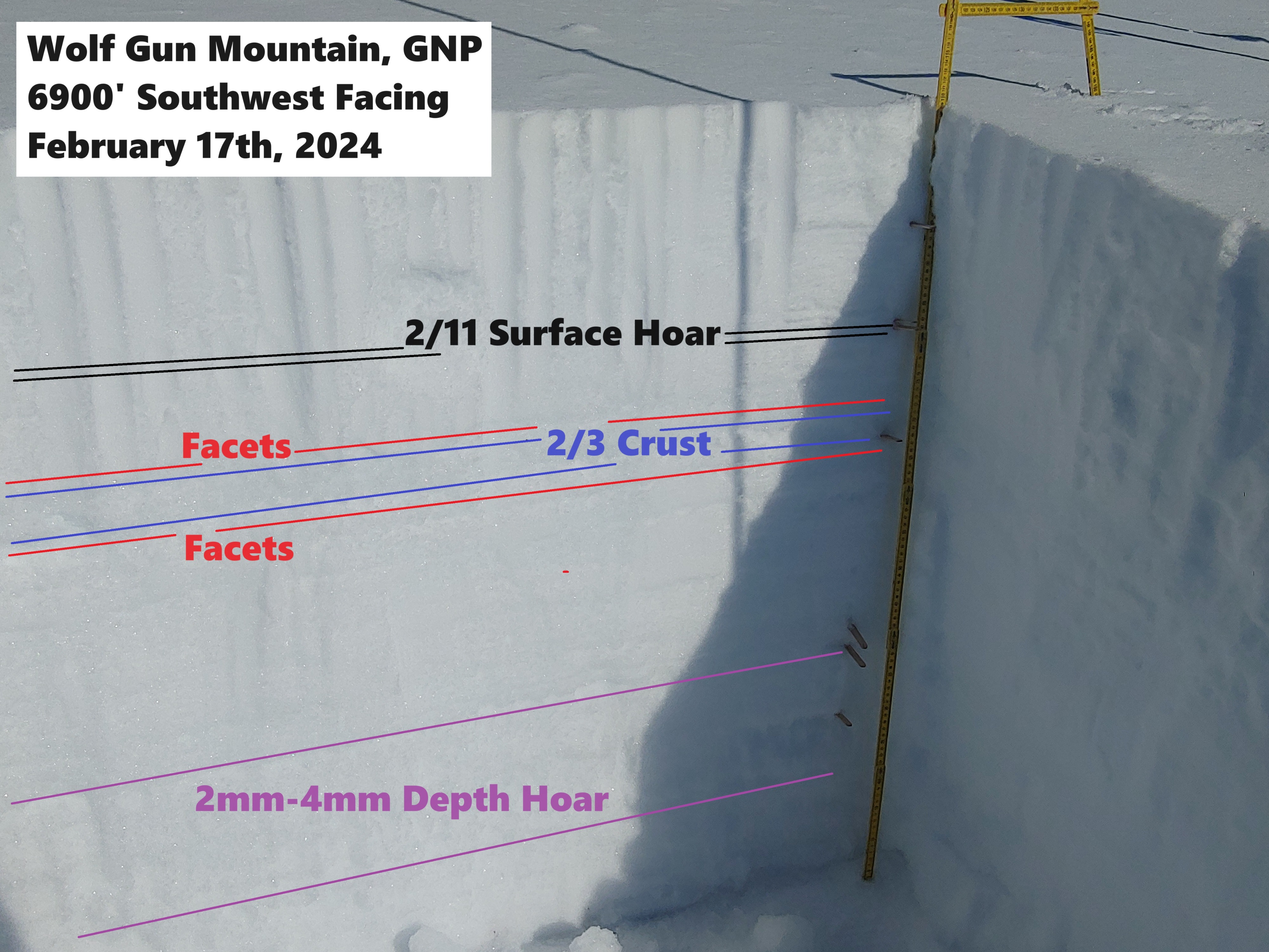
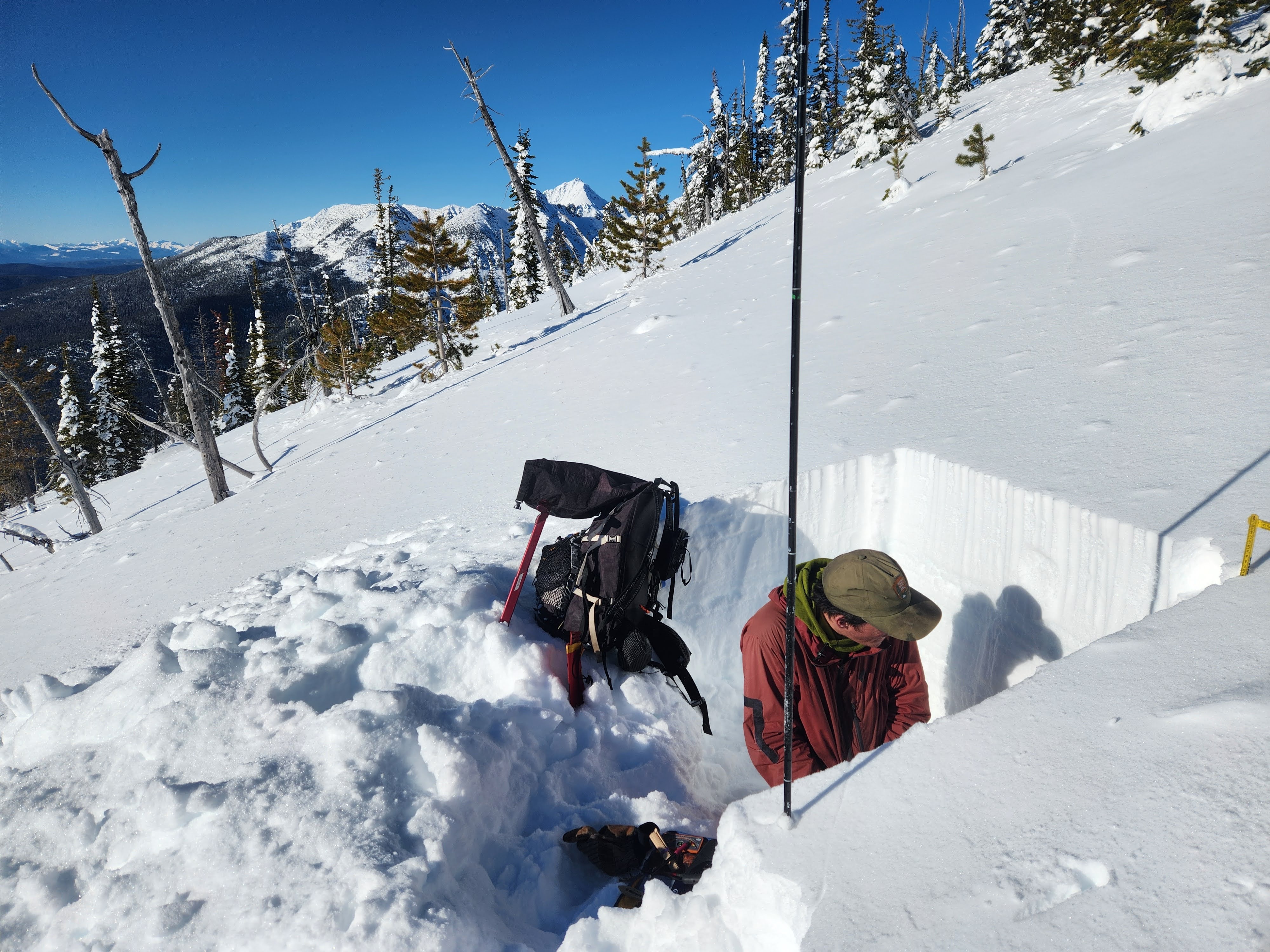
• 3 day patrol into the the head of Logging Lake. We traveled here to collect snowpack data, document recent avalanche activity, and restock/inventory two historic patrol cabins. • Travel from the river to the foot of Logging Lake was relatively smooth. Just barely enough snow to keep skis on your feet and minimal downfall to navigate. We hoped to find a deeper snowpack as we traveled further up the valley, but discovered the opposite. Like much of the park this season, this valley appears to have been starved of snowfall. • On Saturday 2/17, we battled our way to upper elevations to assess avalanche conditions in the area. We ascended a west facing ridge on the front of the Livingston Range, and climbed up towards the false summit of Wolf Gun Mountain. We dug on a SW facing slope at 6900' in an area with uniform snowpack coverage. Many places closer to the ridge that we were climbing had significantly thinner coverage (25-50cm). • We discovered a weak snowpack structure with multiple layers of concern and depth hoar at the base of the pack. Our pit profile with details is attached. We speculated that a similar structure might be found at Stanton Mountain in the McDonald Valley right now. Both of these mountains are situated on the western front of the range and experience significant scouring by systems with strong Southwest Winds. Recent avalanches observed on three different mountains in the valley. Dry loose activity as well as one persistent slab.
Weather
Clear, cold (single digits/teens), and calm our first two days (2/16-2/17). Even on Wolf Gun mountain (2/17), winds remained calm to light out of the east. Yesterday (2/18), things were a touch warmer (20s) with mostly cloudy skies. Winds remained calm in the valley bottom and snow surface remained cold fast and dry all day long.
Snowpack
Logging Creek Ranger Station (3400'): HS= 10-20cm Logging Lake Foot (3800'): HS= 20-30cm Logging Lake Head (3800'): HS= 5-10cm Adair Ridge (5000' NW): HS= 40-50cm Adair Ridge (5600'NW): HS= 60-70cm, *Between 5000-5600 on a NW aspect, the entire snowpack was heavily faceted to the ground. Where did the supportive crust go? It felt like November/December conditions in the Southern Rockies. AKA "Sandbox powder". Wolf Gun Mountain (6000' SW): HS= 50-60cm Wolf Gun Mountain (6900' SW: HS=110cm (Pit profile attached)
Avalanche
- Size
- D2.5
- Count
- 3
- Aspect
- S
- Trigger
- N
- Elevation
- 6500 ft
Several dry loose avalanches observed during our patrol. All of which likely occurred late afternoon on Saturday 2/17/24. One persistent slab observed that occurred either Saturday 2/17 or Sunday 2/18.