
Quick report
- Aspect
- North
- Red Flags
- Poor Snowpack Structure
- Elevation
- 3414 m
- Slope Angle
- 18°
- Red Flags Comment
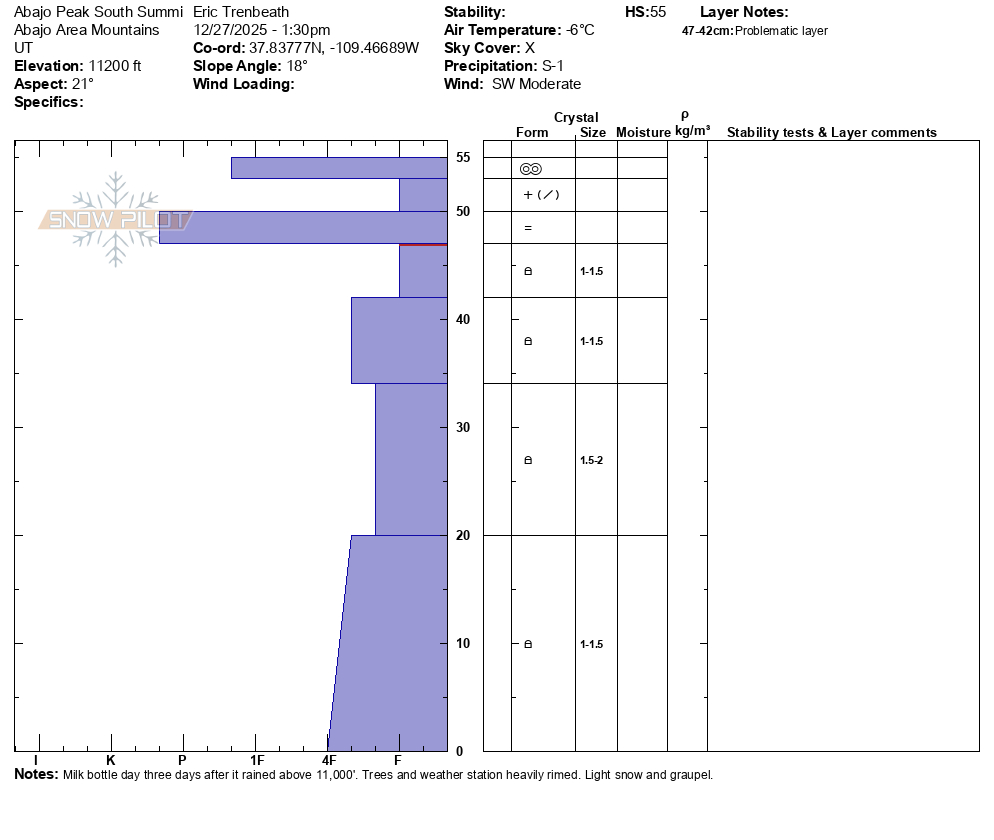
- <p>The majority of the snowpack below the recent rain/rime crust is faceted with an average hardness of 4f-. Warm temperatures and a lack of a temperature gradient have initiated the rounding process. There isn't currently a slab and the danger remains low. Small or even modest amounts of new snow will likely only generate wind drifted or new snow problems. It will take a significant load to affect the facets below the crust.</p>
Coverage remains quite low for this time of year and I utilized a rather unorthodox method of transportation on an access road that winds around the south end of the range and eventually on to more westerly and occasionally wooded slopes where snow has accumulated and stayed since November. I first encountered real snow in these areas at around 9600' and was still able to drive the machine over increasingly snow covered terrain to about 10,400' where I got out and walked.
Snowpack
It's been two days since the Christmas rain above 11,000' which was followed by a couple inches of snow and then surprisingly, capped with a melt freeze "heat" crust. Surface was mostly supportable but somewhat punchy. Trees and weather station were heavily rimed. After two weeks of record warm temperatures 20+ degrees above normal, S-SW aspects are melted out, spotty snow remains on more sheltered SE and W aspects. NW-N-E have anywhere from 6" at 9000' and 20-24" at 11,000'.