
Quick report
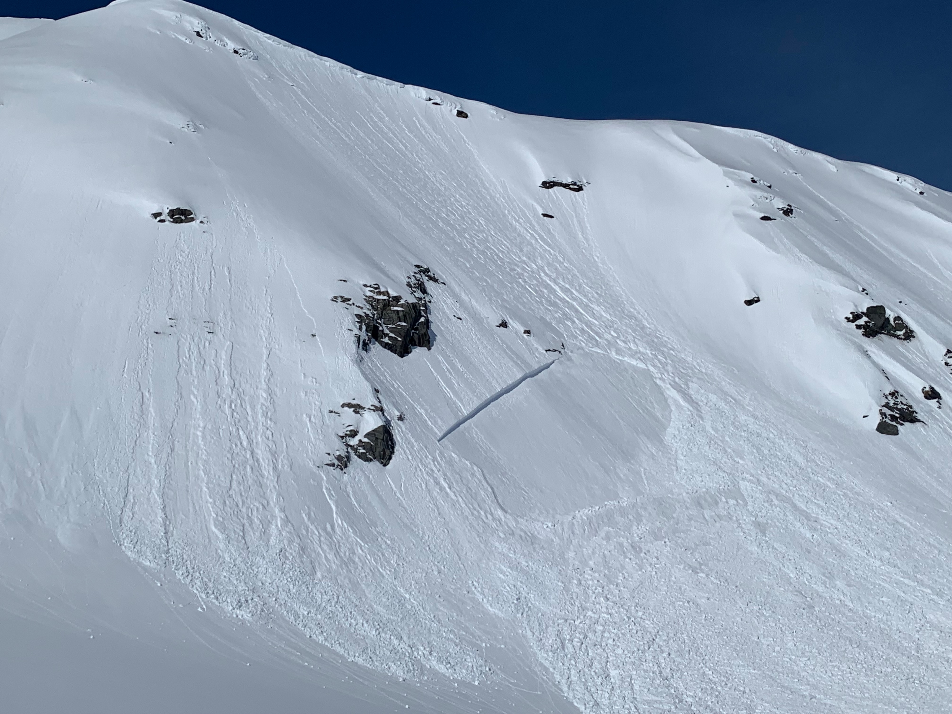
The new snow had consolidated due to recent warm temperatures with no signs of instability underfoot such as shooting cracks or collapsing. Observed 2 natural avalanches that occurred while we were in the area on solar aspects likely at the 4/4 persistent weak layer triggered by small sluff. Snow had temperature effect up to ~3800' and was dry above on shaded aspects.
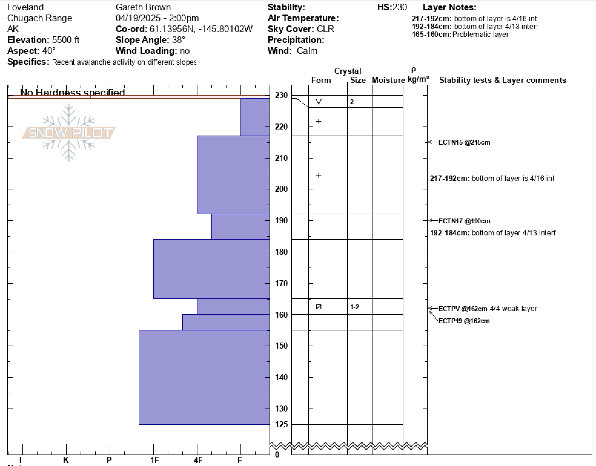
When we dug a pit at 5500' on a NE aspect we found the 4/4 persitent weak layer to be 2 feet down and very sensitive. Pit results produced ECTPV (propagation on isolation) and ECTP 20 when repeated a second time. A quality 1 shear exists with facets identified at the interface. Observations of the depth of this weak layer have been highly variable and range from 2-6 feet in depth. Solar natural slabs and pit results are showing that this layer is less isolated than previously thought. Dangerous avalanche conditions exist in steep terrain while the snowpack is adjusting to the new load and the sun.
Natural D2 avalanches occurred while we were in the area on lower slopes of South Tones and SW face of Catchers Mitt. Both of these were slabs that were triggered by small wet loose activity.Weather
- Cloud Cover
- clear
- Wind Loading
- none
- Recent Snowfall
- 35
- Snow Avail For Transport
- moderate amounts