
Quick report
- Cracking
- isolated
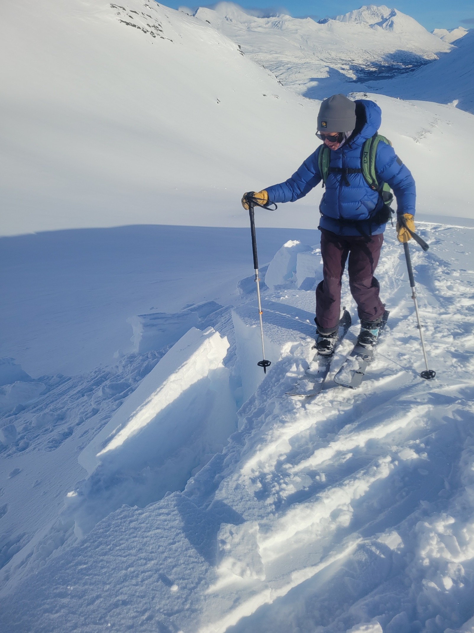
A notable Slab avalanche had released across the road on N Schoolbus/Goodwills. See avalanche obs. We observed a few isolated signs of instability on our route, including cracking within deeper windblown snow. These deeper pockets also failed easily at 2 feet deep on unsupported micro terrain.
Weather
- Air Temp
- Upper 20s
- Cloud Cover
- clear
- Wind Loading
- moderate
- Rain Elevation
- 2800 (from yesterday)
- Recent Snowfall
- 15 cm above 3000
- Snow Avail For Transport
- moderate amounts
A clear and breezy day after a warm storm moved through yesterday. The recent rain crust covered dry unconsolidated snow up to 2800 feet. Recent snow accumulation estimated to be 15cm. Deeper pockets up to 2 feet deep were found in isolated areas. Snow
Snowpack
Below 3000 feet: We found a 4cm thick "crunchy" windslab on top of unconsolidated storm snow. The 1/26 buried surface hoar was identifiable 30cm deep. Most of the surface hoar was decomposed into rounded grains, but there were still a few intact crystals. Hand, and shovel shears were easy to moderate. An ECT test resulted in (ECTN6) down 30cm on the 1/26 layer.
Above 3000 feet: Wind was redistributing snow in exposed areas, including midmountain hips/ridges, as well as most peaks in the area. Throughout our tour, we found areas of sensitive wind-drifted snow up to 2 feet deep, but no stiff windslabs. Windslabs are expected to be forming at higher elevations. The wind-drifted snow was reactive on small, isolated slopes, but we didn't see any further signs of instability on the slopes we traveled on.
Avalanche
- Size
- D2 R2
- Type
- SS
- Aspect
- N
- Trigger
- N
- Elevation
- 5000 ft
One D2 natural on N Goodwills. Small solar-triggered sluffs on rocky S aspects.