
Quick report
There was enough of a freeze overnight to have a supportable crust in open areas at 9000'. In the woods, however, with limited radiative overnight cooling, surfaces were not supportable, and ski penetration was 20 cm into moist/wet snow. Skinning up at 9500', I broke through the crust multiple times into 20-30 cm of saturated snow on a southwest aspect. Above 9500', sunny aspects had a supportable crust.
3 pits were dug:
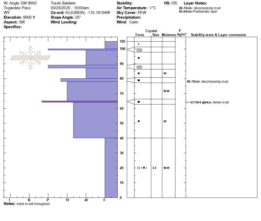
9000' Southwest Aspect, HS 41 (105 cm) inches: ECTN14 down about a foot. The snowpack here varied from very moist to very wet throughout. I did not see percolation columns, but the mid-pack, as well as the rounding facets at the base, were wet. Multiple crusts exist here, which are trapping/pooling some water but not to the point of pouting out of the snowpit. Cooler temperatures over the next few days should help to lock up and freeze this mid-elevation snowpack.
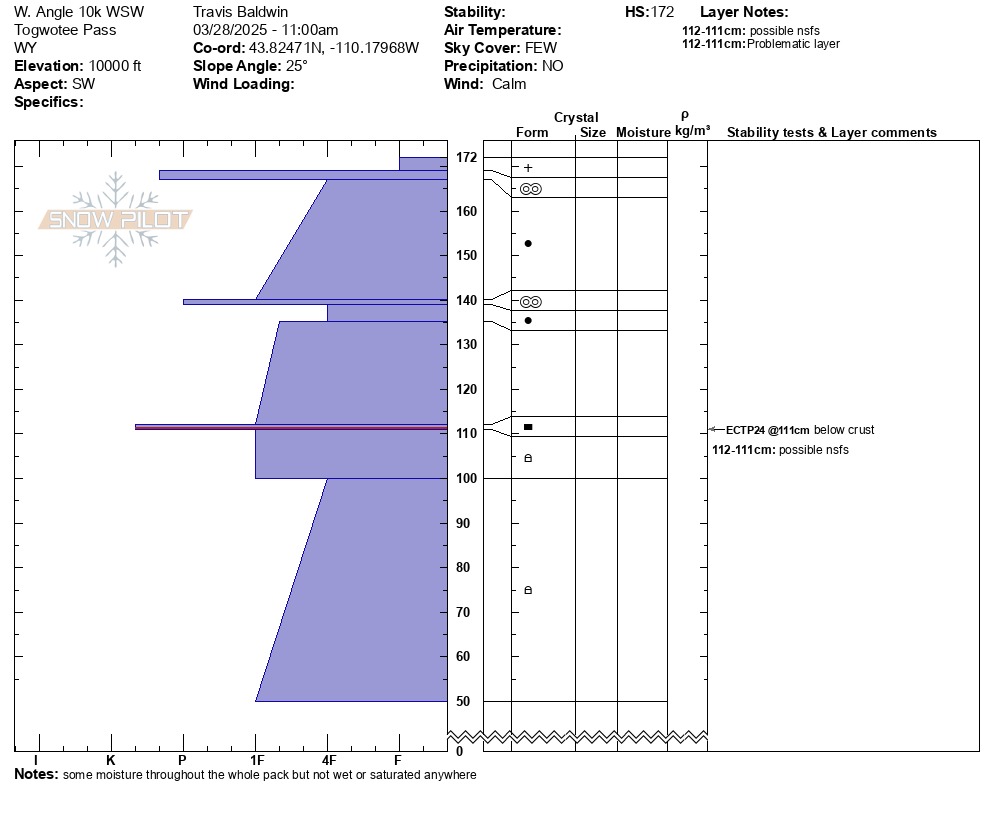
10,000' West Southwest Aspect, HS 68 inches (172 cm): ECTP24 down 27 inches (70cm) below a crust - possibly the 3/13 interface. Most of the snowpack was moist at this elevation but not wet.
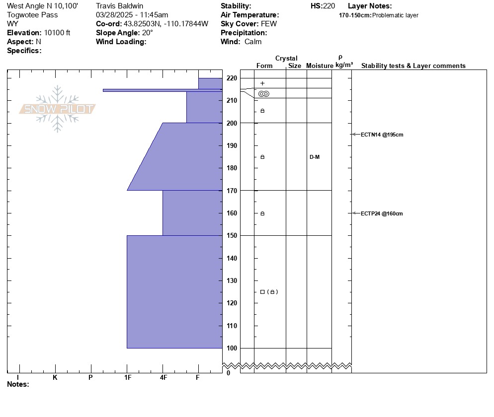
10,100' North Aspect - just below the ridge with some wind loading contributing to HS, HS 86 inches (220 cm): ECTP24 down 24 inches (60 cm) in a noticeable hardness change - possibly facets that developed during cold clear nights around 3/10-3/13. The snowpack was mostly dry in this location. Did not dig to the ground here, just the top 50 inches (125 cm).
Nothing too surprising here - lower elevations on Togwotee have experienced a lot of warming in the last few days, and the snowpack is wet. As things cool off over the next couple days, stability should improve but it takes time for that much water to freeze - I remember something in my thermodynamics class about the latent heat of fusion or specific heat capacity of water...hmmm. Give it time.
At upper elevations and shady aspects, the messaging remains the same - there are buried persistent, weak layers in the snowpack that continue to produce propagation in pits in some places. While the strength of the snowpack was high in my pits today, the structure wasn't great. It might take a very large trigger or finding the sweet spot to trigger an avalanche but we are not out of the woods yet. The upper snowpack, particularly on northern aspects, is still very much a winter snowpack.
No signs of recent instability.Weather
- Cloud Cover
- few
- Wind Loading
- none
- Recent Snowfall
- 4
Mostly sunny with some very thin clouds. Felt warm. Dead calm with no wind.