
Quick report
- Aspect
- North
- Red Flags
- Wind Loading, Poor Snowpack Structure
- Elevation
- 2560 m
- Slope Angle
- 24°
Old pockets of persistent slab avalanches above the Curtis Creek Rd, likely pulled out by the groomer a couple weeks ago.
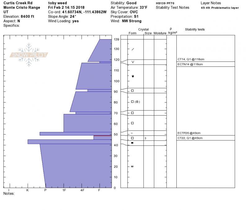
A couple persistent weak layers are visible in this pit. The upper one, about 10 inches below the surface is buried surface hoar, which is widespread in the Monte Cristo Range.
Well developed and fairly large (3 mm) facets elevated about 1.5' above the ground by hard November snow. My test results in this layer show full propagation, but quite a lot of force is required to make it fail (26 taps)
Snowpack
- Instability Comment
- <p>A couple buried persistent layers exist, but these appear dormant currently. A large loading event in the future could easily reactivate the buried surface hoar or deep mid-pack facets...</p>
Snow still nice and soft, powder-like in forest and sheltered upper elevation terrain. Rime crust on open slopes. MF crust or damp surface snow at lower and mid elevations. Very shallow snow melting out at lower elevations and in sunny terrain.