
Quick report
- Aspect
- Northeast
- Red Flags
- Poor Snowpack Structure
- Elevation
- 2743 m
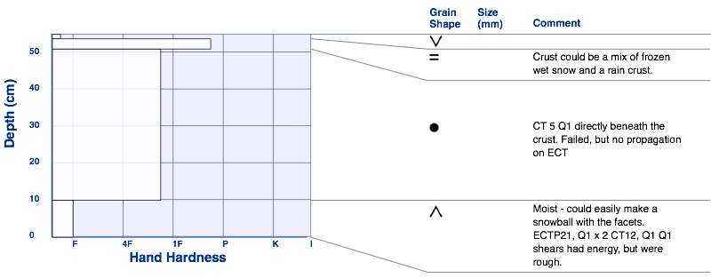
BELOW - Taking a look at a more northerly facing, mid elevation slope, about 8,330 to 7,900' - much shallower, weak, colder snow pack. Very thin, uniform rain crust, again topped with small surface hoar crystals. Entire pack was weak beneath the crust. Some 4 Finger hardness snow, but mostly Fist hardness. Facets on the ground were cold, dry and weak. In spite of warm temperatures, this snow did not seem to be getting much warmth - shady, plus these are some of the shortest days of the winter.
Bottom Line - There are some interesting weak layers to watch during the next week of high pressure - any faceting beneath the rain crust and the depth hoar on the ground. Shallow snow pack areas will be particularly prone to weakining.
Snowpack
Widespread rain crust - thicker at the upper elevations, thin, shiny and breakable at the mid elevations. Most of the northerly facing slopes had small surface hoar crystals on the crust. While the surface hoar is noted, it could get destroyed each day with sun, heat or wind. Timing for backcountry travelers could be a huge consideration due to the crusts - icy hard early in the day, may soften nicely or become breakable with day time heating. Lots of early season variation in the snow pack depths, normal when you have a shallow snow pack. "Slides for life" possible on the steep, hard surfaces.