
Quick report
Izzy and I headed to the Selkirk Mountains to continue making wellfare checks on the snowpack and to document recent avalanche activity in the area..
- The rate of weaking that is occuring near the surface right now is staggering.
- After some mild temperatures earlier in the week, you might expect that there are lots of areas with a thick supportable crust by now, but you would be sadly mistaken. Northwest winds and the return of cold temperatures has weakened the crust, making it breakable in most locations excect for on ridgetops, where the surface is compacted and hardened by the wind.
- The good news is that the weak snow in our upper snowpack won't become a problem for us until we get our next delivery of snowfall to the region. The scheduled delivery date of that package is a bit uncertain right now, and seems to keep getting delayed.
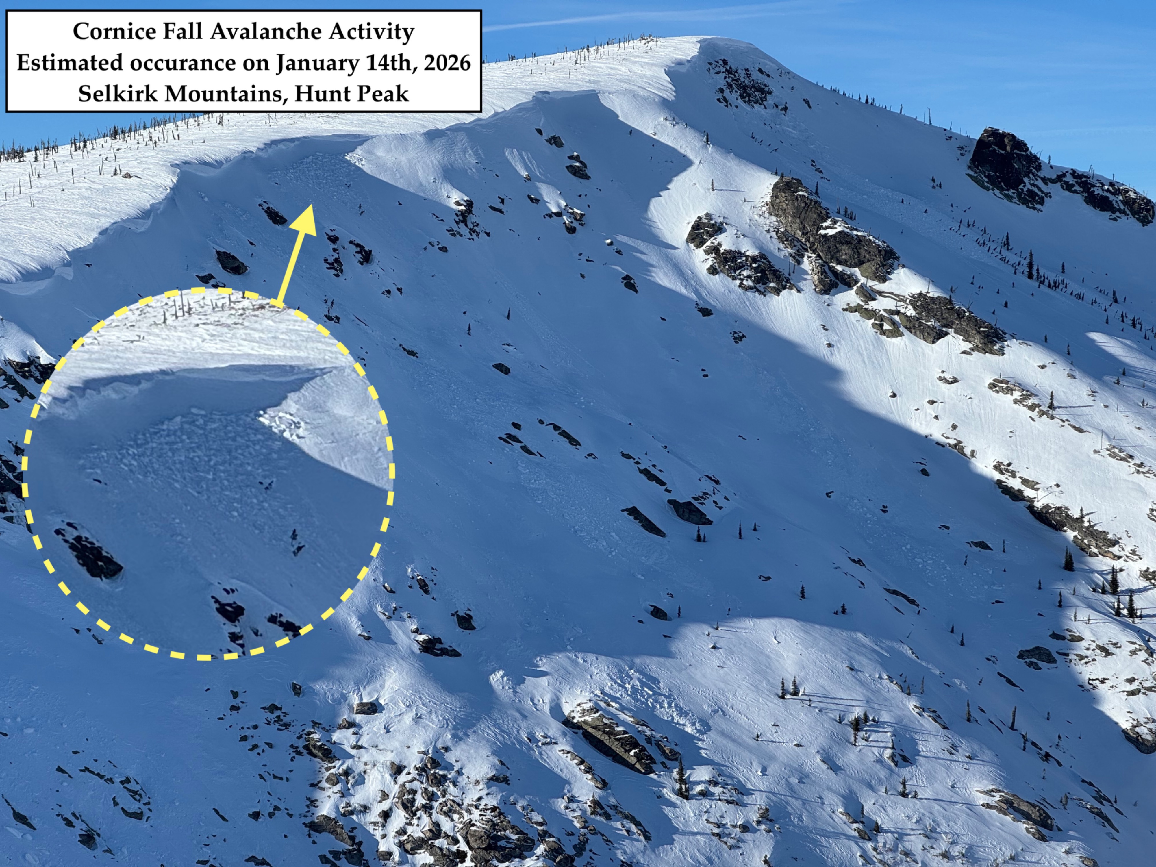
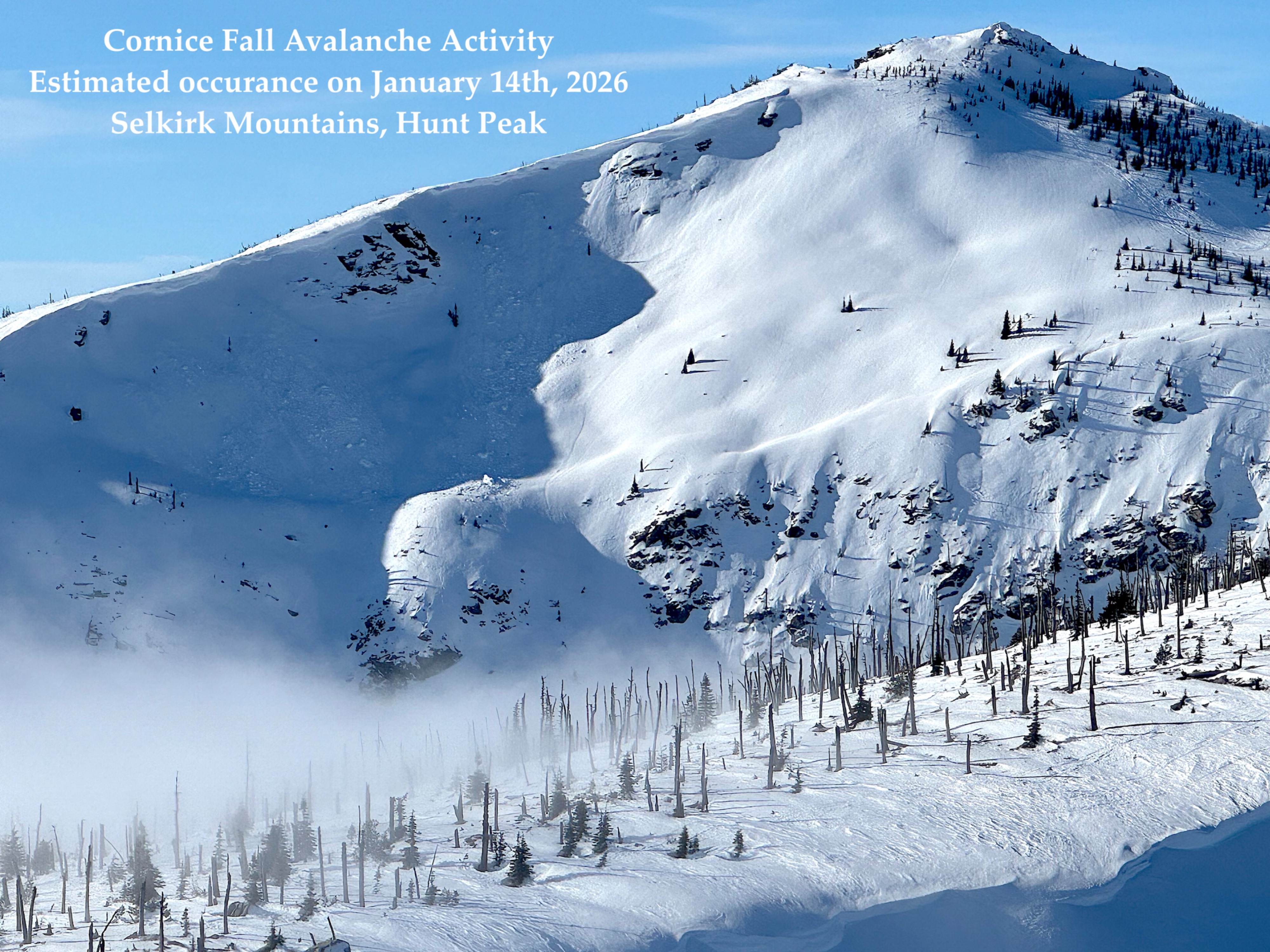
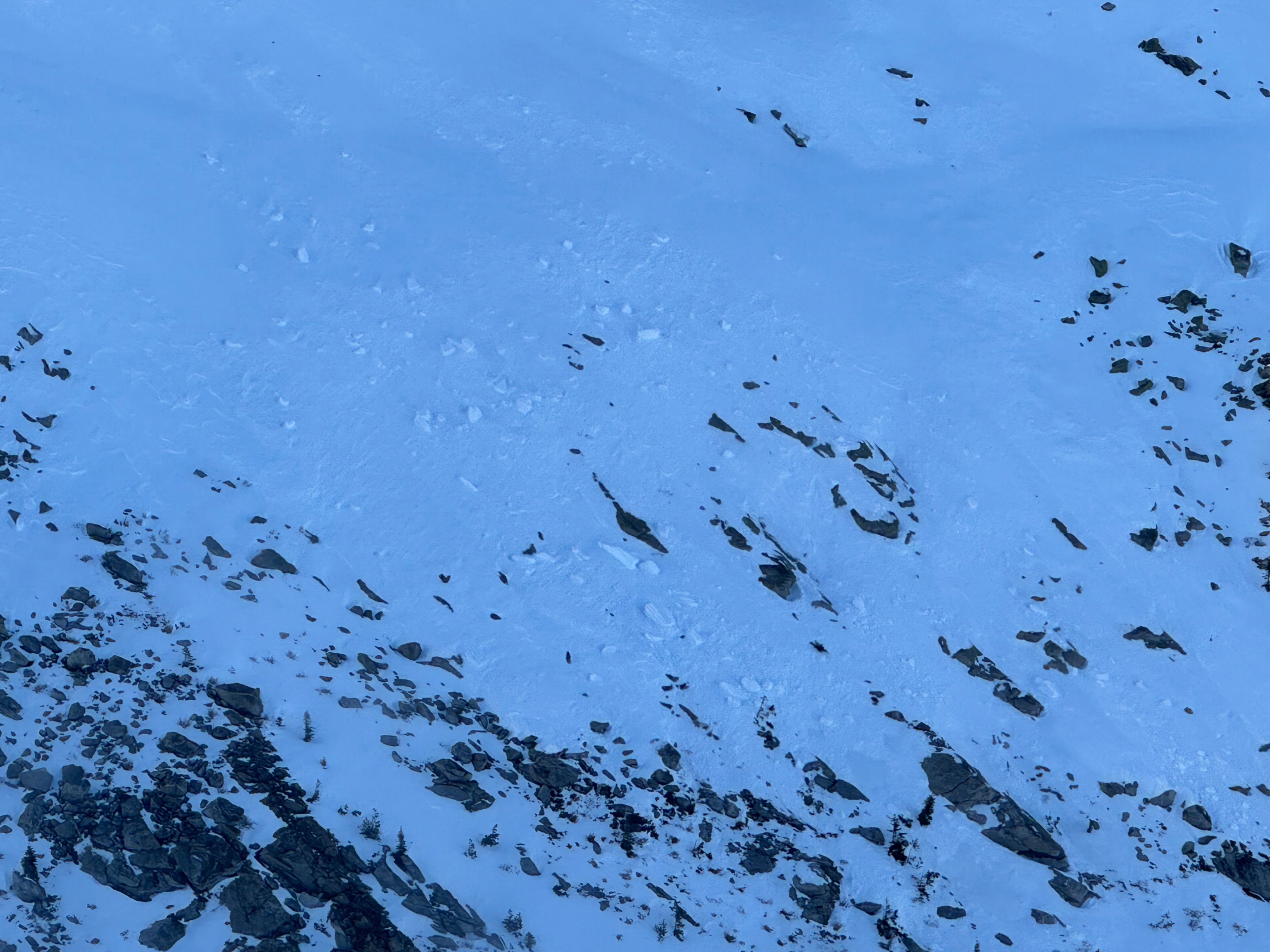
- We also noted evidence of abundant cornice fall in the area. This activity had likely occurred between January 12th and 14th, when the mountains were experiencing light rain and rapid warming.
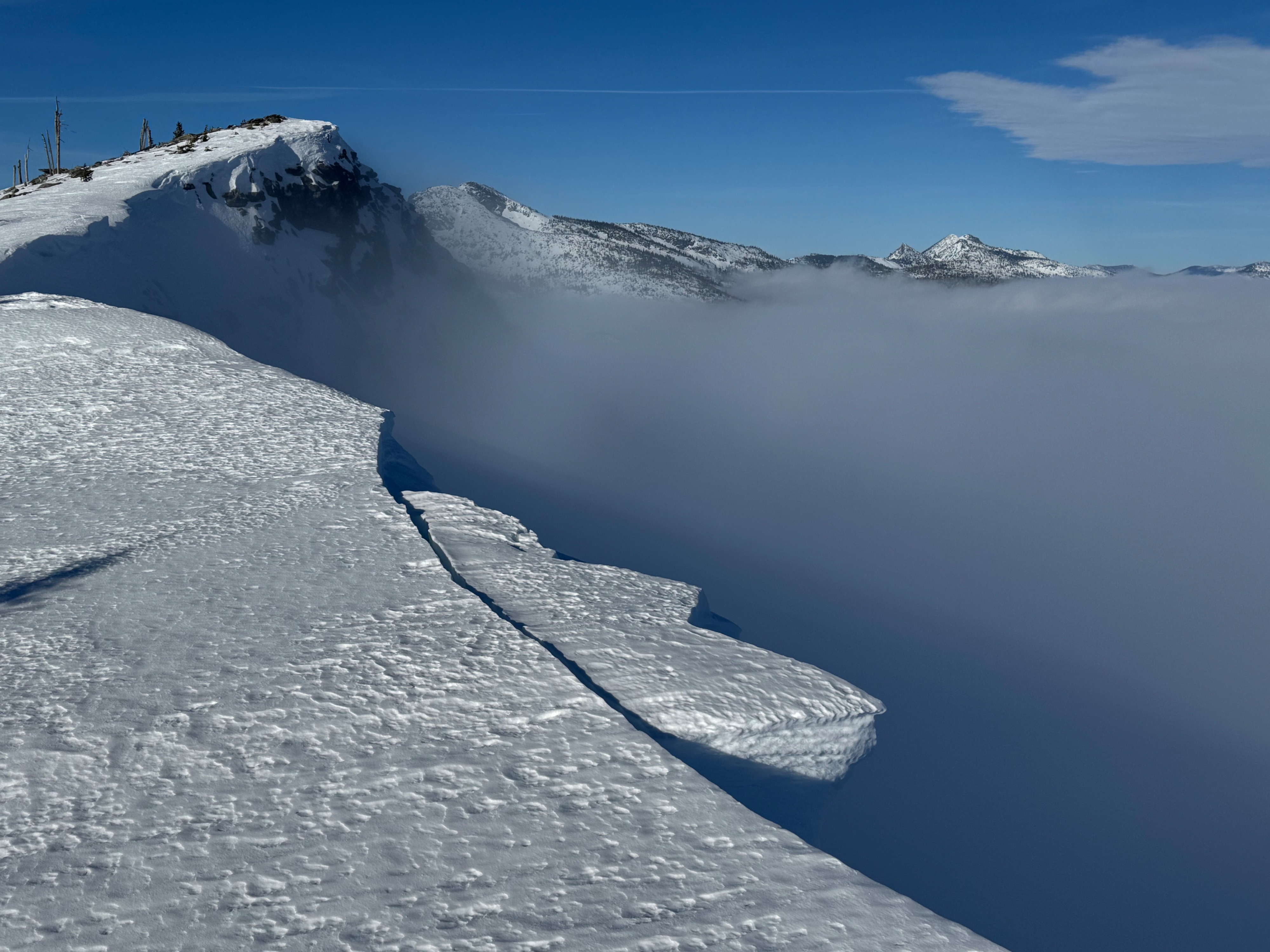
- The Cornice Fall actvity is a great reminder to always give cornices a wide berth and to utilize visual clues (trees and rocks) on ridgelines to help determine where the actual edge of the ridge exists. When in doubt or if clues are absent, give more berth. These disloging blocks are usually very hard and remarkably heavy, They have the potential to easily injure a person by themselves. And a lot of times, they work to provoke larger slab avalanches in the start zones they bombard.
Weather
- Air Temp
- not measured
- Cloud Cover
- clear
- Wind Loading
- none
- Rain Elevation
- N/A
- Recent Snowfall
- none
- Snow Avail For Transport
- none
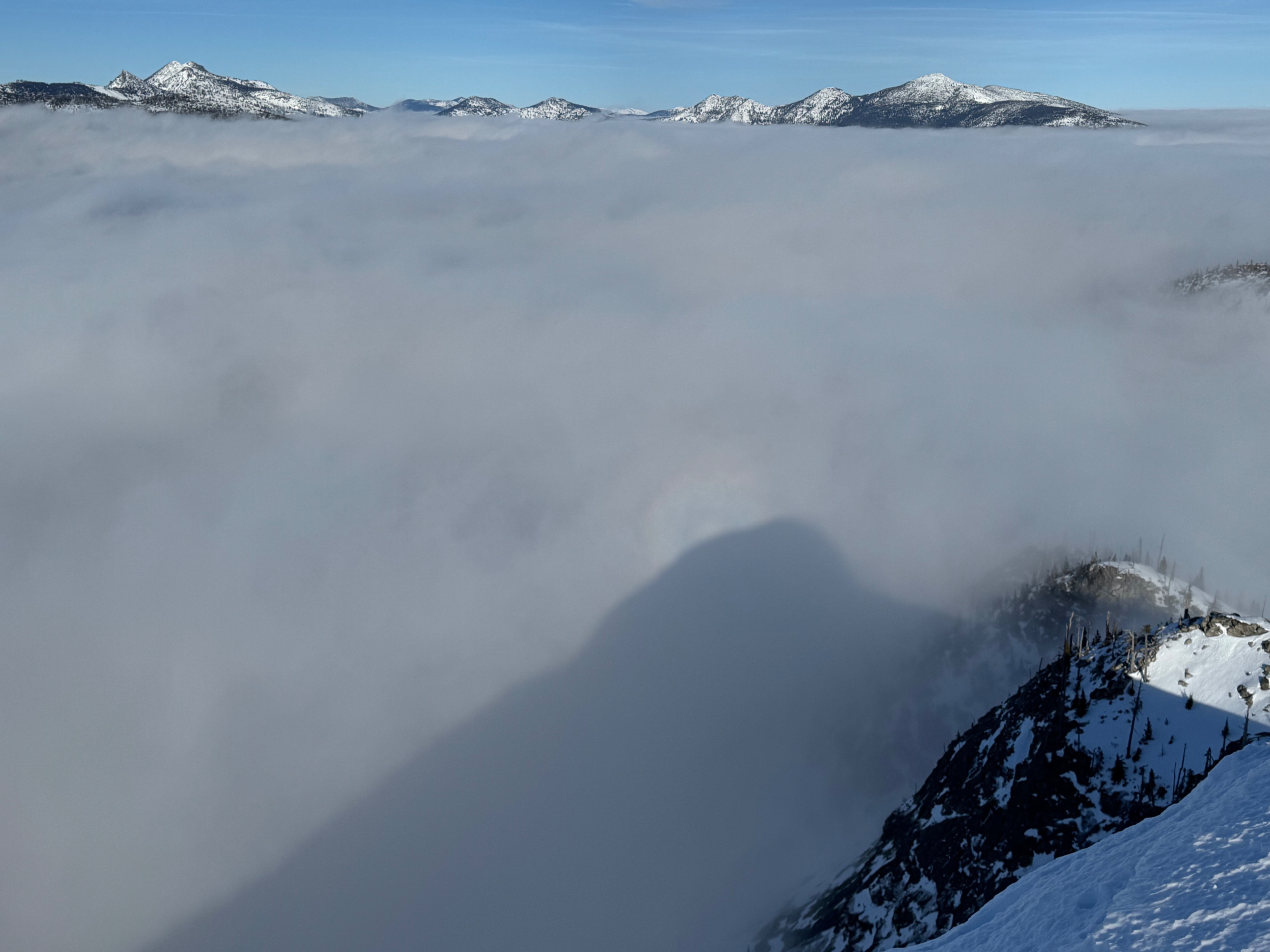
Cold, Clear, and Windy above thick valley stratus. The stratus deck elevation was notably higher today than in recent days. We were just barely able to breach through it this afternoon when it was hovering around 6300 feet. It seemed to stay right around 6000 feet most of the day. The winds were calm below the stratus layer, but above it on ridgetop, we were met with northwest winds blowing steadily 15-20+ mph (estimated )
Snowpack
- The rate of weakening at the snow surface right now is staggering.
- The thermal/rain/sun crusts that developed earlier in the weak are rapidly decomposing and becoming unsuportable.
- In many sheltered locations we are finding a layer of surface hoar (3 to 6mm) capping the crust.
- Immediately below the surface crusts, the upper snowpack is rapidly facerting and very weak.
- The only ingredient missing for an avalanche problem today would a slab of snow on top of the presently weak snow making up our upper snowpack.
Avalanche
- Size
- D2 R1
- Type
- C
- Count
- 4
- Aspect
- E
- Trigger
- N
- Elevation
- 6600 ft
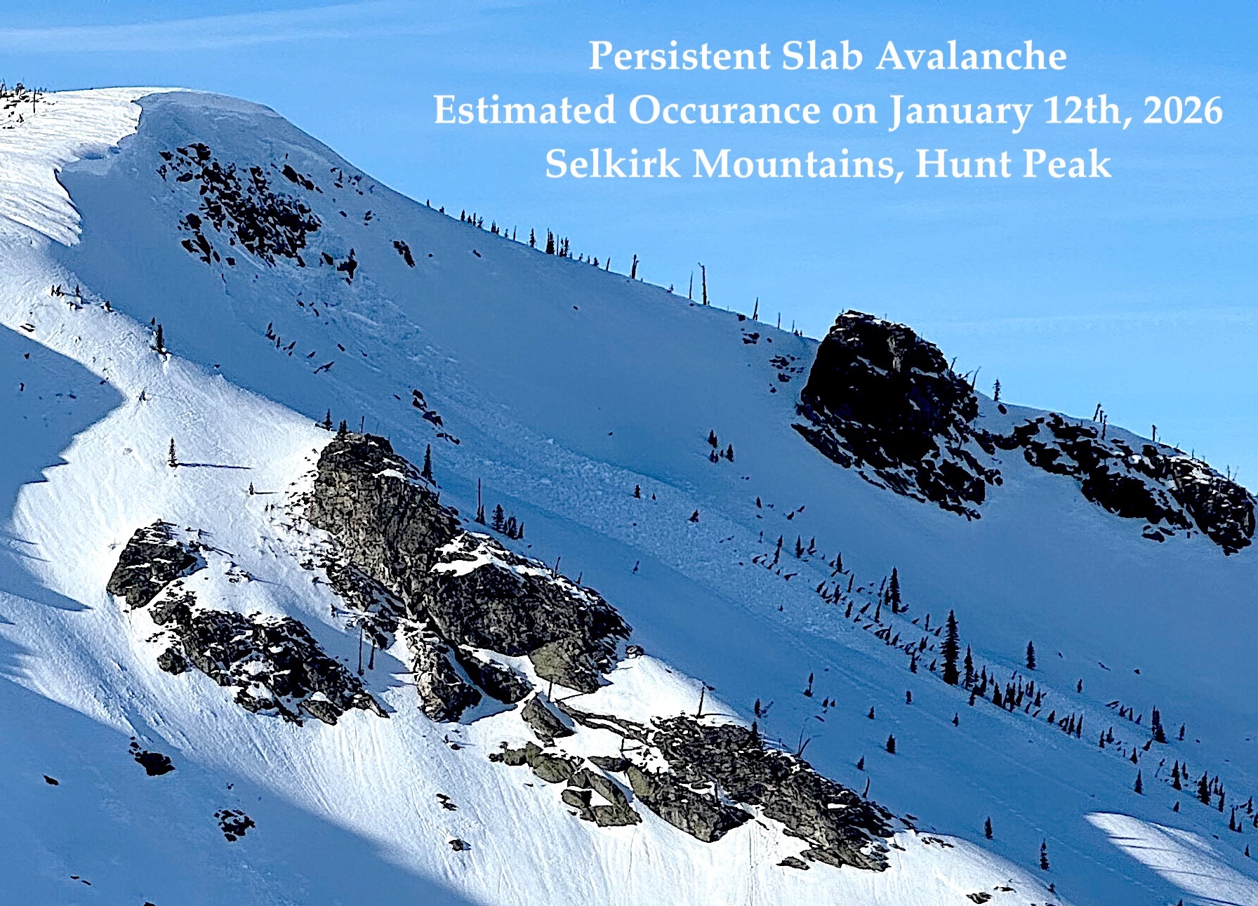
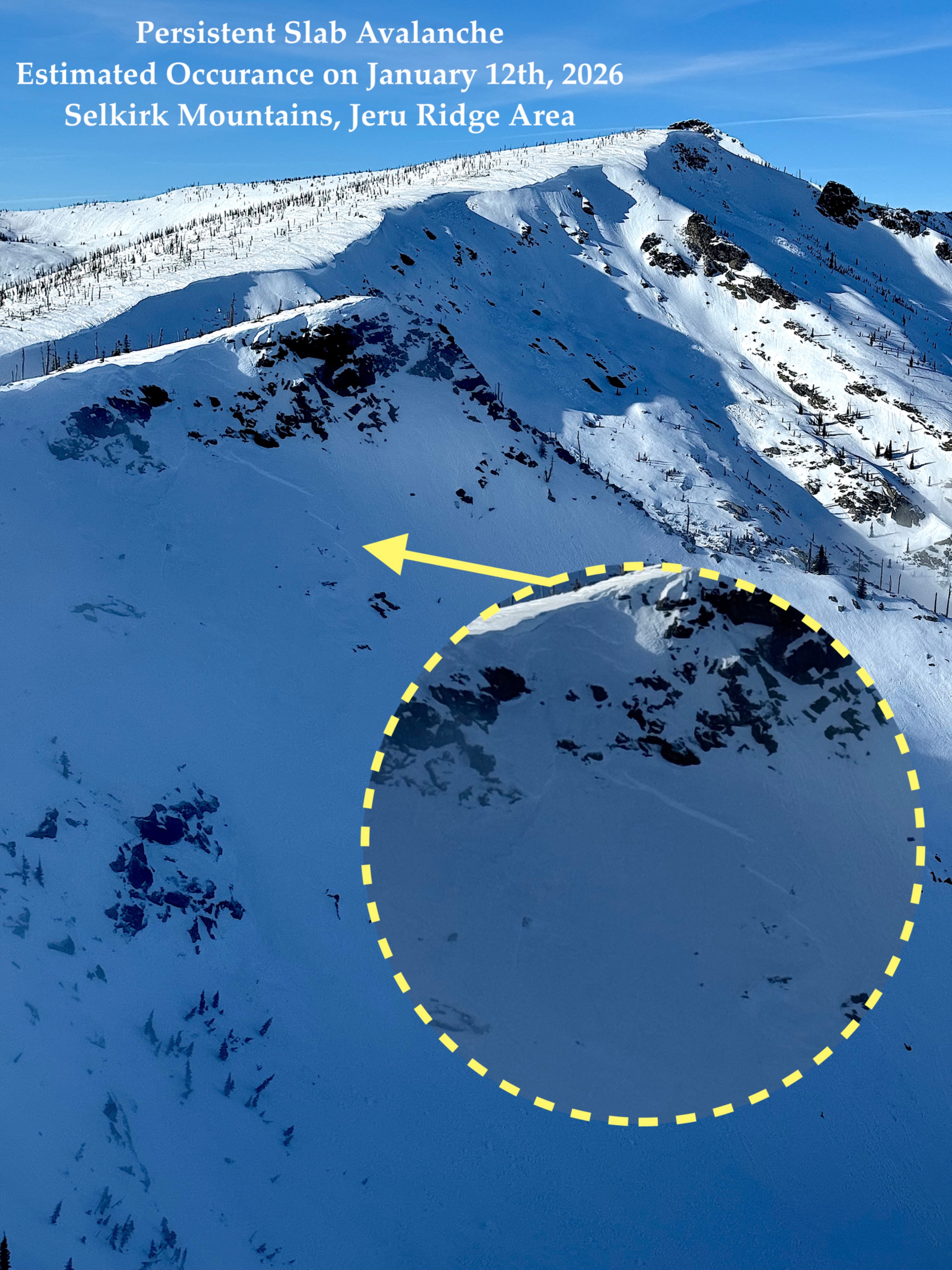
Evidence of recent Cornice Fall activity in this area was fairly abundant today. Many massive hard blocks dislodged from the ridgelines and tumbled hundreds of feet down slope. In a few instances these large heavy blocks sympathetically triggered persistent slab avalanches as they came crashing onto the start zones. All of this activity is estimated to have accured between January 12th and January 14th, when we were receiving light rain across the Selkirks and rapid warming.