
Quick report
- Aspect
- Northeast
- Red Flags
- Poor Snowpack Structure
- Elevation
- 2774 m
Photos:
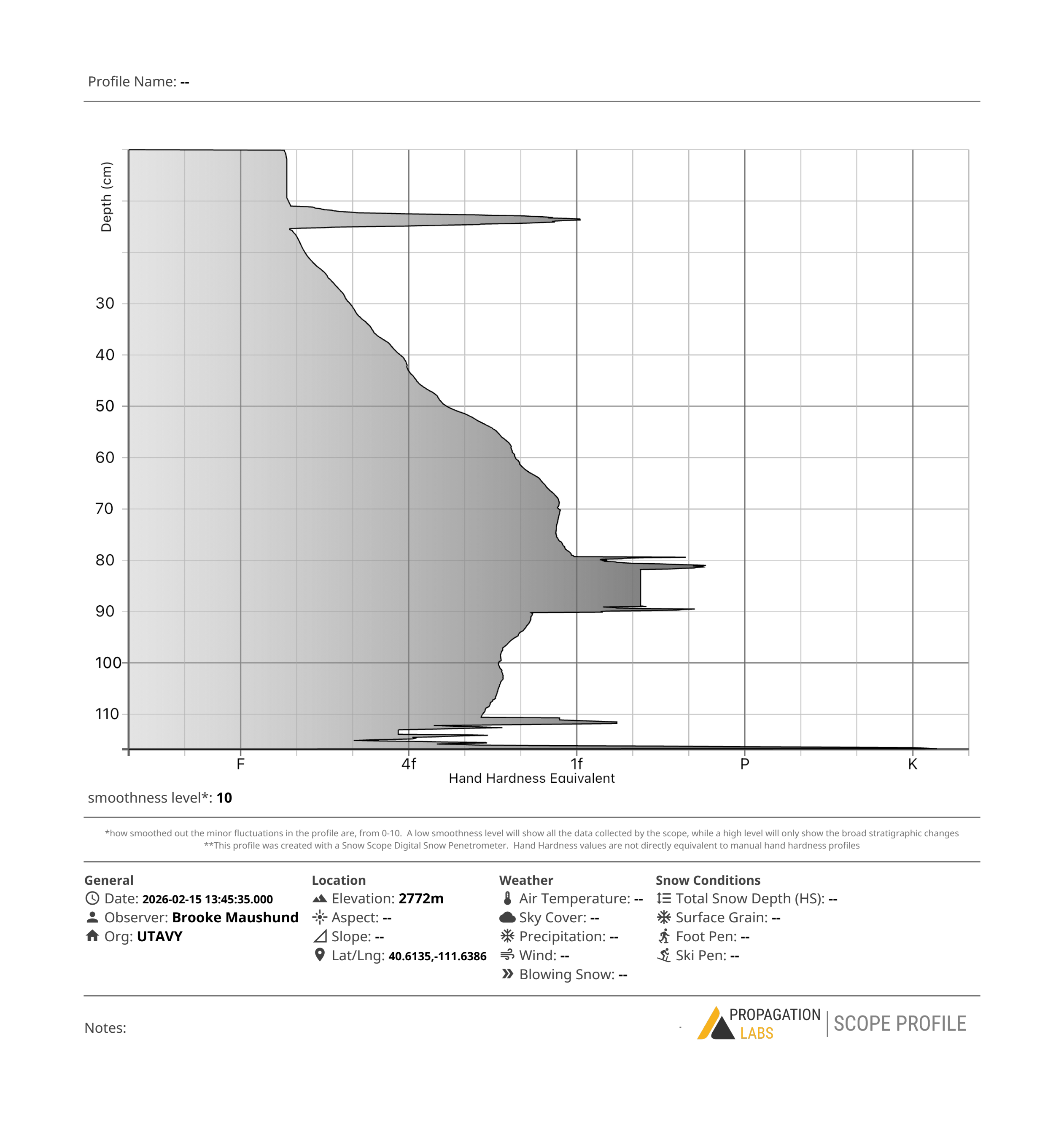
#1 — Snowpit at Trent and I's study plot we've (cumulatively) revisited 4 times near the base of Chicken Shit Ridge ENE 9100'. Lots of weak snow beneath the 4" of newer snow from last week, but no slab present in this location.
#2 — Greenhousing was evident in the cake-like resurfacing tracks from the morning got throughout the day.
#3 — Low hanging clouds that helped with greenhousing.
#4 — Moistening surfaces at mid-elevations didn't reach a threshold for a wet problem.
Snowpack
- Instability Comment
- <p>The weak snow that sat out faceting during January until last week is now buried. While I did not find much of a slab on top of this weak snow <em>in the areas I traveled today</em>—so not a prominent "strong over weak" structure to create a slab avalanche—I am concerned looking ahead into the week. With the forecast calling for 2-3" of H2O, it's hard to not imagine large, destructive avalanches running on the now buried January persistent weak layer.</p> <p>Test results today fell in line with this: no propagating results (ECTX & ECTN within the weak January snow). However, snowpit results and a quiet walk up Days Forks one day don't paint the whole picture. My avalanche-starved eyes will be wide open heading into this storm—I hope yours are too. </p> <p>While the load the snowpack saw last week was small, there were still large slab avalanches that ran on the weak drought snow in other areas. Now we're nearly tripling that load later this week. You could call the slides that ran last week canaries in the coal mine, but it feels more like a fire alarm going off in an already burning building. Regardless: a sign of what's to come.</p>
Traveled up from BCC, to Upper Days, then up Chicken Shit Ridge on my way out. Most notable today was the moistening of the snow surface due to greenhousing. 3-5" of newer snow in most areas from our most recent precipitation events last week. While surface snow on mid-elevation slopes became damp, we did not reach the threshold for a wet problem in areas I traveled. However, we'll be seeing a nice melt-freeze crust form overnight.
HS range 90-150cm, 8900-10,000' E-N-NW aspects.