
Quick report
- Collapsing
- isolated
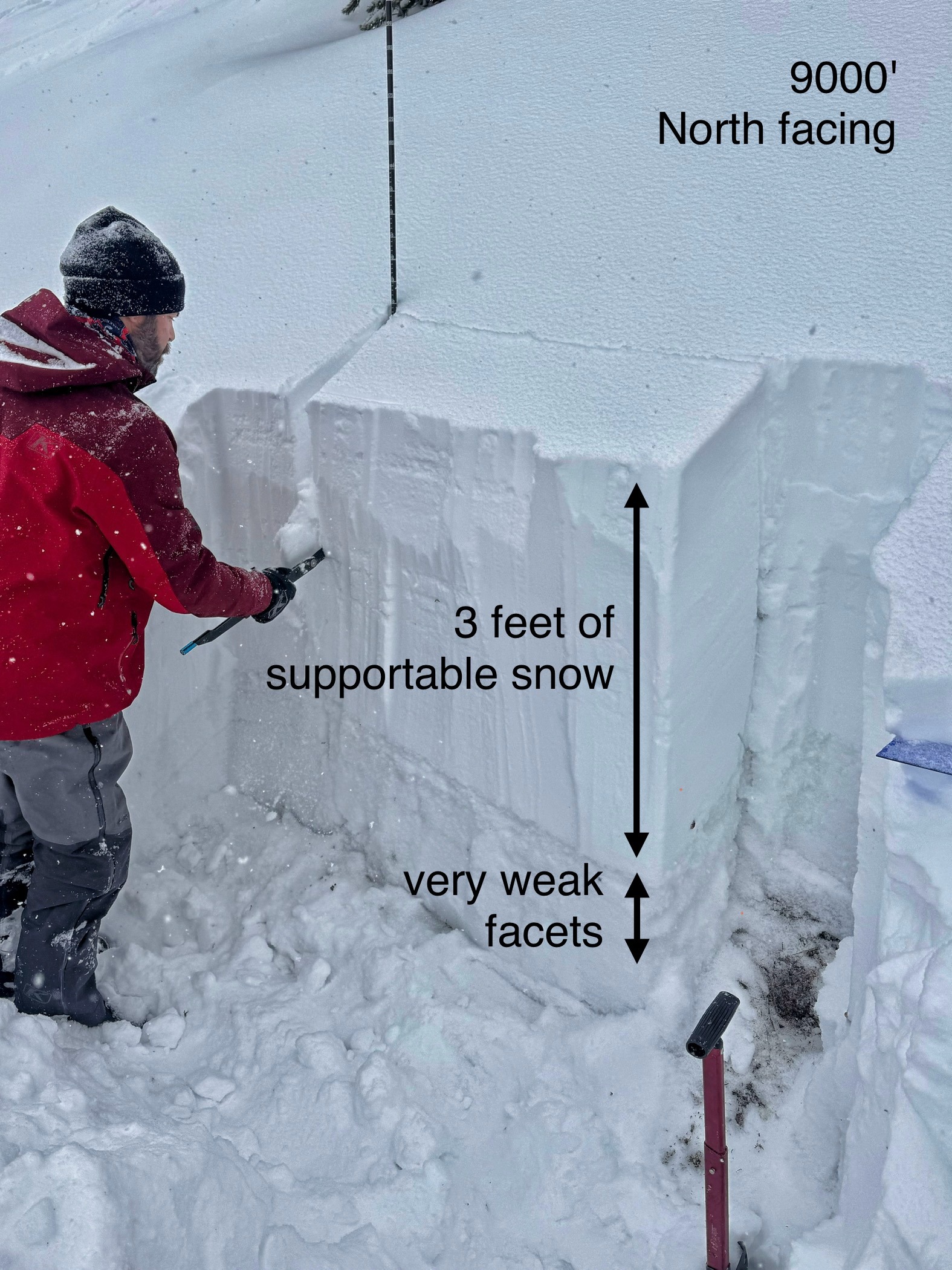
We rode into the Taylor Fork to the weather station and then through Sage Basin. The snow on the trail down at the truck was thin, but passable for the first few miles. Someone had come through and cut out the downfall from the wind event. The snow in the riding area was 2.5 to 4 feet deep and supportable despite having the same weak, sugary foundation of facets as everywhere else in the forecast area. It snowed S1-S2 throughout the day (0.5-1" per hour).
We had one isolated collapse near the Sage Basin wall, but that was the only obvious sign of instability. No avalanches observed. There were quite a few tracks on the steep wall of Sage Basin. With present loading, I would expect similar terrain to be more sensative to human triggers tomorrow.
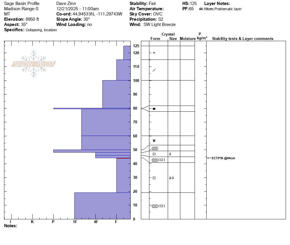
We stopped and dug pits at "Consolation Hill" (SE-Facing slope @9100'), next to the Beaver Slide (NE-facing slope @ 8950'), farther north on the Sage Basin wall (ENE-facing @ 9000'), and above Sage Creek (S-facing @ 8900'). The foundation was weak and faceted in all locations except the south-facing slope above Sage Creek, where the early-season snow had melted back to dirt before the storms post-Thanksgiving began to fill it in (ECTX). We got ECTP 16-24 in the remainder of our pit sites.