
Galena Summit to Ketchum and up the East Fork
Quick report
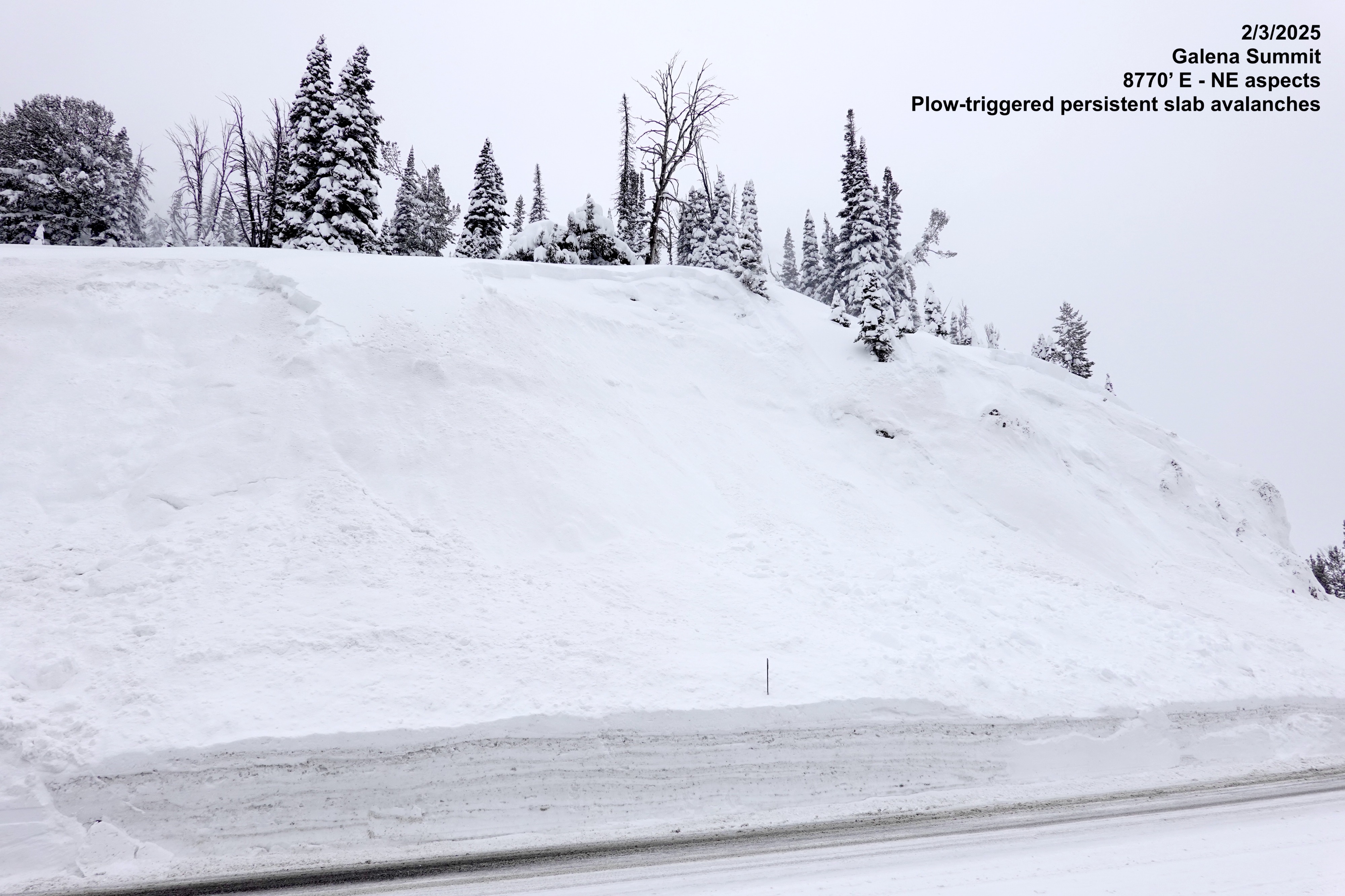
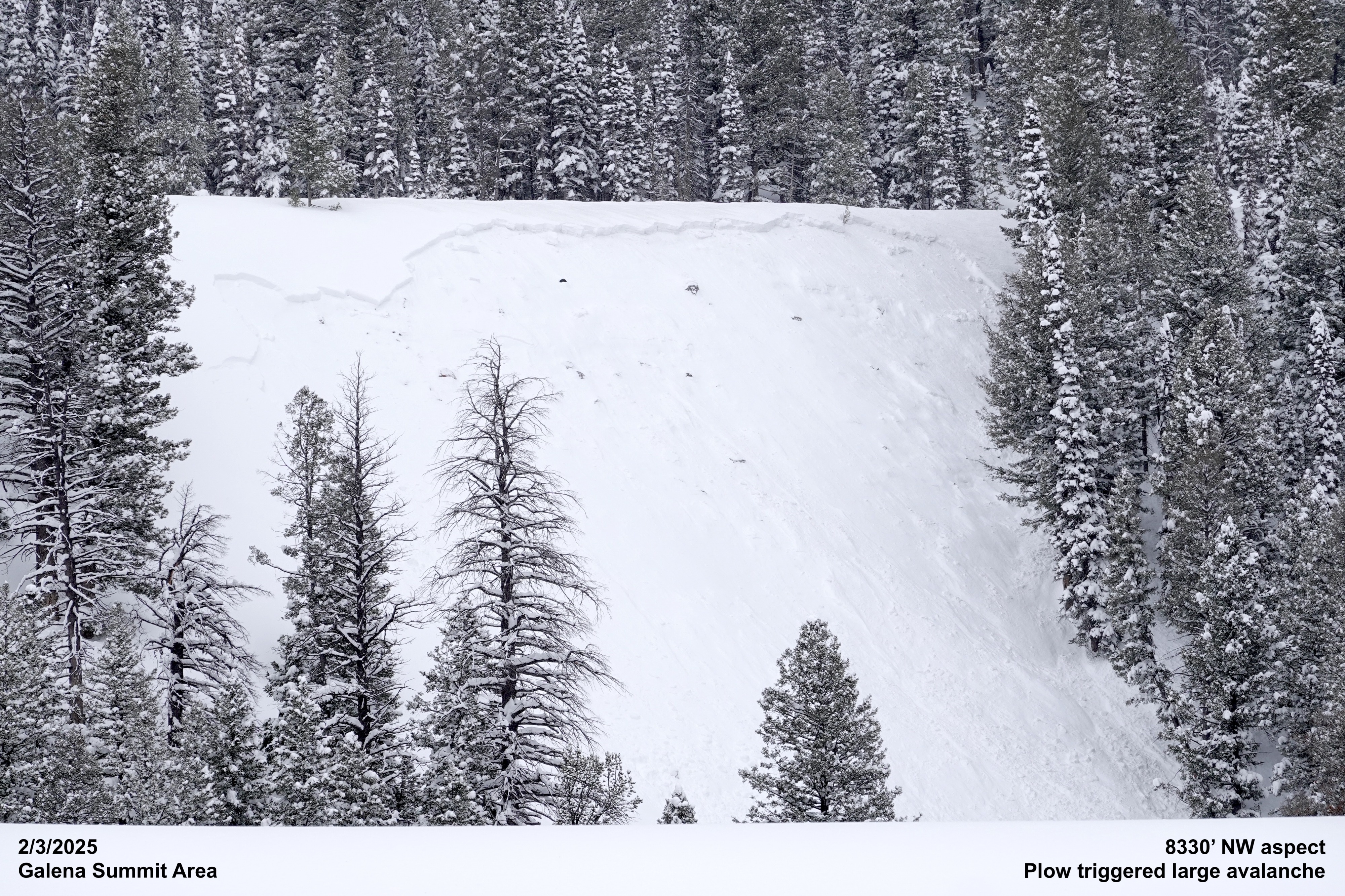
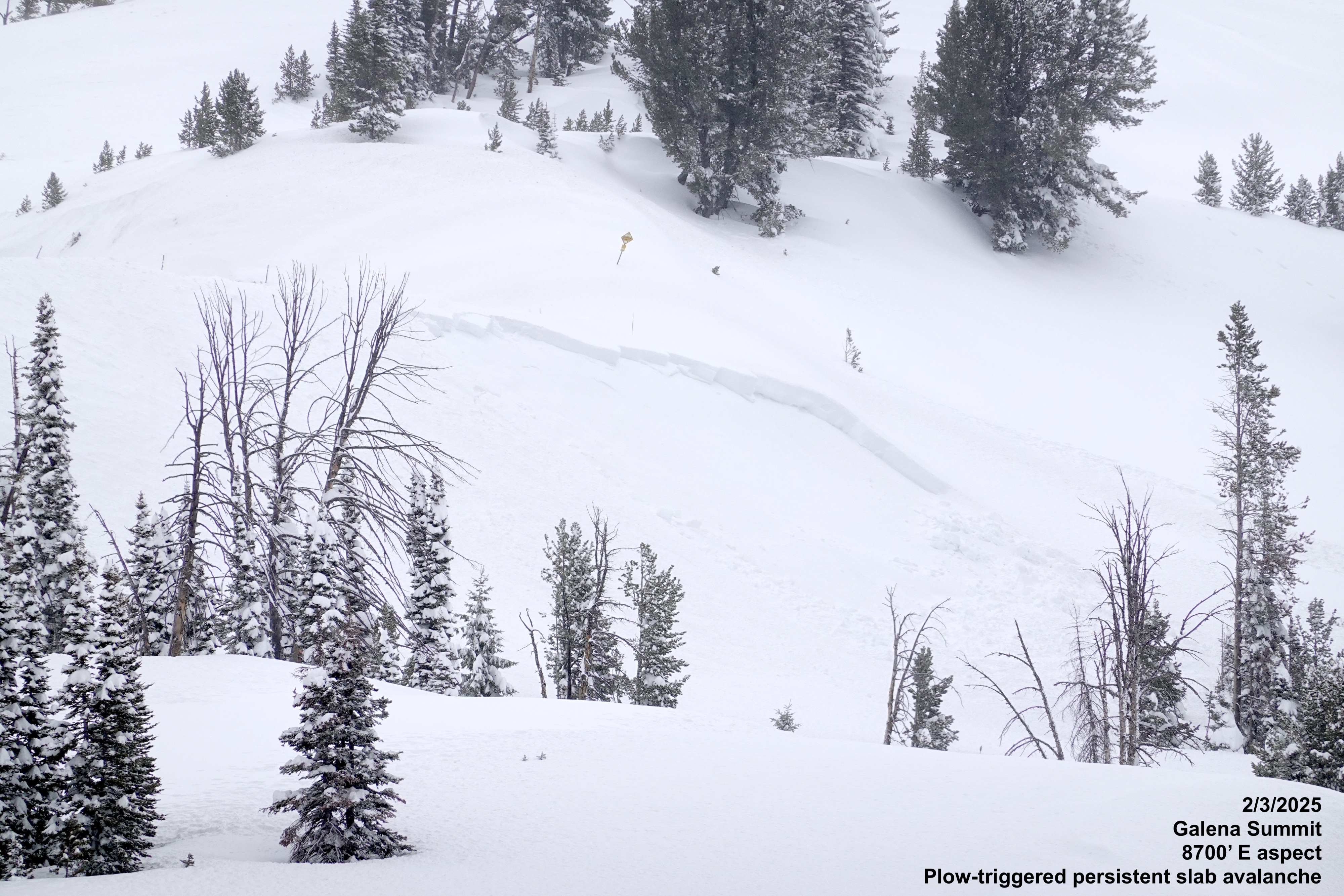
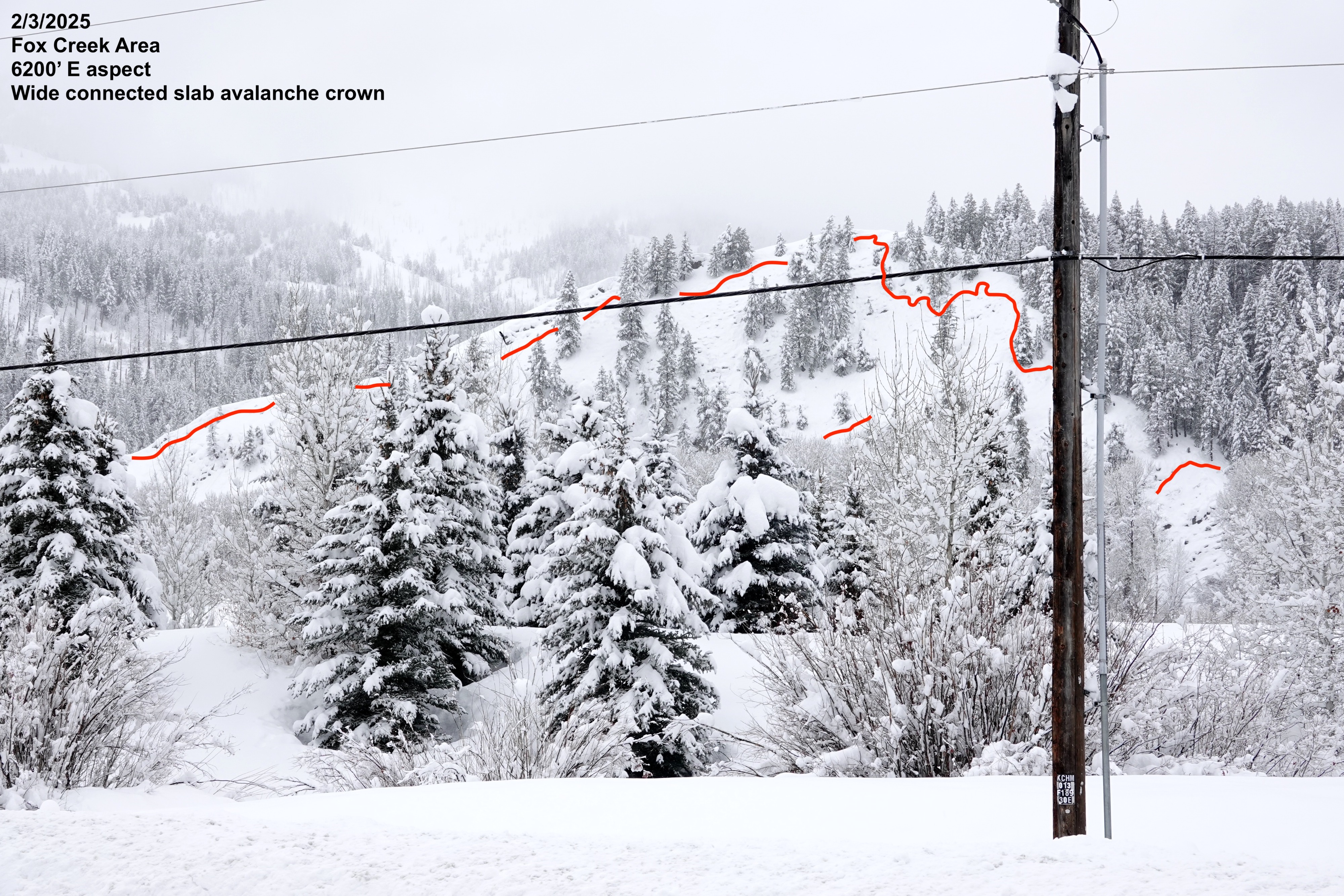
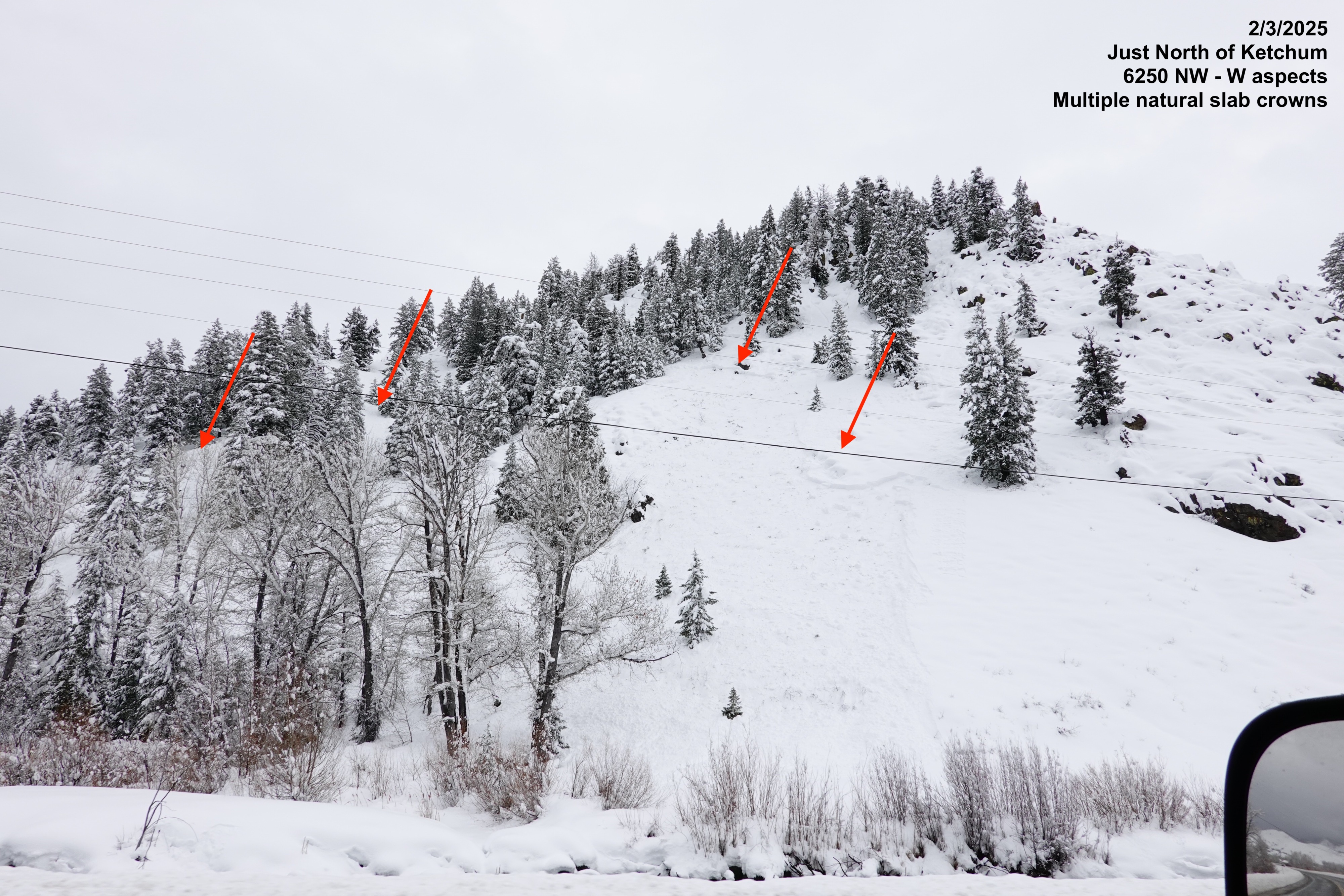
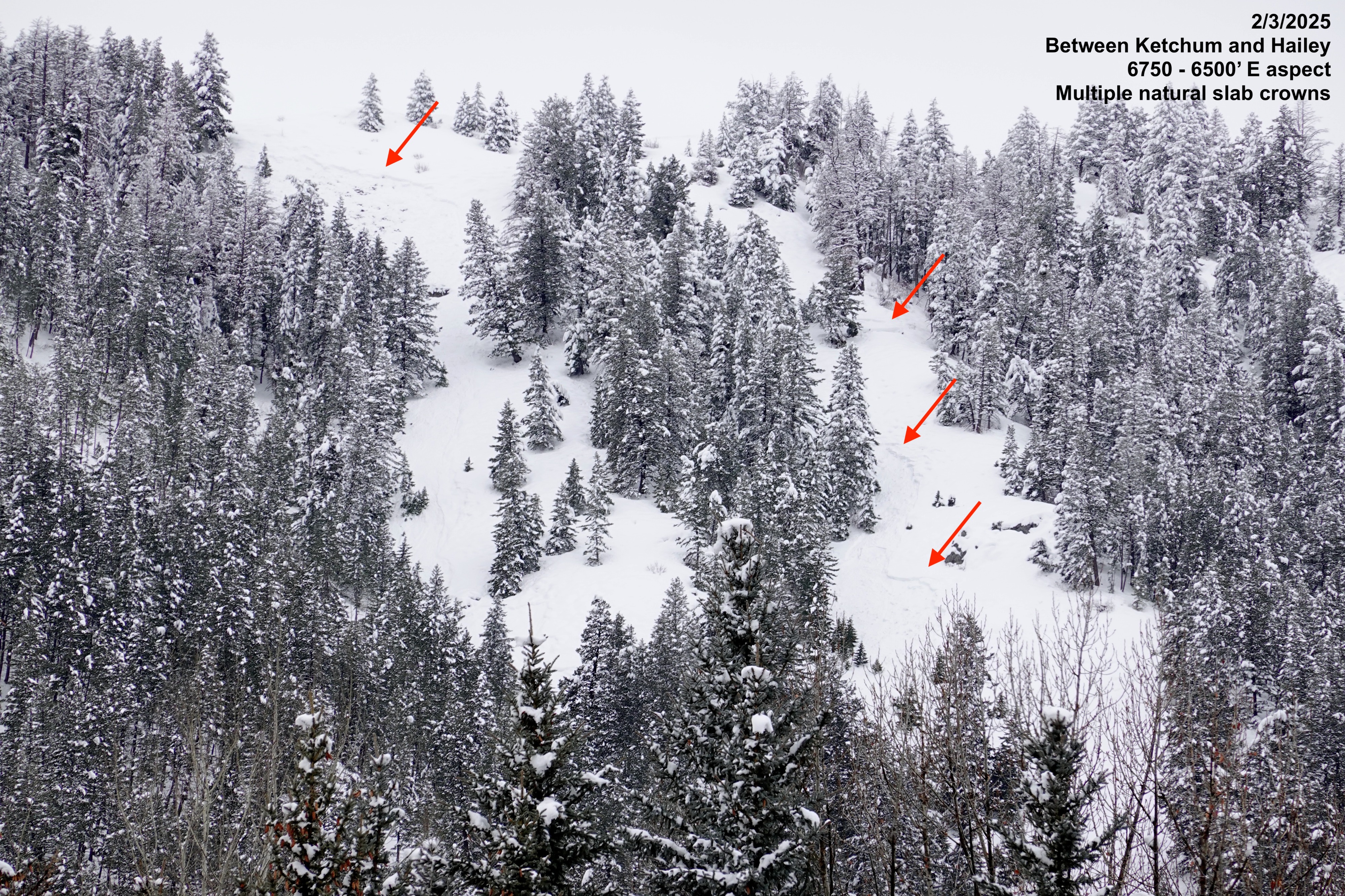
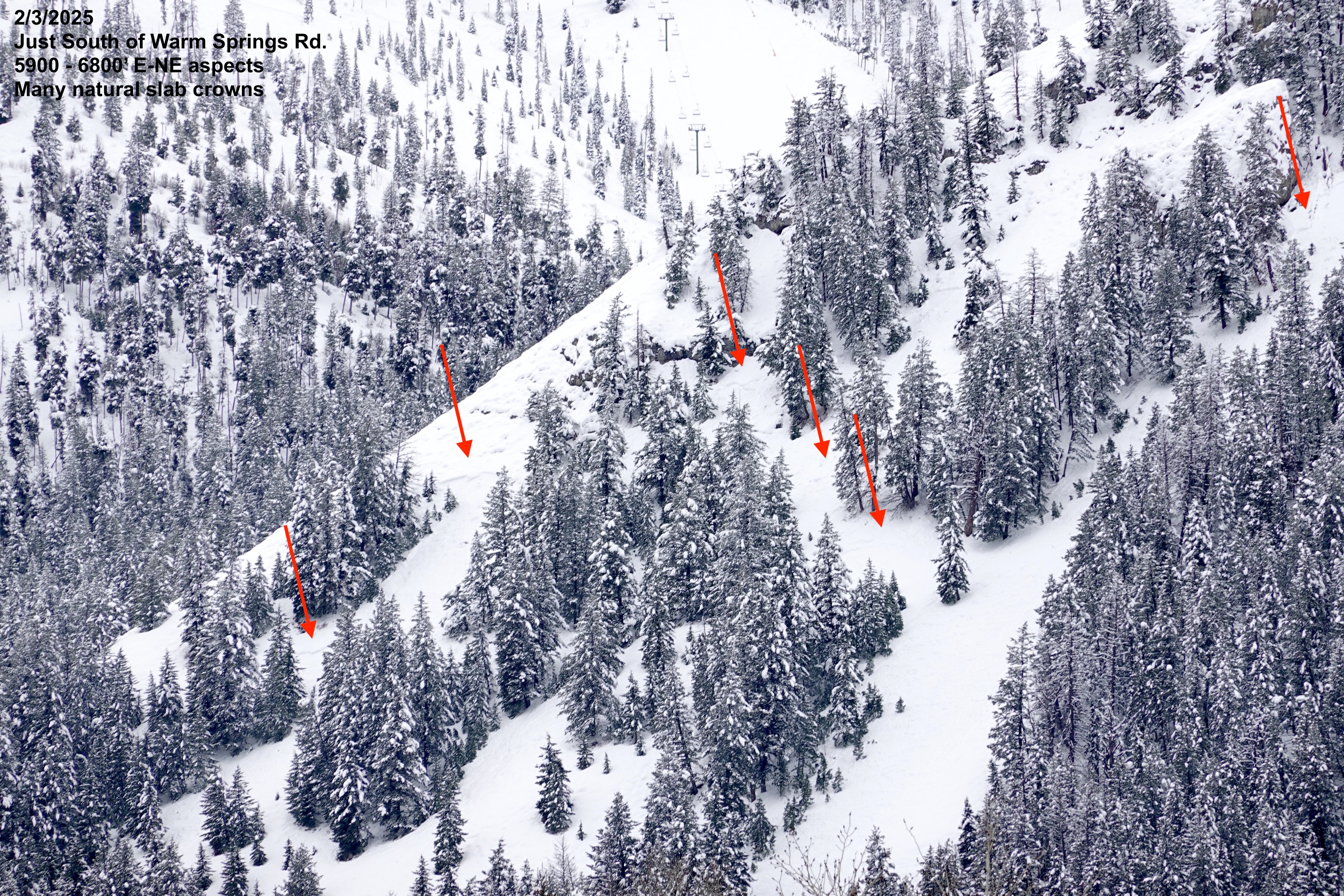
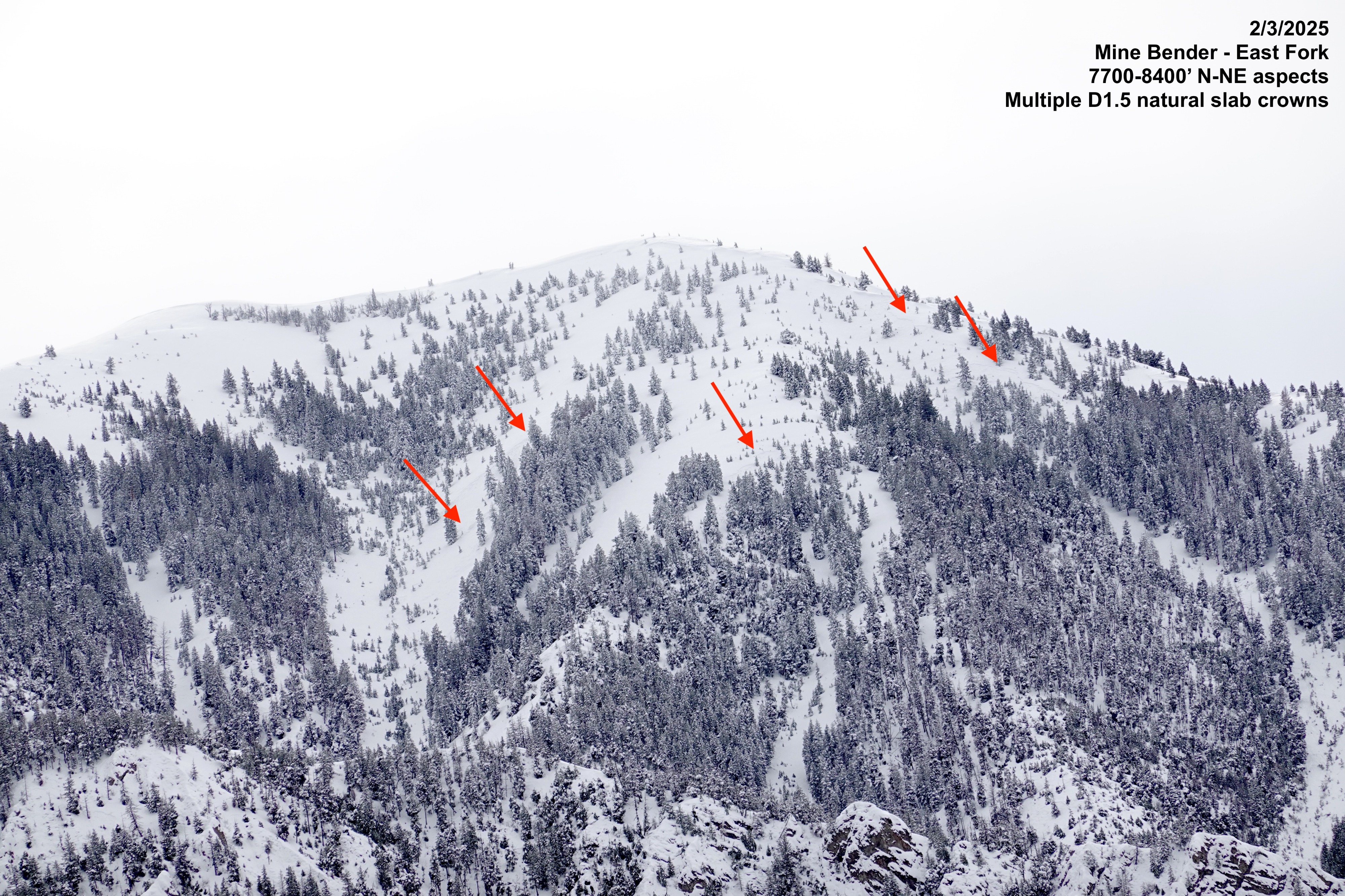
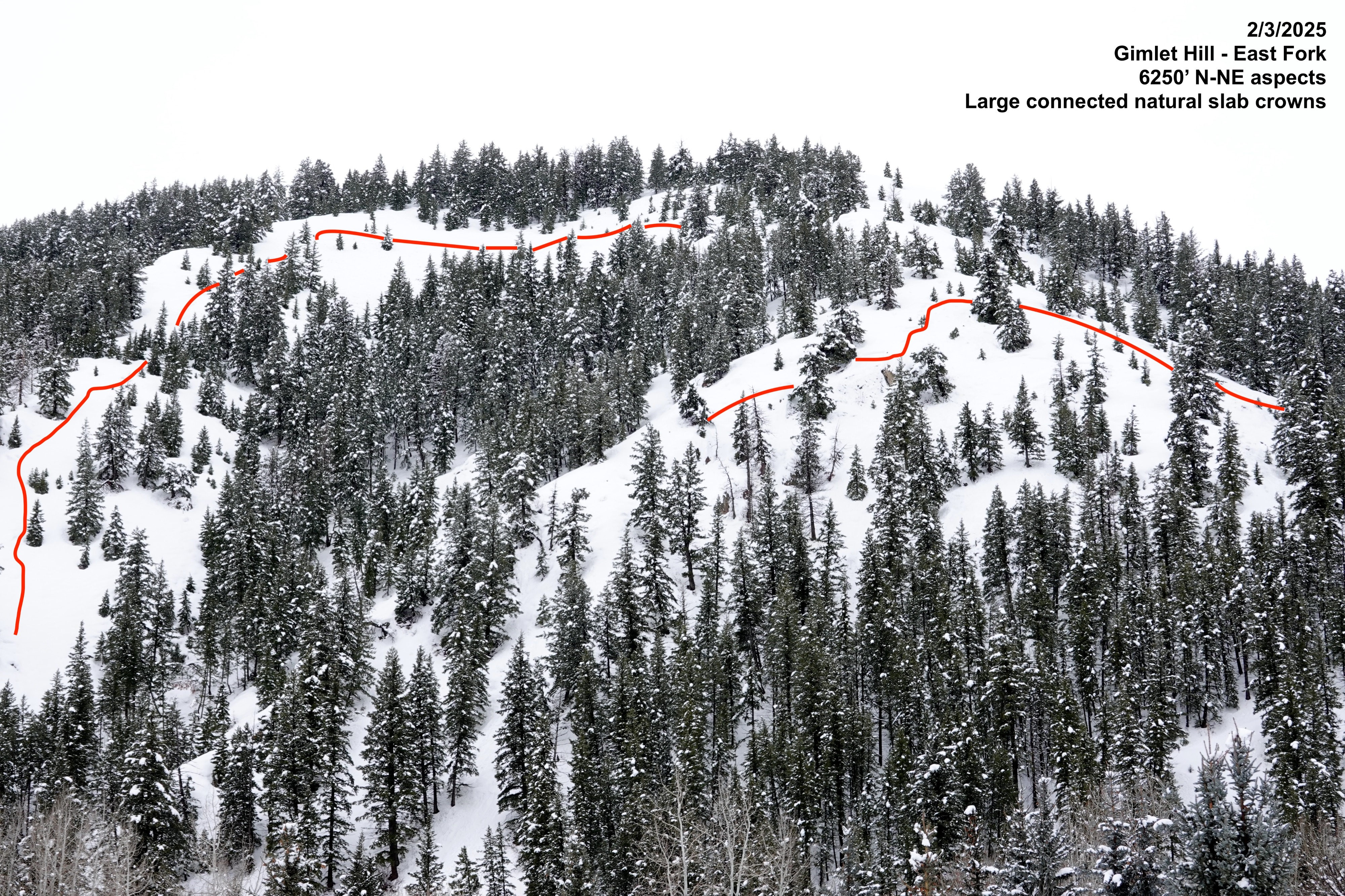
We observed the widespread natural (and plow-triggered) persistent slab avalanche cycle today from Galena Summit down to Ketchum and out the East Fork. Most avalanches observed were size ~D1.5, but visibility was limited to observe the larger avalanche paths where we expect larger avalanches may have occurred.
Widespread natural avalanche cycle observed that all appear to have occurred in the past 24 hours.Weather
- Air Temp
- ~30
- Cloud Cover
- overcast
- Wind Loading
- light
- Rain Elevation
- ~6900 max
- Recent Snowfall
- 40-70
- Snow Avail For Transport
- moderate amounts
Light freezing rain around Prairie Creek TH at 1:15pm and afternoon clearing in the valley south of Ketchum later in the afternoon.
Avalanche
- Size
- D2 R3
- Type
- SS
- Aspect
- NW
- Trigger
- AV
- Elevation
- 8330 ft
Observed no less than 35 natural avalanches today, primarily on NW, N, NE, and E aspects on steeper slopes. Many crowns were connected through and around terrain features - a classic persistent slab characteristic. These avalanches all appeared to have failed at the old snow/new snow interface and were 40-70cm thick (storm snow since 1/31/2025).