
Quick report
- Cracking
- Observed
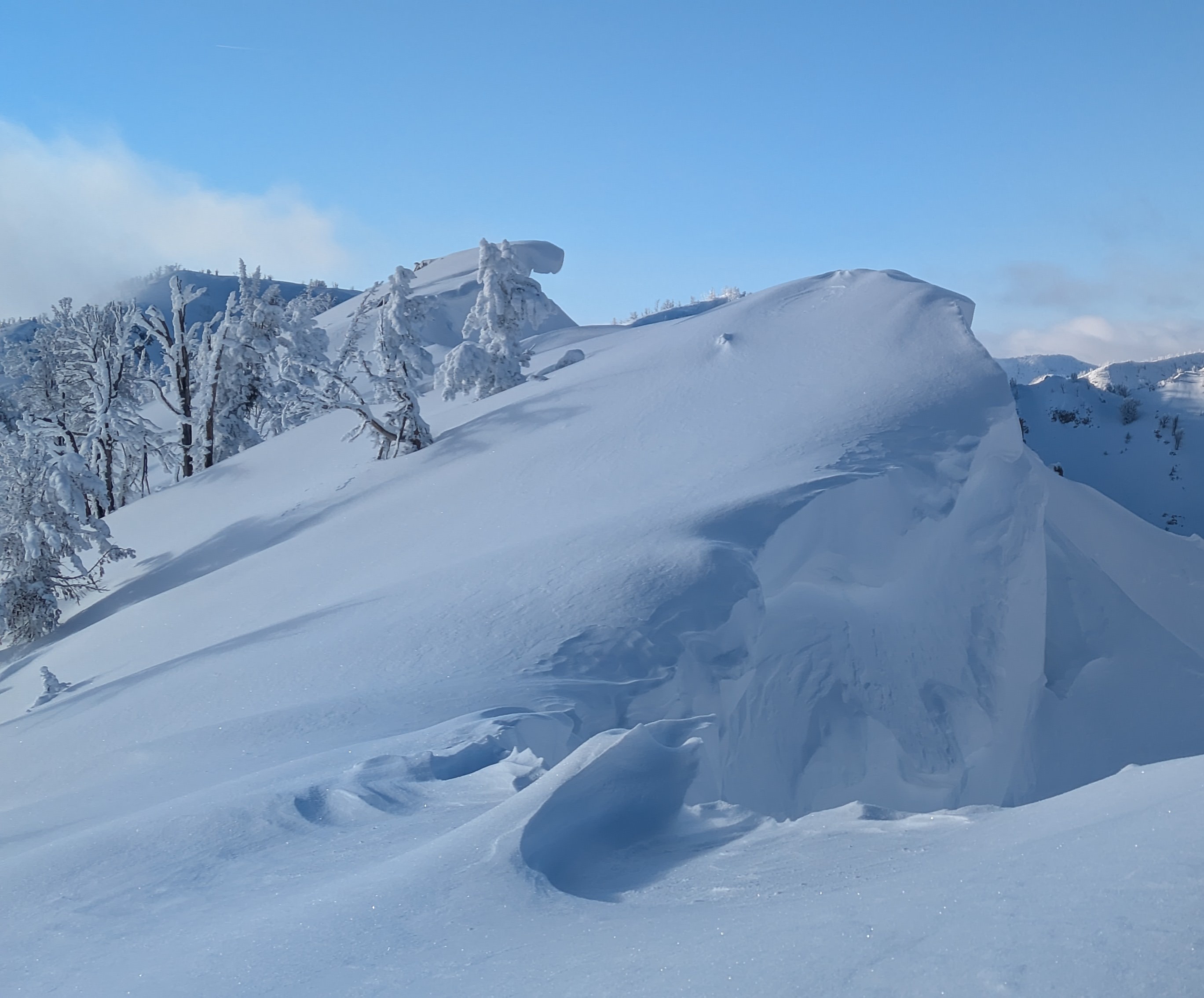
The combination of cold air temps, passing bands of low clouds from a cloud deck at 9,500-11,000', and muted sunshine from a set of high cirrostratus clouds hanging on the western horizon kept snow on solars cold and dry today. Hallelujah! I think this was the first reasonably sunny day when solars didn't get immediately cooked all season. It looked like other ranges may have been receiving more sun. As experienced through the storms of the past week, new snow seemed to be bonding well to itself and the late-December drought layer below. I did not observe any large avalanches in the immediate vicinity. To be fair, I spent a lot more time skiing than I did looking for avalanches. Additionally, the amount of new snow and wind distribution during the storms likely hid evidence of slides that did occur. I did see at least a half dozen places that large cornices had collapsed, with big blocks littering the aprons below. These large cornices are hazardous and seem like "great" triggers for buried weak layers. Many of them have hidden crevasses behind them from partial failures/peeling away from the ridge. Still quite a bit of uncertainty around the late-December drought layer. It does not appear to be a widespread problem, but its worth thinking about. Not too hard to imagine a surprising avalanche failing on this layer in the right/wrong spot. Direct observations of this layer immediately prior to burial seem limited. The early-season weak layer (late-November facets) is deeply buried. I'm still thinking about this layer, mainly because of the extent of natural activity on the layer during December storms, and more than a few big weird avalanches that have happened somewhat recently (like the deep slab in big fatty). Based on natural activity, it seems within the realm of possibility for a very large chunk of cornice to pull out a deep slab on this layer. I did not see any recent large avalanches. A few very small sluffs occurred in terrain receiving direct sun. I initiated some cracking in the most recent wind drifts (deposited after cold front when wind shifted to blowing out of the NW.
Weather
- Cloud Cover
- scattered
It was a bright, cold day. Lots of sunshine out there, but lots of shade too. Winds were flat calm, with occasional "gusts" in the 1-5 mph range.
Snowpack
2.5 feet of settled storm snow above New Year's and early Jan layers by 7,500'. 10-12 inches of this was from during/after cold front. Snow totals increased as I climbed, but there had been so much wind distribution that it was hard to get a good sense for accurate totals.