
Quick report
Following a grey and rainy period, the weather shifted to more of a classic spring-like day. A surface freeze at night made for quick travel conditions in the morning. The intense late March sun quickly warmed up solar aspects, softening the surface. Temperatures weren't quite warm enough for wet snow problems to emerge, but some of the precursor signs developed. Clear skies allowed for good visibility to survey some of the natural avalanches that released from the recent heatwave.
In the afternoon, aspects that were receiving direct sunlight started to soften, and the overnight surface freeze broke down. I could sink into mushy snow close to the top of my boot. There was a lot of evidence of the recent Wet Loose avalanche cycle, but no rollerballs or sluffs from today.Weather
- Air Temp
- 30
- Cloud Cover
- few
- Wind Loading
- previous
- Rain Elevation
- 5800
- Recent Snowfall
- 3
- Snow Avail For Transport
- none
After many days of rain, abundant sunshine all day felt extra nice. Very few clouds, and a light west/southwest breeze. Temperatures started below freezing, but increased to the low to mid 30s F as the bright late March sun rose higher in the sky.
Snowpack
After over 5 days of continuous above-freezing temperatures and rain, the snowpack has changed drastically. Thankfully, a solid freeze overnight allowed for surfaces to become supportable in the morning. By 1100, aspects that received sunlight had softened, and boot penetration was nearing boot top.
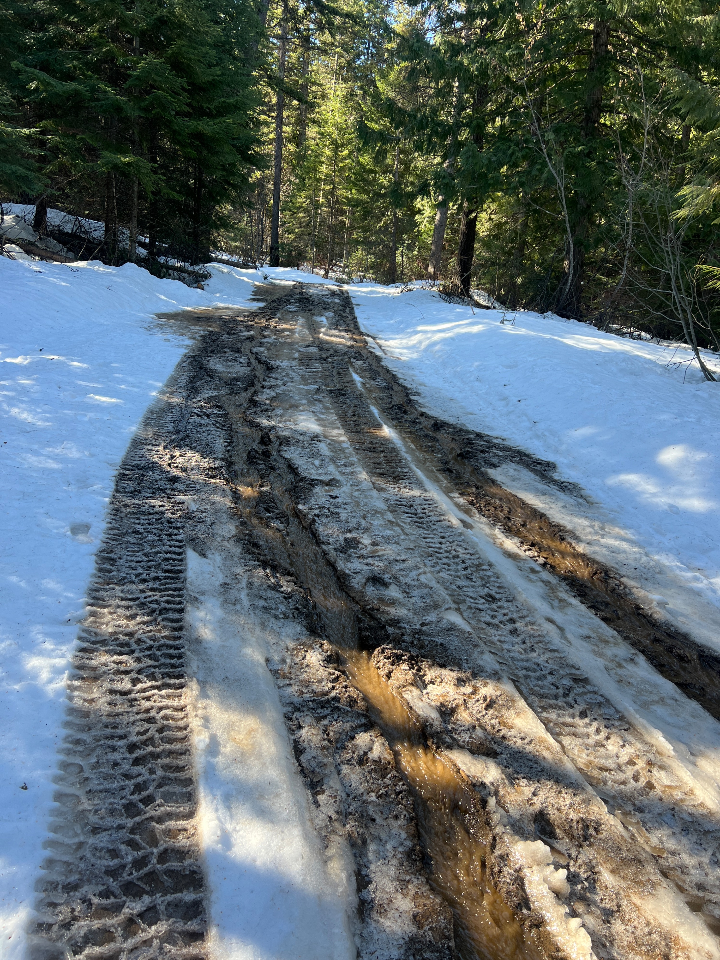
Unfortunately, all elevations were affected by the recent heatwave. Deep settlement cones are at the bases of trees, and snow has melted out of branches and cliff bands. At lower elevations, creeks are rushing and running water is appearing on access roads. Access to higher elevation terrain is starting to become a bit of an adventure again.
On a northeast aspect near 6,300', there was about a 1 inch dusting of recent snow (mostly graupel) that was from a lowering rain line on Friday morning. This was sitting on top of 10cm of P- refreezing melt forms. The 30cm below that was 4F-1F moist melt forms, with a 1F saturated rain crust below that. Water was pooling at this location, but yielded no results in snowpack tests. All of the snow below this was dry-moist, and the 2/14 and 1/28 buried surface hoar layers were still identifiable. These weak layers were not saturated and are rounding.
Avalanche
- Size
- D1.5
- Type
- WL
- Count
- 3
- Aspect
- NW
- Trigger
- N
- Elevation
- 6700 ft
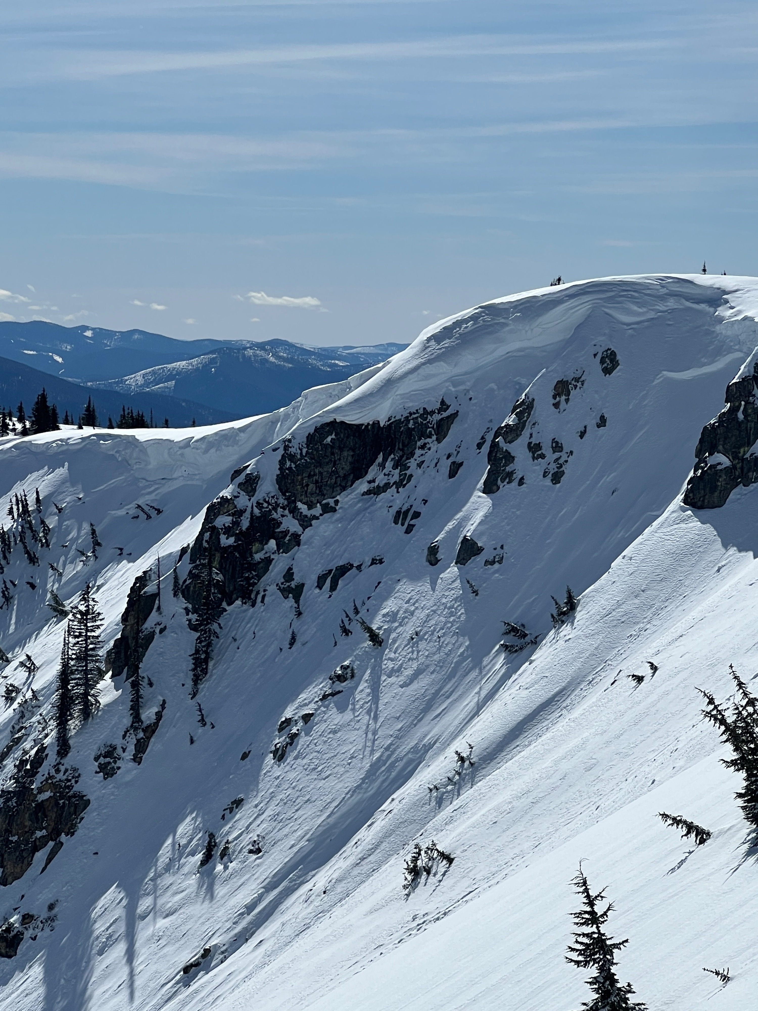
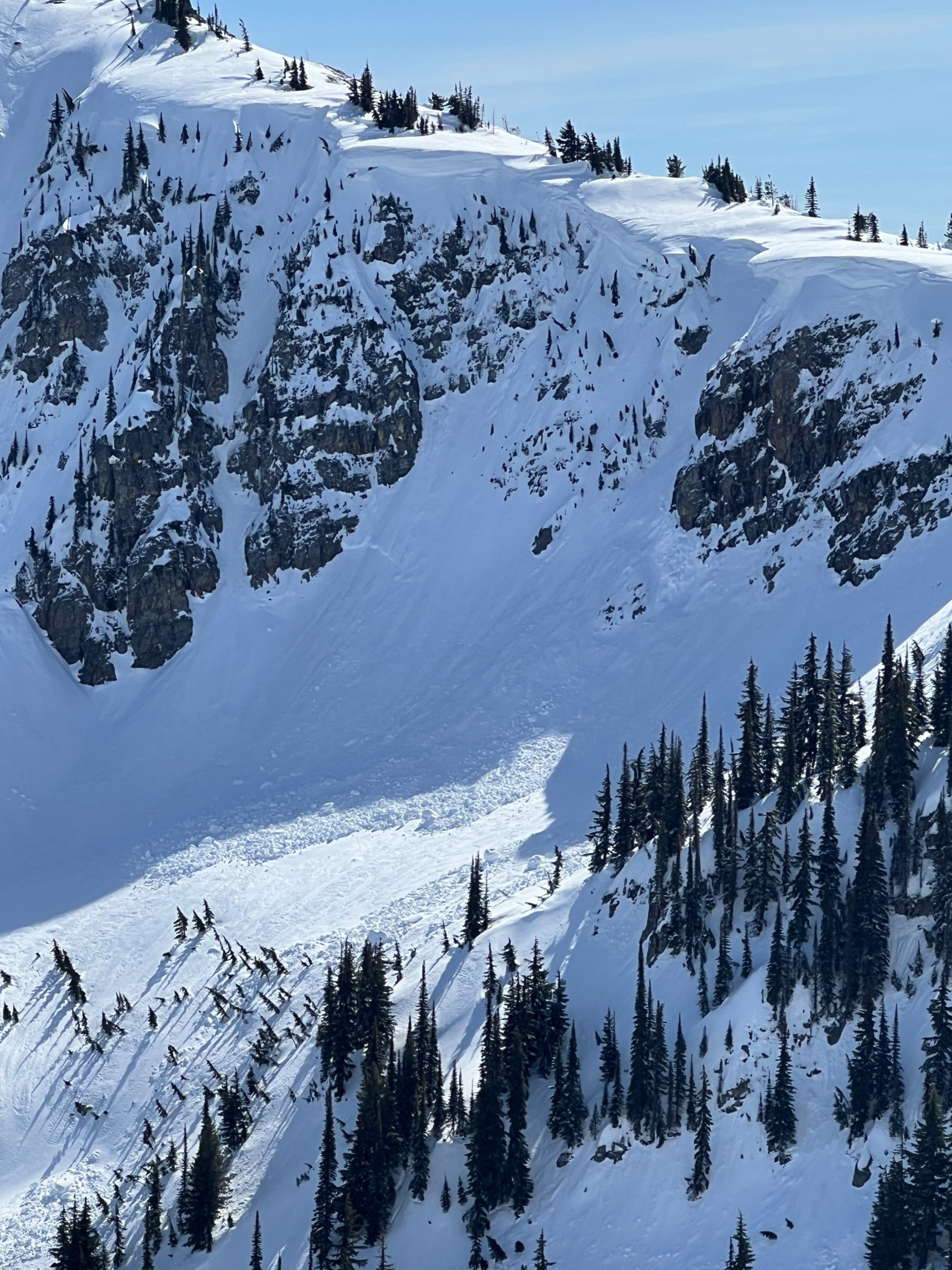
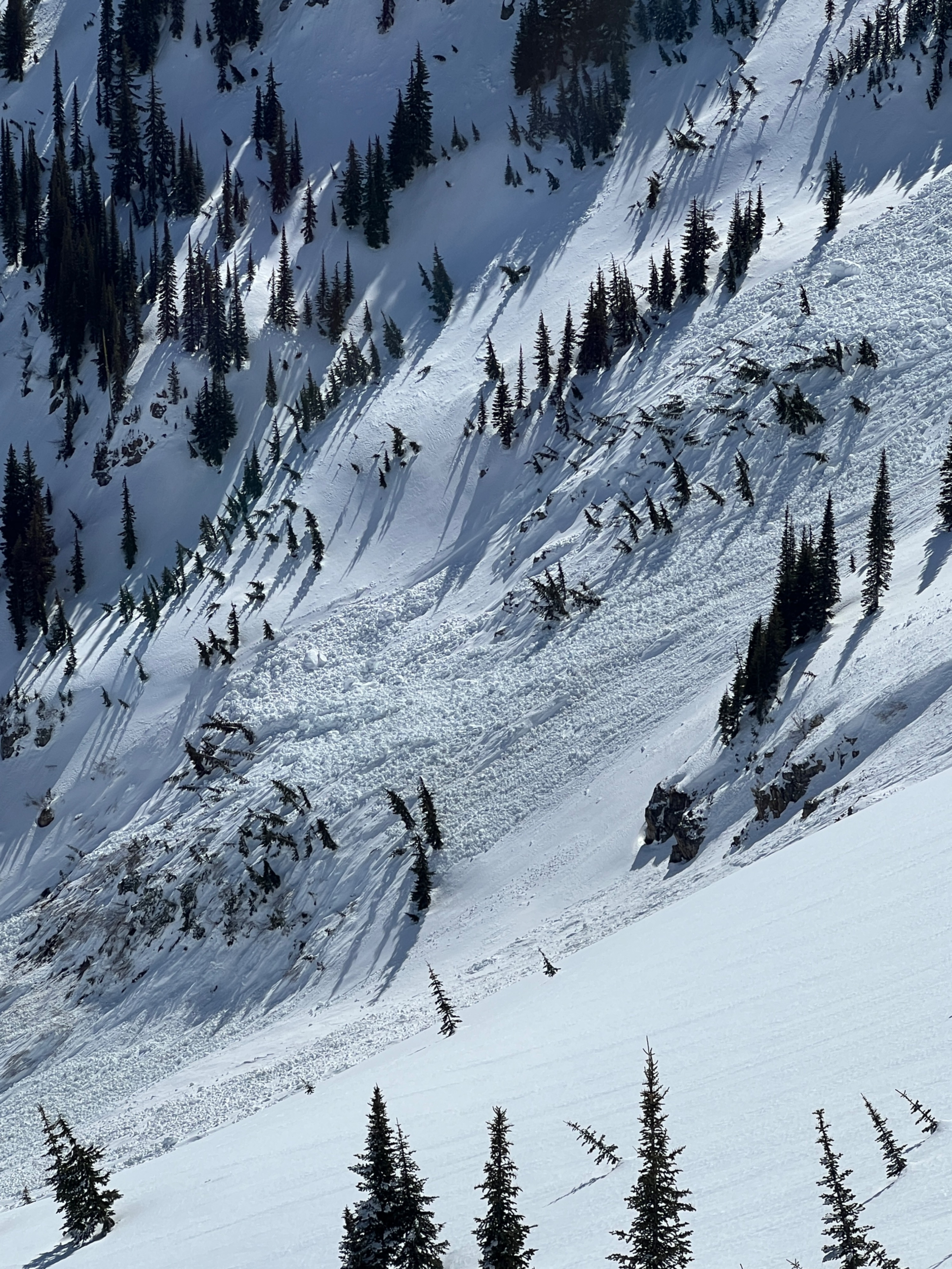
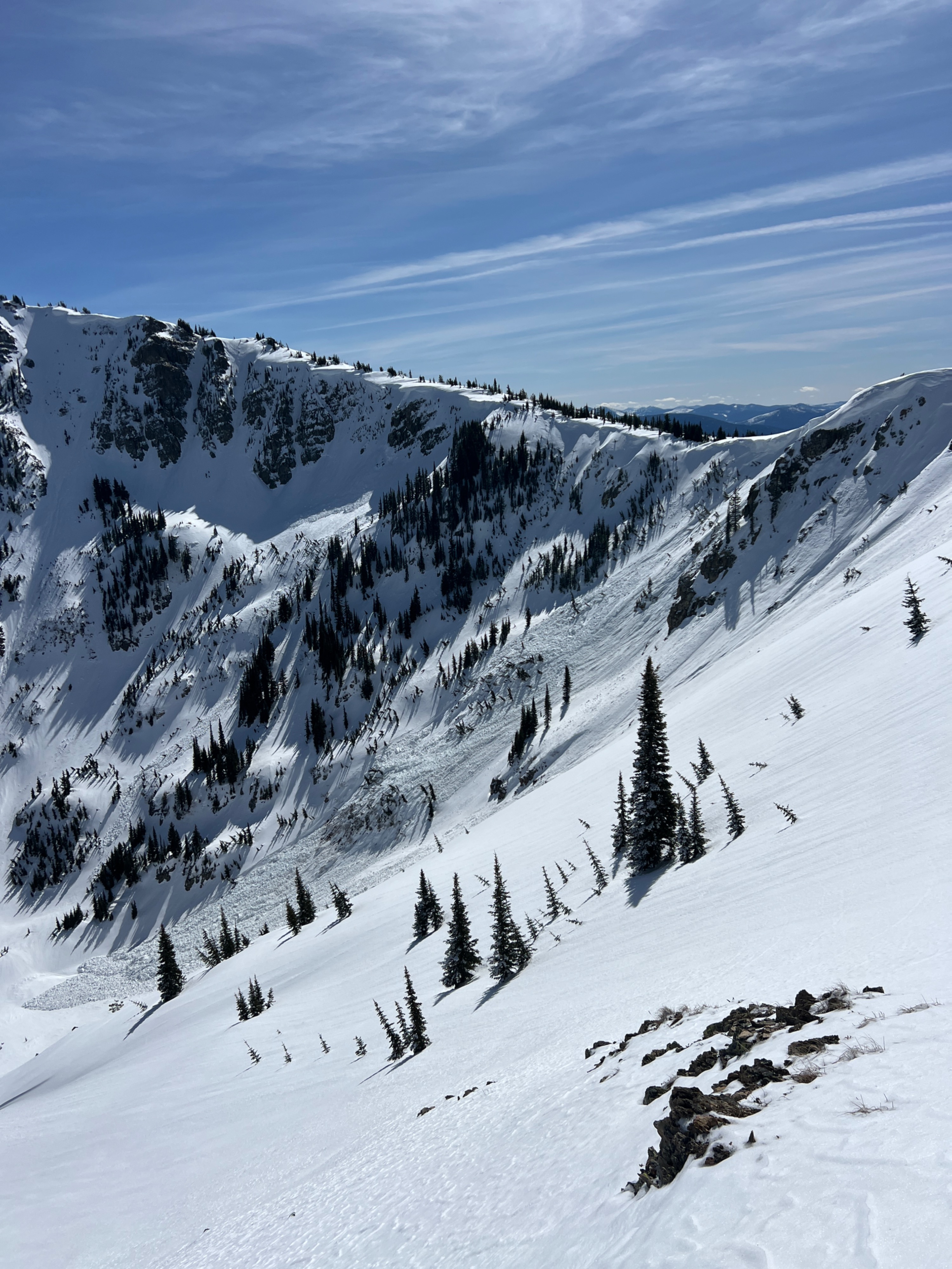
In steep rocky terrain, there was a lot of evidence of the previous heatwave. Small Wet loose avalanches littered many aspects, and cliff bands had shed all their snow. I observed a couple of loose snow avalanches that started quite small, but ran long distances down slopes over 40 degrees, entraining more snow as they moved downhill. Very large overhanging cornices on an east/northeast-facing ridgeline broke off from the recent warm weather, which in turn triggered a couple of slab avalanches. Large chunks of cornice could be seen in the debris, and the wet snow gouged to ground in some places. Smaller trees were flattened, and larger trees were shifted perpendicular to the slope from the dense debris.