
Quick report
- Aspect
- Northeast
- Red Flags
- Cracking, Poor Snowpack Structure
- Elevation
- 2896 m
- Slope Angle
- 24°
- Red Flags Comment
- <p>Old hard windslabs were unreactive. </p>
Snowpack
- Instability Comment
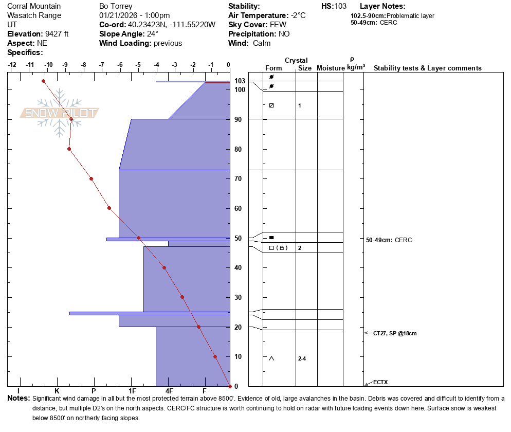
- <p>For now, the snowpack is conditionally stable. However, the weakening of the surface snow, the thin Christmas Eve rain crust, facets combo, and depth hoar near the ground could lead to a complicated snowpack with multiple persistent weak layers that could fail. Here, the CERC is much thinner than observed in the Salt Lake zone; the layer of facets below is dry, they are gaining strength, but the ~inch of snow directly beneath the crust is soft, loose, and still <em>mostly</em> angular facets. What's the saying about a rounding facet still being a facet? If that wasn't enough, the base of the snowpack still holds a weak layer of depth hoar near the ground.</p> <ul> <li>The weakest surface snow we found was <strong>below</strong> 8500 feet on NW-N-NE facing slopes. </li> </ul>
Similar mixed bag of snow surfaces that other observers have reported across the range over the last several days. The biggest difference is the amount of wind damage above 8500’. Wind board, breakable wind board, and orange peel textured snow starting to facet.
Below 8500’ on north aspects held weak faceted snow on the top 8 inches of the snowpack.
Wind Damage on E-NE-Facing slope at 9300 feet.
Wind damage on an east facing slope at 10,300 feet.