
Quick report
We made a quick trip to the Skyland area to see what kind of avalanche activity occurred during the past 10 days.
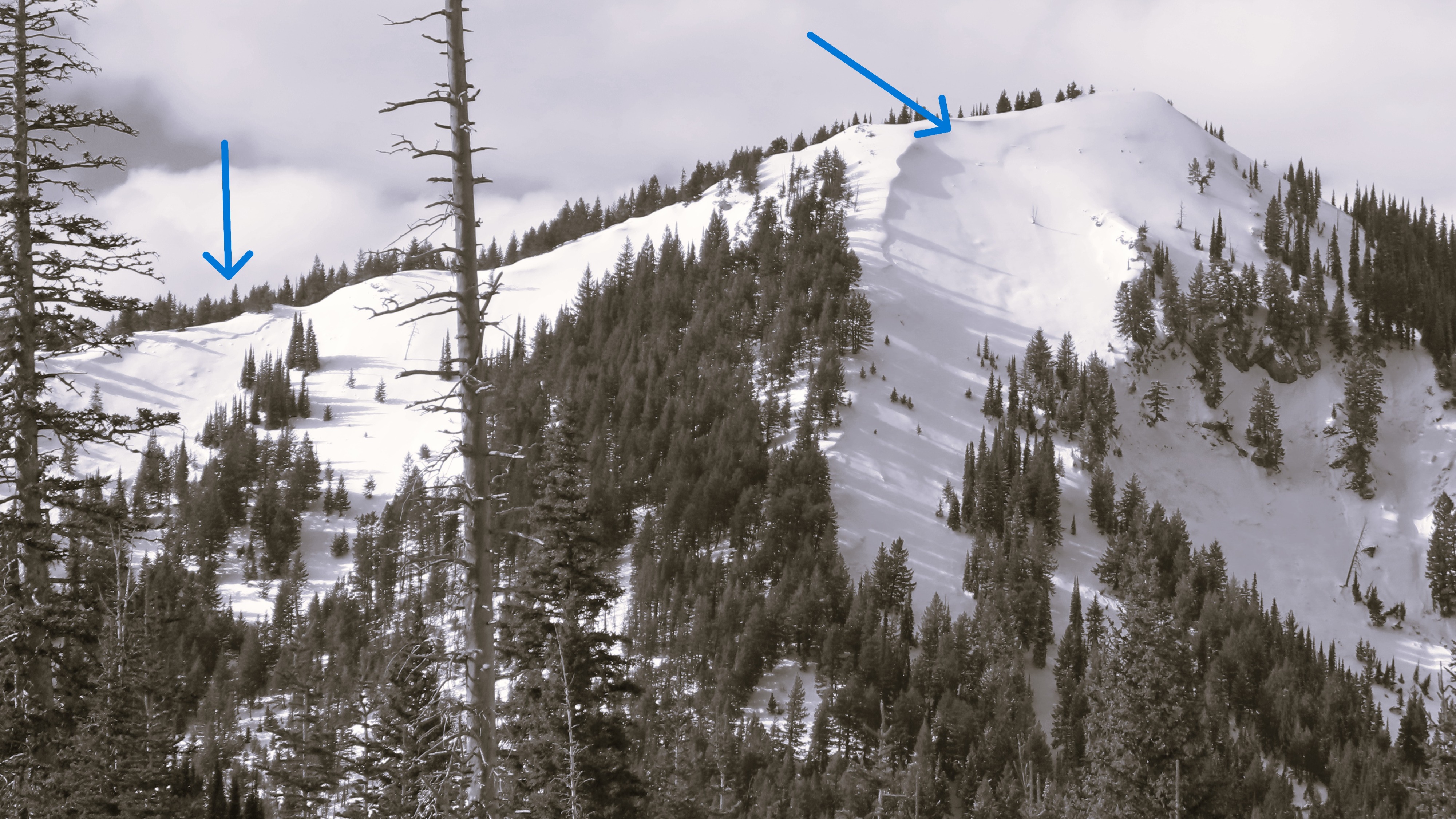
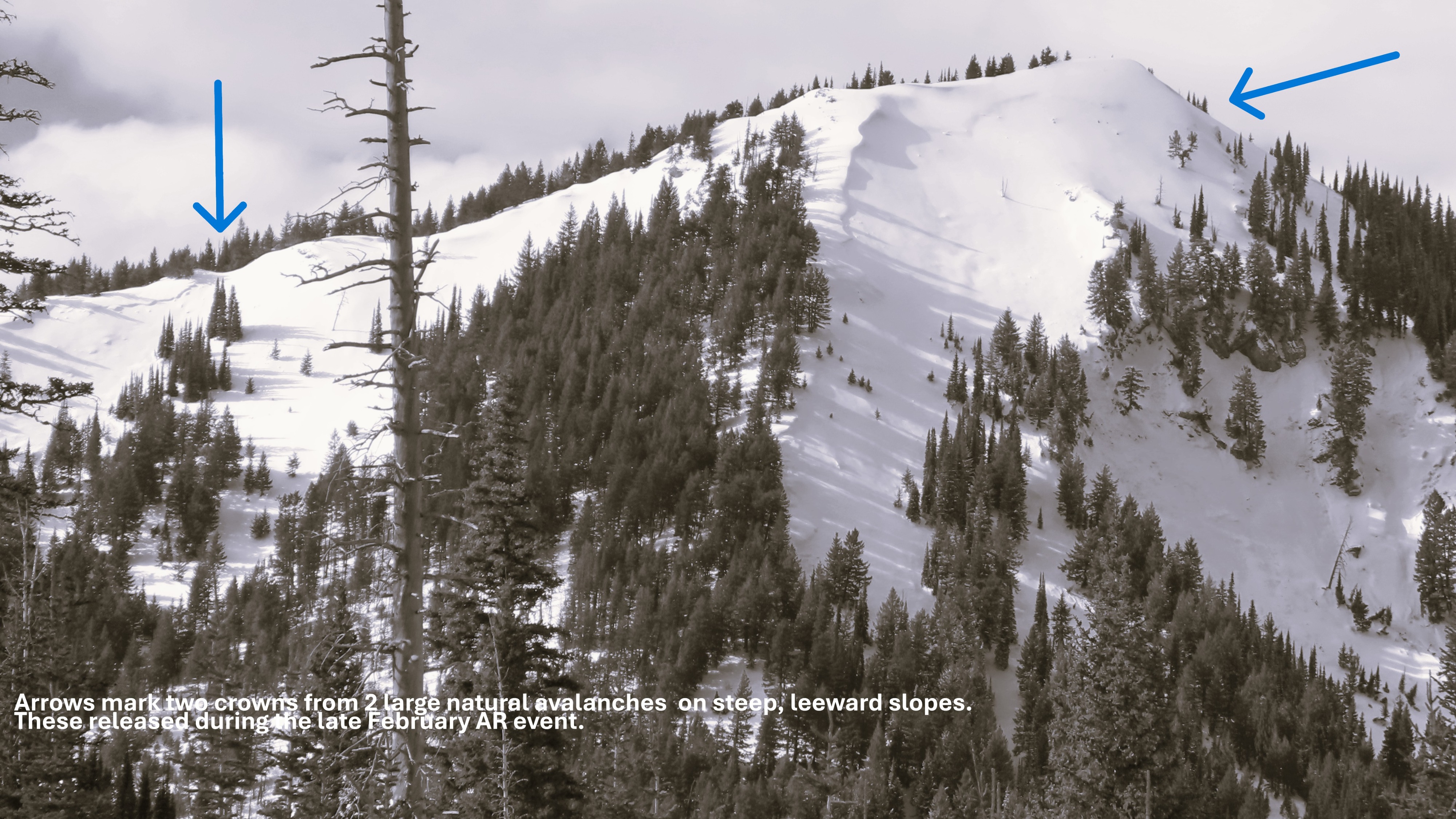
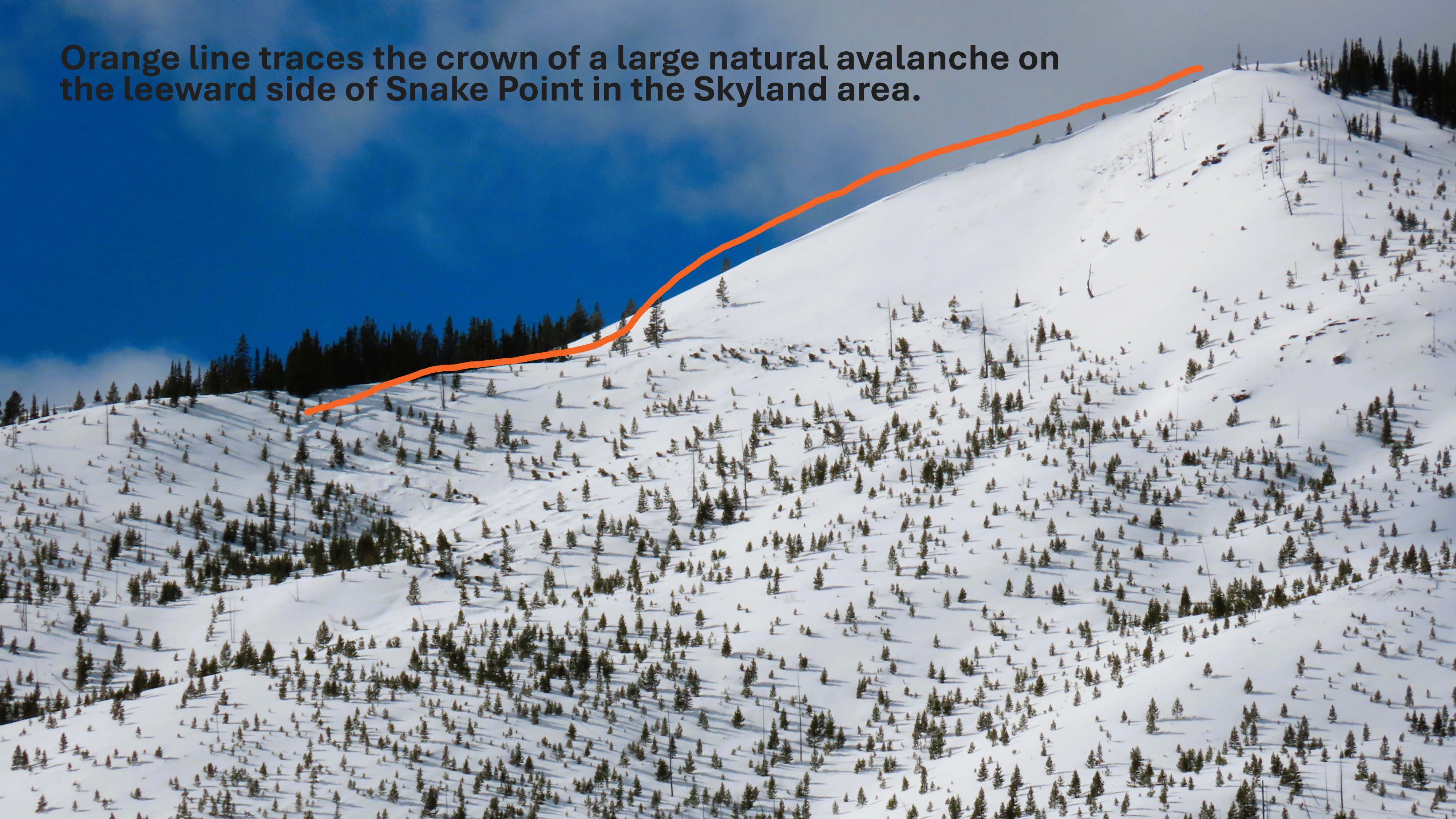
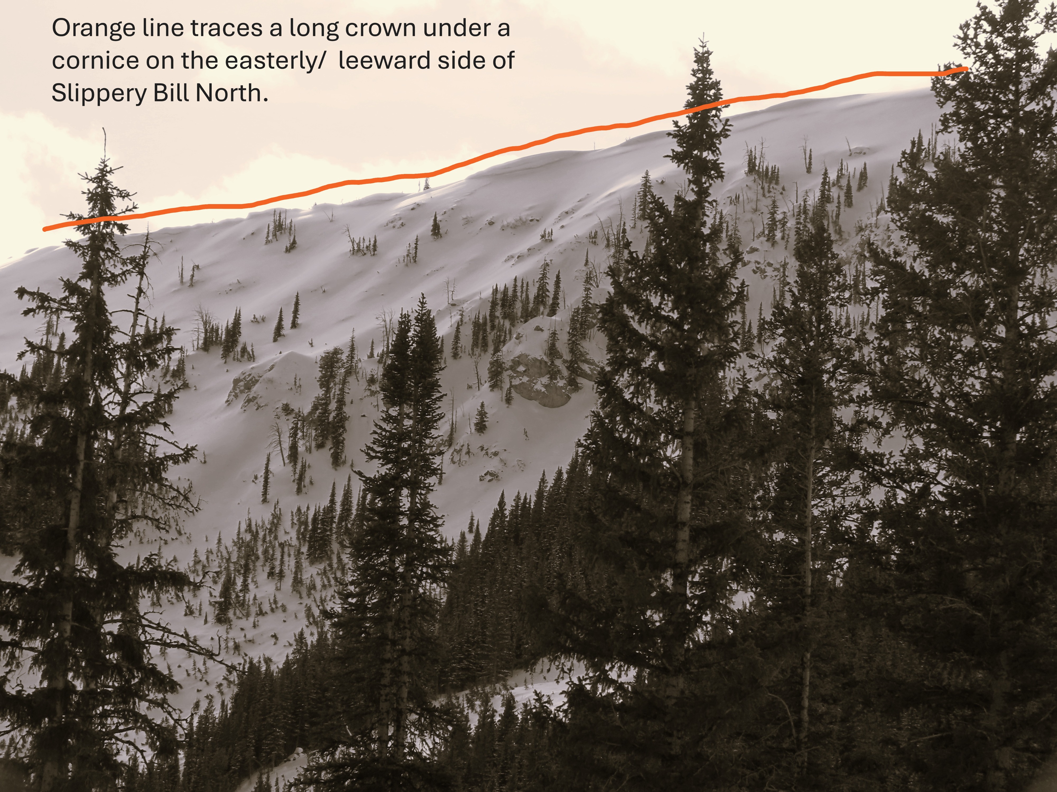
- We saw crowns and debris from numerous large and very large natural avalanches. Most were partially filled in with recent snow or softened by rain and sun, so they were sometimes not obvious.
- All of the older crowns and debris from slab avalanches we saw was on leeward slopes near ridgelines.
- We were surprised not to see evidence of a natural wet snow avalanche cycle - some rollerballs and maybe one pile of debris on a westerly slope.
- Based on the location and apparent age of the crowns and debris, it appears most of the natural avalanche activity in this area occurred during the Atmospheric River storm 2/23-4, perhaps later in the storm when wind speeds were strongest.
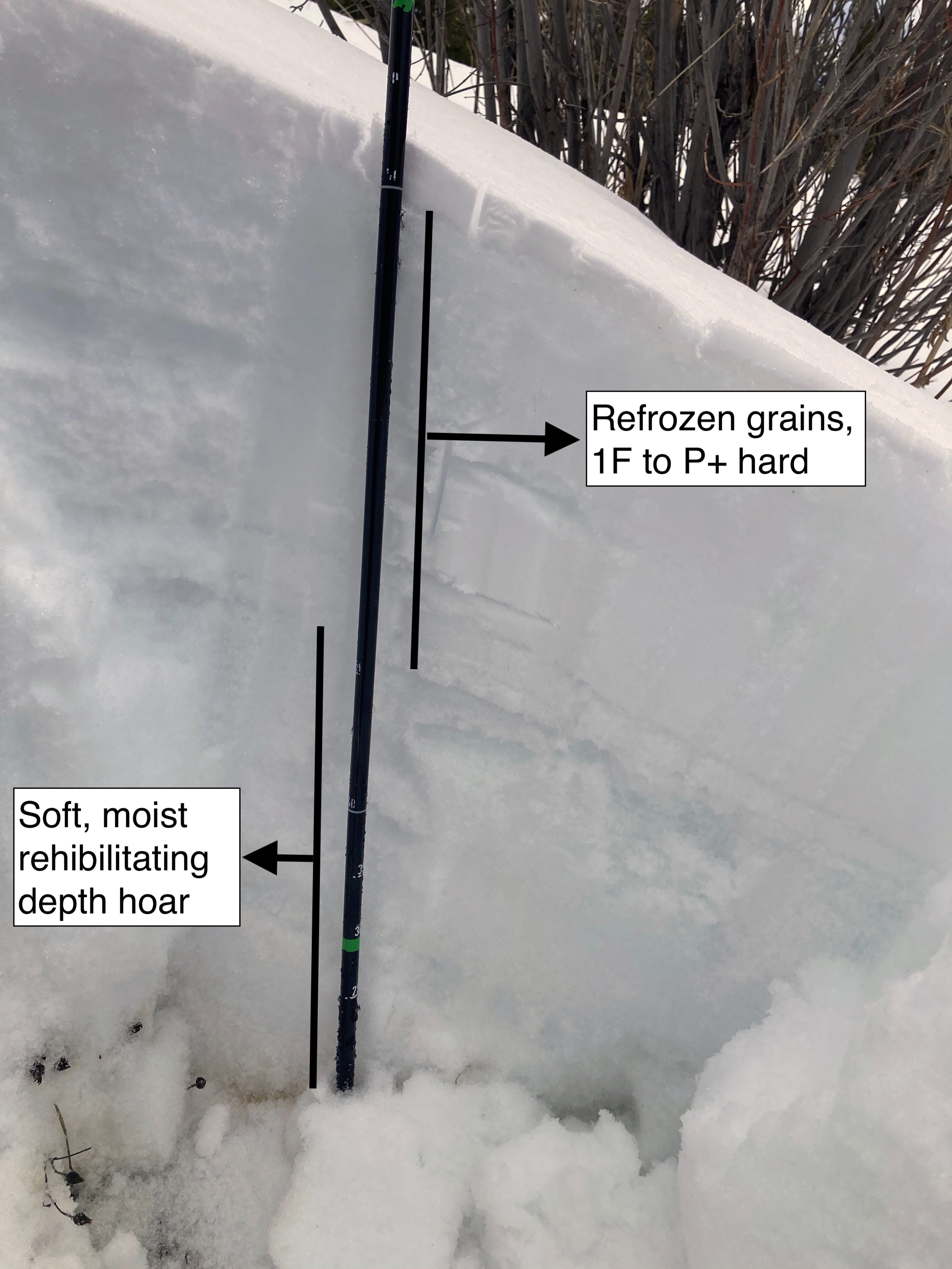
At road level, 1 to 3 inches of new snow covered an upside-down snowpack: hard, refrozen snow capping very soft, moist snow to the ground. See snowpack section. The surface snow was sometimes supportable on foot. You could put a sled on edge, but the edge didn't carve into the snow.
Weather
- Cloud Cover
- broken
- Recent Snowfall
- 5-8
- Snow Avail For Transport
- small smounts
Mild temps and broken skies with sometimes gusty winds even at the snowmobile trail elevation. No signs of blowing snow, however.
Snowpack
Snowpack obs adjacent to the road, 5400-5700 feet, W and E aspects.
- ~40 cm of refrozen snow. This layer is not homogenous, however. The hardness varies and it is layered. P+ or K- hard melt-freeze grains alternate with 1F+ to P hard layers that seem to be composed of rounded grains. Some hardness/ grain type difference are thin and subtle.
- 50-60 cm of soft (4F) moist snow to the ground. The grains are mostly necked rounds, with some large grains still showing traces of striations and corners. This snow was not saturated with melt water.
- The surface cap seemed more supportable on easterly slopes.
- An ECT at 5400 feet on a westerly slope propagated at 24 taps 40 cm below the surface; the block did not slide off the column. The failure layer was rounding facets at the top of the soft snow. This snow was large depth hoar grains at this site on 2/13.
A person's weight would be unlikely to trigger a slab so long as the snow surface was supportable.
Avalanche
- Size
- D2 R2
- Type
- HS
- Count
- 7
- Aspect
- E
- Trigger
- N
- Elevation
- 6700 ft
Crowns and debris from multiple large and very large natural avalanches on/ below leeward slopes. These appear to have run during the Atmospheric River event; crowns looked similar age as crown on Elk Mountain known to have slid during that event. Most above rain/ snow line during that event Slabs probably consisted in part of wind-blown snow; they look to have released deep enough in the snowpack for the failure layer to be the January Junkshow. A few more recent slides. Possibly from warming event or cornice falls. Surprisingly little evidence of slides from recent warmup.