
Quick report
From the car, 3-4 inches of new snow overnight was very wet but significantly drier by 8000 feet. At mid elevations, the January 4th interface is down about 3 feet (1 meter) in most places underneath a consolidating storm slab. The 2/3 crust is very obvious with probing on southeast aspects below the storm snow.
Spent a good amount of time out of the old skintrack on the way up and did not get any collapsing or cracking. While the storm snow is consolidating, it did not seem to be overly stressing the snowpack.
By late morning, the sun had fully emerged and was rapidly warming anything with a southern tilt. When switching from a northeast aspect to an east and then southeast aspect at 9000 feet, the sun effect was astounding and the top few inches of snow were quite moist whereas an hour before it was mostly dry. This trend continued throughout the early afternoon and low elevation snow was saturated and the trees were literally raining. Challenging skiing ensued.
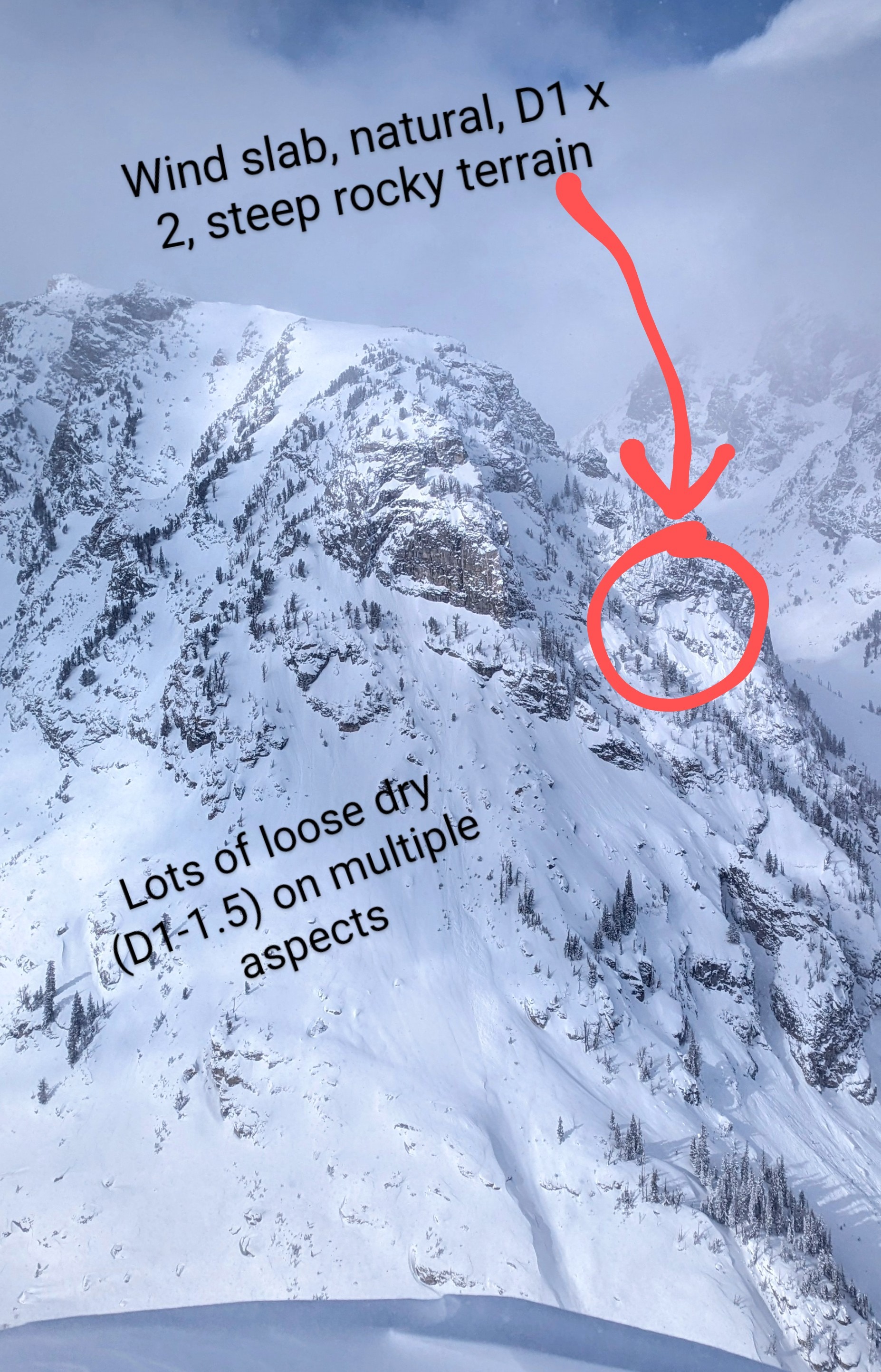
Temperatures remained cold in the alpine at upper elevations and widespread dry loose avalanches (Up to D1.5) were observed on multiple aspects. Two small (D1) natural wind slabs were observed in thin, steep rocky terrain on an east aspect at about 9800' (the 11's on Wister).
Weather
- Wind Loading
- light
- Snow Avail For Transport
- moderate amounts
The weather was the story today. Just below freezing at the car this morning, overcast skies. 3-4" new snow overnight that was very wet and sticky. Between the car and 10,000' we had periods of fog, heavy snow (S-2) and then gradual clearing and warming by late morning. Light south winds at upper elevations gusting to moderate. Increasing temps throughout the day and getting above freezing at 9500 feet with some intense solar input. 36 F back at the car but felt much warmer in the sun.
Avalanche
- Size
- D1
- Aspect
- SE
- Trigger
- N
- Elevation
- 9800 ft