
Quick report
Theme of the day, lots of snow. The series of recent storms over the last 4 days brought 20-26" of snow in the middle-upper elevations. Recent snow was right-side up. Boot penetration was knee deep once you stepped off your machine. Recent avalanches were all hard to see and occured mid storms, primarily on steep wind loaded N-E aspects. We found signs of instability within the recent snow between storm interfaces and the new-old interface (buried 12/27) during hand shear tests that failed with easy-moderate pressure. Formal stability test confirmed these findings (See Snowpack section). Did not experience any cracking or collapsing. Snow depth and coverage has improved significantly (up to 80" of snow at 9000'), except lower elevations on the approach which is still thin. Cloud skies all day, light westerly wind, and light snowfall (less than 1cm/hour).
Snowpack
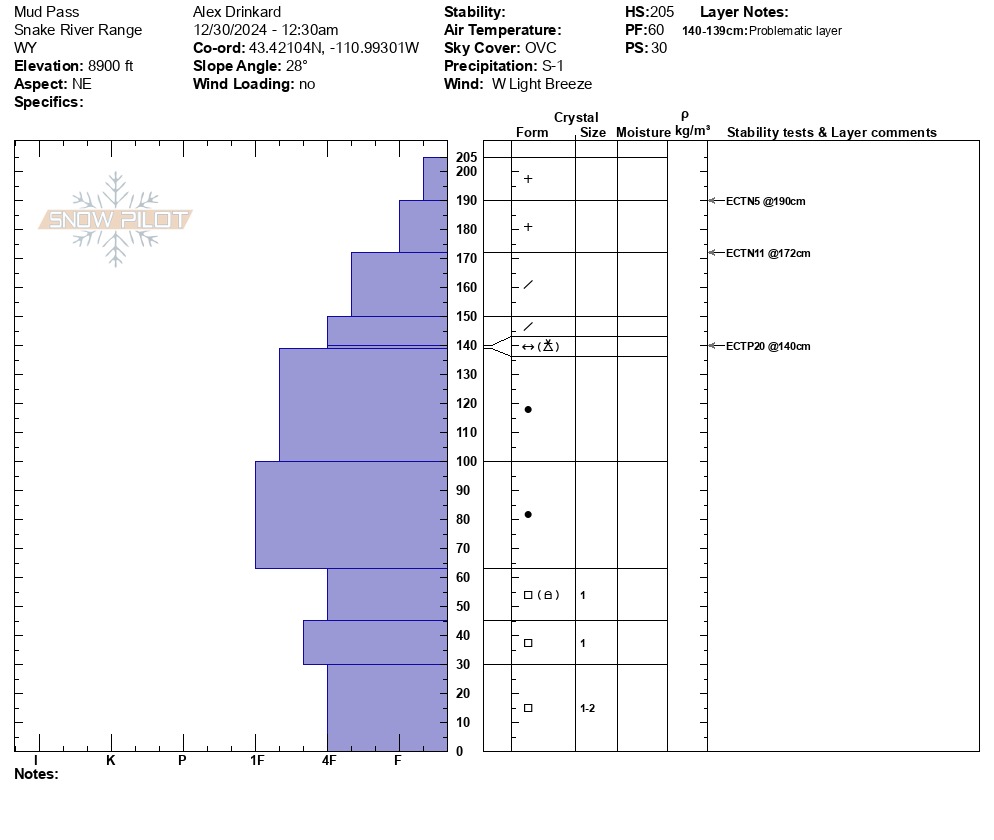
Dug a snowpit on a NE aspect at 8900' HS: 205cm ECTP20 down 65cm (25") failing on new to old snow interface that was comprised of needles (possibly near-surface facets) and graupel. The subtle layers of storm interfaces between temperature and wind changes over the last 4 days did not fully propagate, but they did collapse more than half way across the column. These layers are gaining strength quickly.
Early December weak layers were buried 140cm at this location. The bottom 60cm of the snowpack consisted of 1-2mm facets. Some facets were beginning to round, but still need more time to fully heal. The deep snowpack will certainly help. Snow depth across the Snake River Range can vary and mosquito is consistly some of the deepest.