
Quick report
- Cracking
- isolated
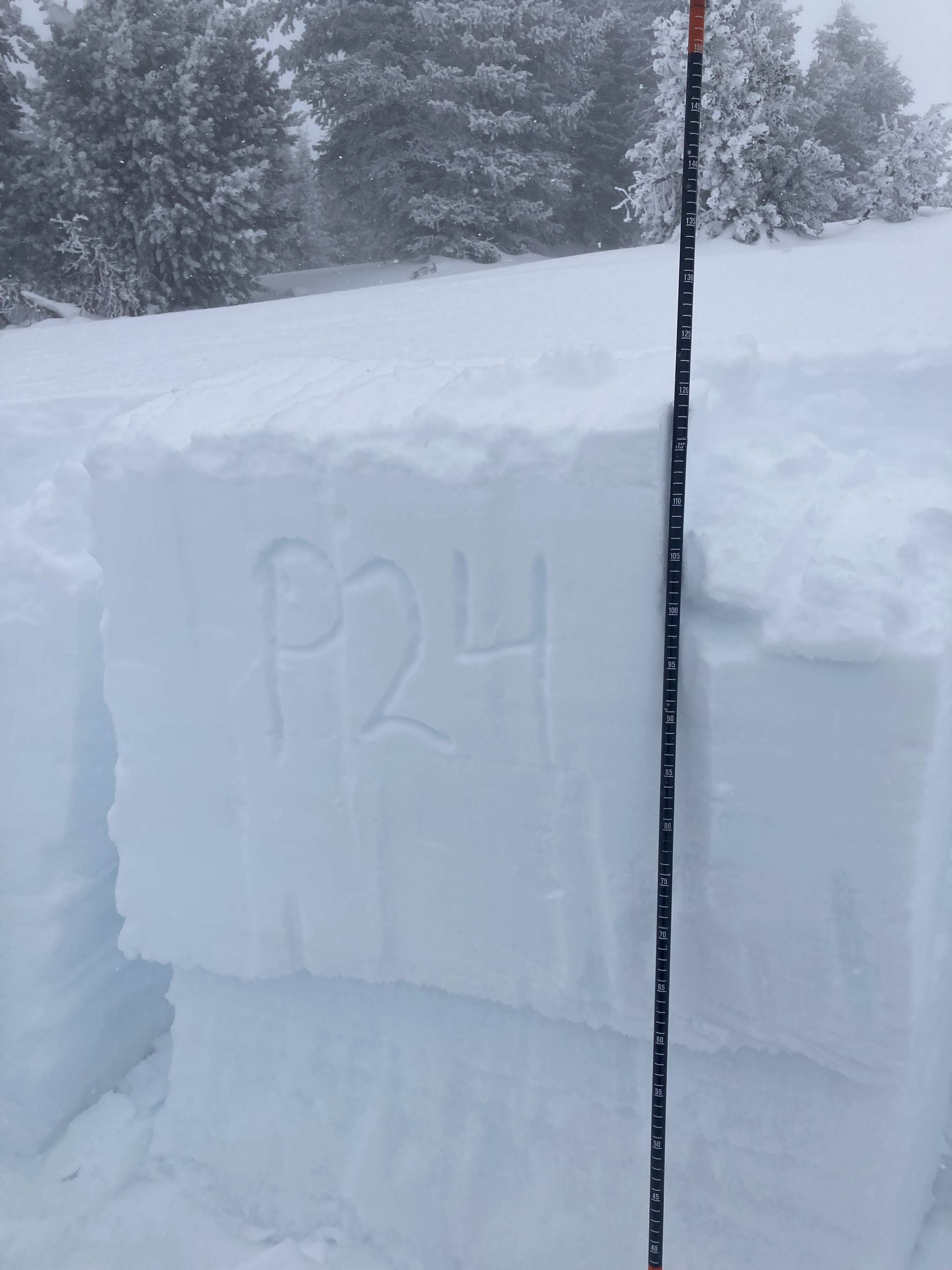
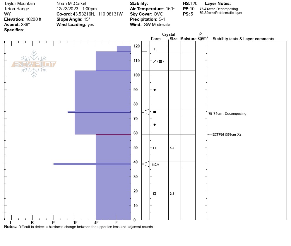
Toured up Taylor to monitor the snowpack on north facing terrain above 10,000'. A supportable crust exists on most aspects up to 8500' and on S-SE facing terrain above that. Snow depths vary greatly with aspect but range from 2-4' above 8000'. Dug on a NW facing slope at 10,200'. HS = 120 cm ( ~4ft). Observed propagation on the November drought layer. ECTP 24 x2 down 60 cm (~2ft). The snowpack in this location was dry. The snowpack structure in areas other than high north facing terrain is improving. Ski pole probing revealed a more consistent hardness profile than previously observed on S-E facing aspects. Moist snow was also observed on these aspects. There was no evidence of surface hoar buried by the new snow in the few areas I looked.
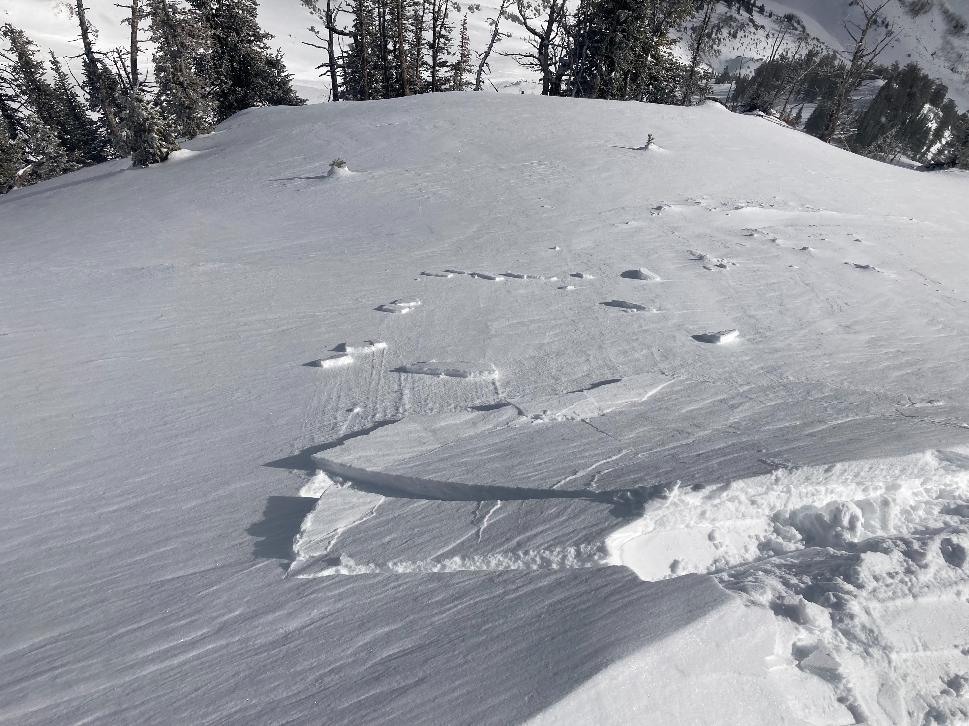
New snow and wind was creating very small soft slabs on the lee side of ridge crests above 10k.Weather
- Air Temp
- 15
- Cloud Cover
- overcast
- Wind Loading
- moderate
- Recent Snowfall
- 5
- Snow Avail For Transport
- small smounts
Partly cloudy and showery before noon. A stronger pulse (S2) of snow rolled through around 2 pm. Moderate winds above 10k out of the west.