
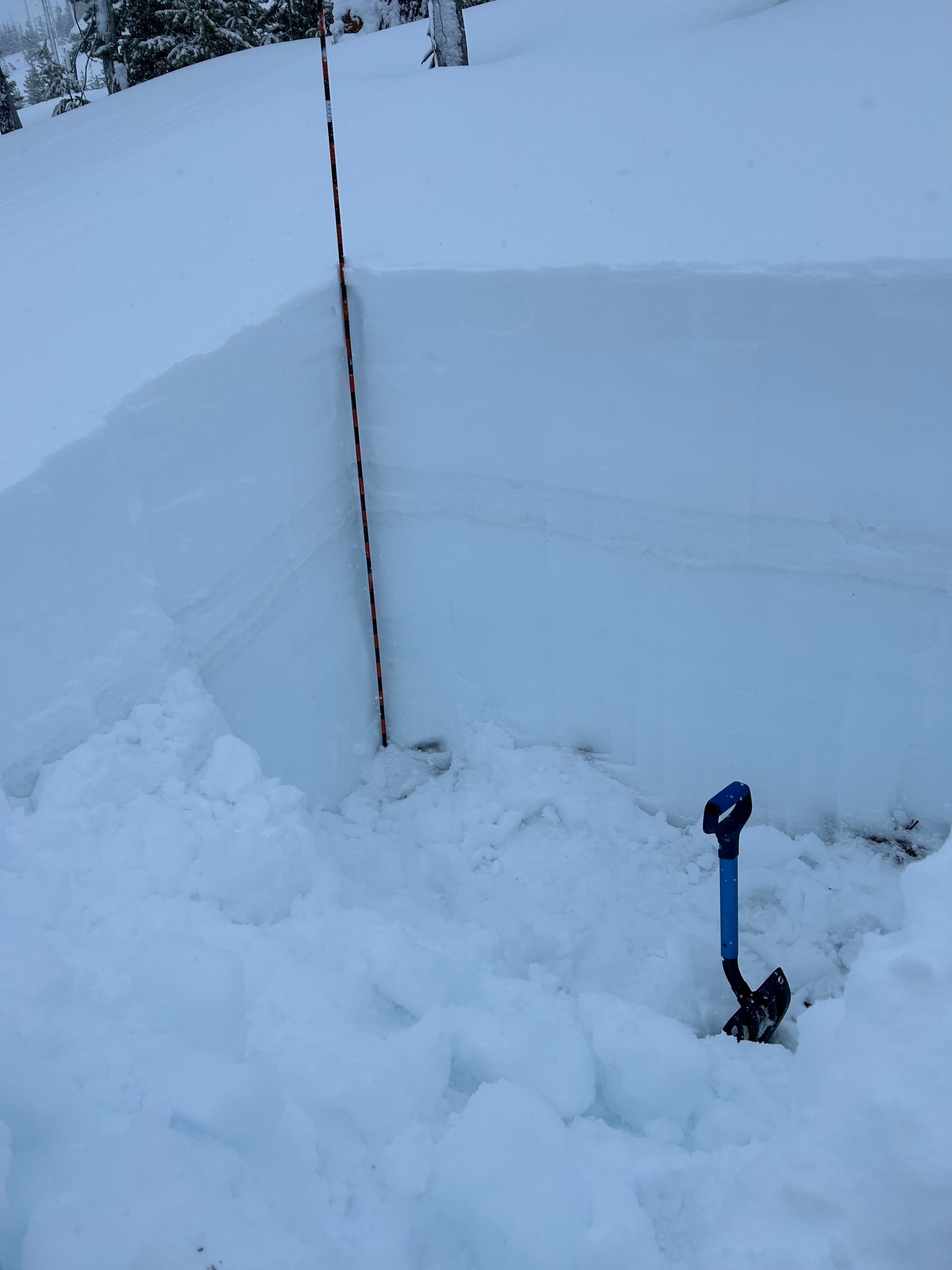
Quick report
Bottom line, we have a super thick, super hard melt crust about 60cm down. Below this, I had zero worries about the snowpack. Did not find the basal facets that have been mentioned a few times in recent forecasts / obs. There is clearly some reactivity in the new snow, so pay attention to shallow (and some deeper) wind/storm slab activity in coming days. None observed in the morning (cool temps, light snowfall). When driving out, sun-affected aspects on south side of Hogg Rock were shedding small warm sluffs.
Weather
- Air Temp
- 28
- Cloud Cover
- overcast
- Recent Snowfall
- 60 cm (from last Weds on).
Snowpack
Dug to the ground (165cm). From the top, 60cm of recent storm snow (4F). Then, a 15cm crust sandwich (very obvious in attached photo), with two defined icy crusts. Below that, 30 cm of K hardness melt crust. Brutal to shovel. From there, about 60 cm (to the ground) of 1F moist melt forms. Boot pen was 60cm. CT8 SP 20cm down, followed by CT23 SP about 50 cm down. These were both within the deep recent storm layer. ECT and PST showed no propagation.