
North Core Ridge, 200 ft. below Brown Star
Quick report
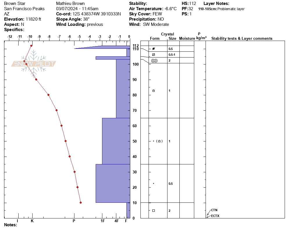
On north facing slopes, the snowpack is strengthening and showing very little tendency for propagation. East facing slopes are staying wind and sun hardened, even in the blue sky conditions of 3/7. As is often the case, dry periods create tomorrow's weak layers and this was noticeable in the top 10 cms of most north facing slopes. A layer of facets has developed between two alternating crust layers, one wind/sun crust in the upper layers 2 cms of the snowpack and the other 5cms below. This layer of facets, although guarded by the upper sun/wind crust, could be problematic if we ever receive another large snow event.
No signs of instabilityWeather
- Air Temp
- 20 degrees
- Cloud Cover
- clear
- Wind Loading
- light
- Recent Snowfall
- 0
- Snow Avail For Transport
- small smounts
Clear skies, moderate SW winds, warming temperatures, time of tour was 20 F.
Snowpack
There is a surprising amount of coverage in the Inner Basin with many skiable lines. The surface of most east facing slopes was shiny hard melt/freeze crust with varying vertical assemblages of wind affected and hardened surface. North facing slopes off of core ridge offered a similar template of choices; however, some lines had accumulated a fresh 2-3" of wind blown snow and skied quite nicely. These were isolated locations, but if identifiable and contiguous, they offered fine turns. HN varied from 20 cms in rocky ridgeline zones to 100 in catchment zones to 180 in deposition locations. The snowpack on north-facing slopes contained a layer of facets near the surface sandwiched between two crusts. Basal facets remain in the bottom of the snowpack, but crystal type is moving towards rounds, with the size reduced to around 2 cms and the thickness of primary faceted crystals decreased to 10 cms.