
Weather
- Cloud Cover
- overcast
- Wind Loading
- light
- Recent Snowfall
- 15
- Snow Avail For Transport
- moderate amounts
Snowfall was light to moderate during the late morning to early afternoon hours, with the rain/snow line hovering around 7,000 feet. Winds were light out of the west. Approx. 15cm/6" of new snow above 8,500 feet
Snowpack
New slab development was minimal in the upper elevations during the midday hours. A thin crust that formed yesterday between 8,000-10,000 feet in the southern tetons was thin, breakable and sitting below 15cm/6" of new snow.
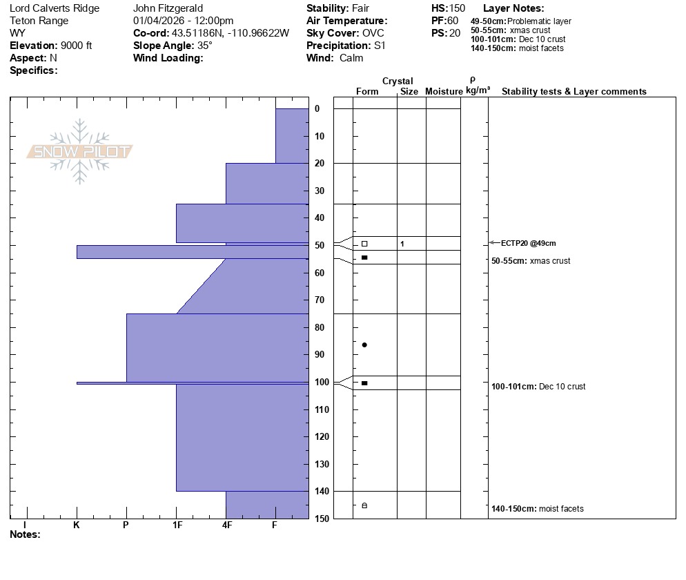
A snowpit at 9,000 feet showed propagation potential at the Christmas crust, which was 50cm/20" down in this location. Small grained facets were found at this interface sitting on the crust and is the layer of concern. This combination is not found everyhwere, but is most likely to be found between 8,500-9,000 feet. Observations have not shown this to exist above 9,000 feet, as this was rain/snow line elevation during the formation of the crust (prior to freezing).
The Dec 10 crust was 1cm thick in this location and just deep enought to not be able to impact with a column/tap test. Sawing through the 5cm thick knife hard christmas crust also helps in extrapolating out of the pit that a skier is unlikely to impact any layers below. Moist facets made up the bottom 10cm of this pit. Neither of these layers are a current concern, but are worth tracking over the long term.