
Quick report
An intense storm tonight through Friday morning will cause numerous avalanches as storm snow piles atop a weak snow surface. These have the potential to run fast and far on a crust 6-12" beneath the surface. Although less likely, much larger avalanches may break on weak snow ~3' deep.
No obvious signs of instability.Weather
- Cloud Cover
- overcast
- Wind Loading
- light
- Recent Snowfall
- <1 cm during tour
- Snow Avail For Transport
- moderate amounts
High, thin clouds allowed diffuse sunshine most of the morning. It was cloudier to our north. The cloud deck thickened in the afternoon. Snow began around 2 PM with very light accumulation. We experienced some moderate wind gusts at our location and observed some light wind loading in the higher surrounding peaks.
Snowpack
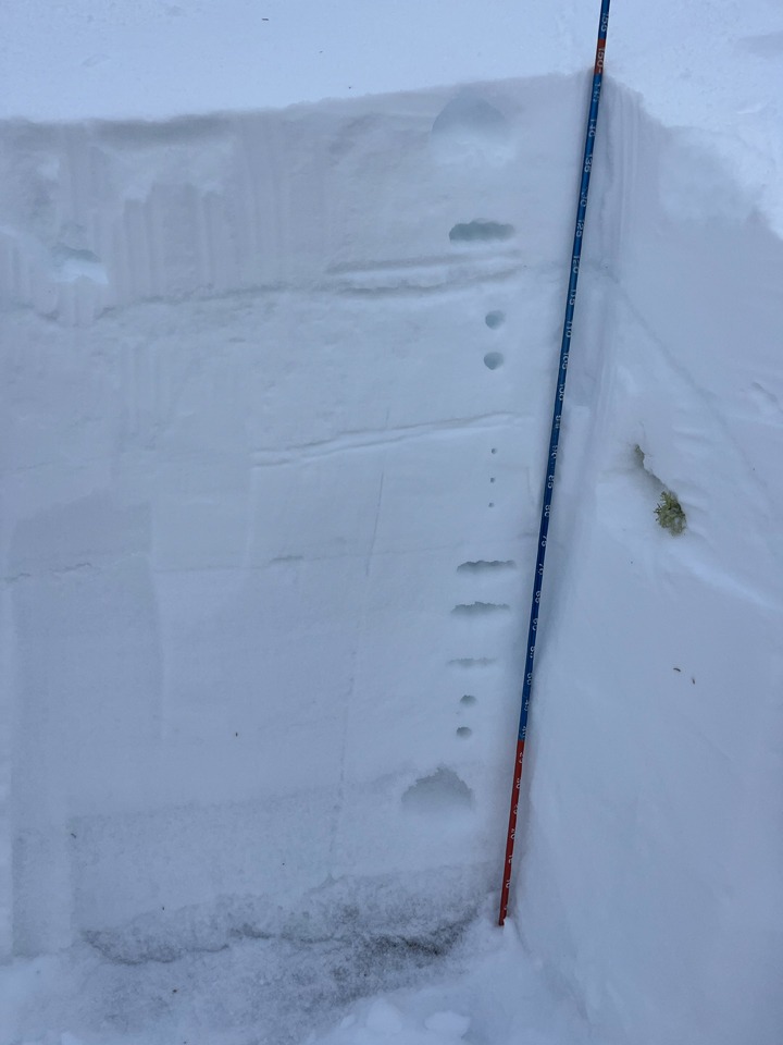
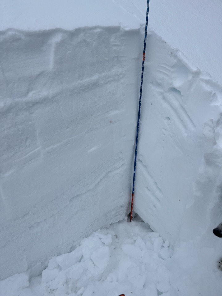
See photos for specifics.
Surfaces: We observed some weak wafer crusts on S-ESE aspects with some near-surface facets beneath. Shadier slopes were mostly near surface facets. The worst looking surfaces were at low elevations where only 15-20 cm of recent snow has heavily faceted under recent inversions. This very weak snow sits on a stout (2/1) crust. We did not find any surface hoar.
(2/1): As mentioned above, this interface will be very sensitive where recent snowfall was less than 20 cm, particularly at low elevations. Climbing in elevation, the slab above 2/1 thickened to about 30 cm. The bond on the top of the crust looked strong. Below the crust was a more faceted layer that may come into play with tonight's loading. ECTNs that broke directly under the shovel.
(1/6): Was 4F->1F and looked fairly strong. ECTXs that withstood numerous additional hits and topples into the pit. On the ESE slope, this layer was heavily disrupted by 2/1 meltwater.
(11/30): This was the worst-looking weak layer in both pits (F+ on NE and 4F on ESE) but was 120-140 cm deep in both locations.
Avalanche
No new/recent avalanches.