
Quick report
- Cracking
- isolated
- Collapsing
- widespread
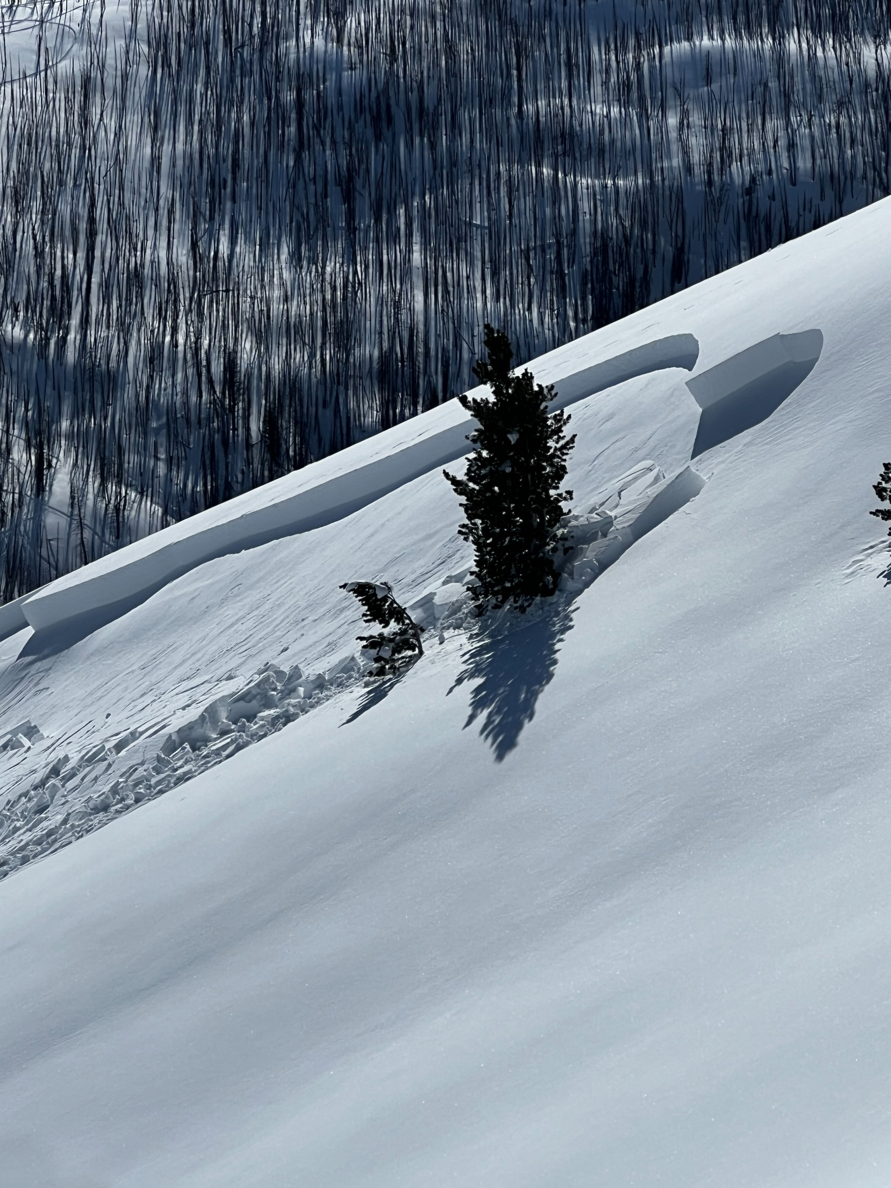
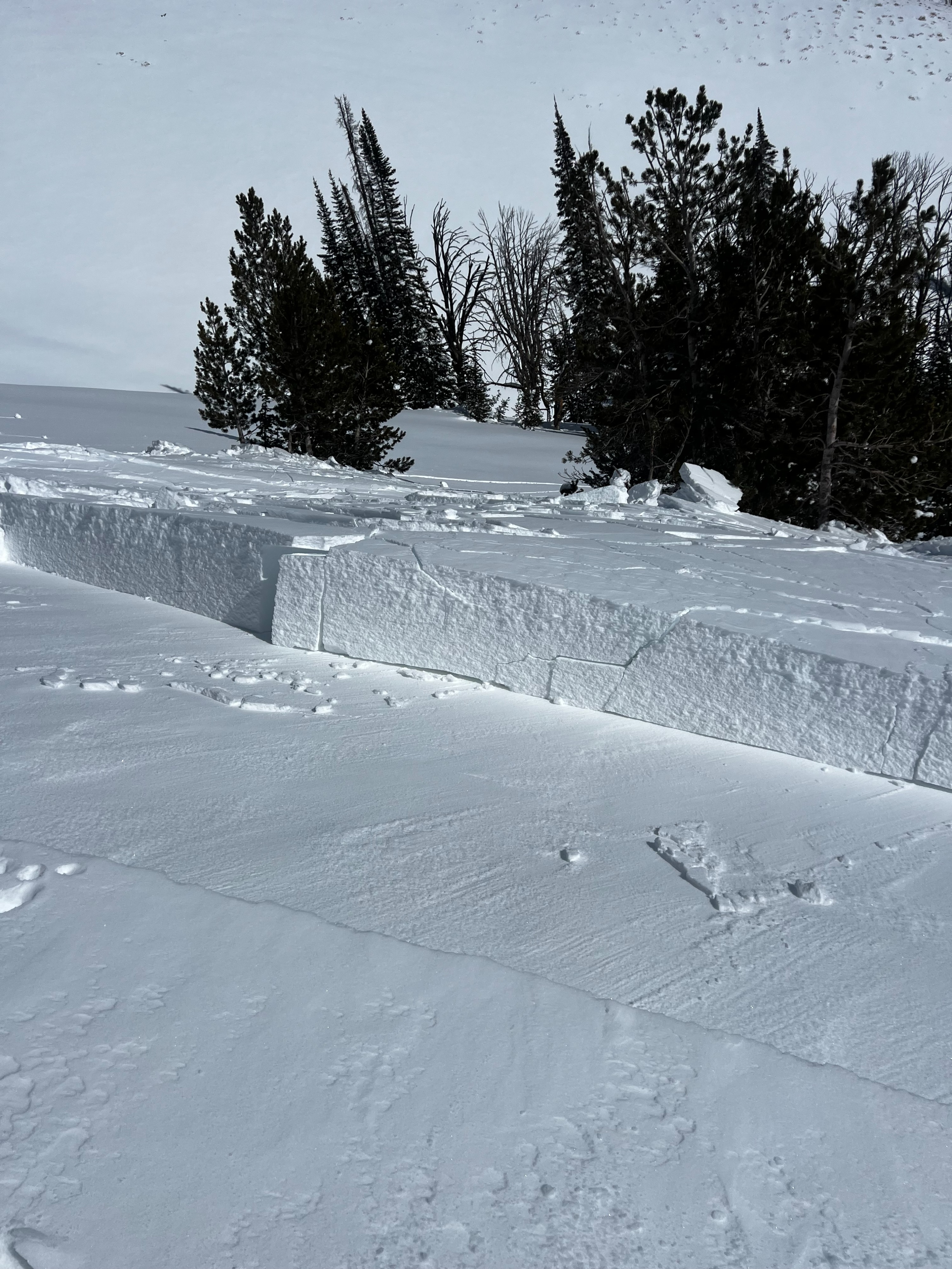
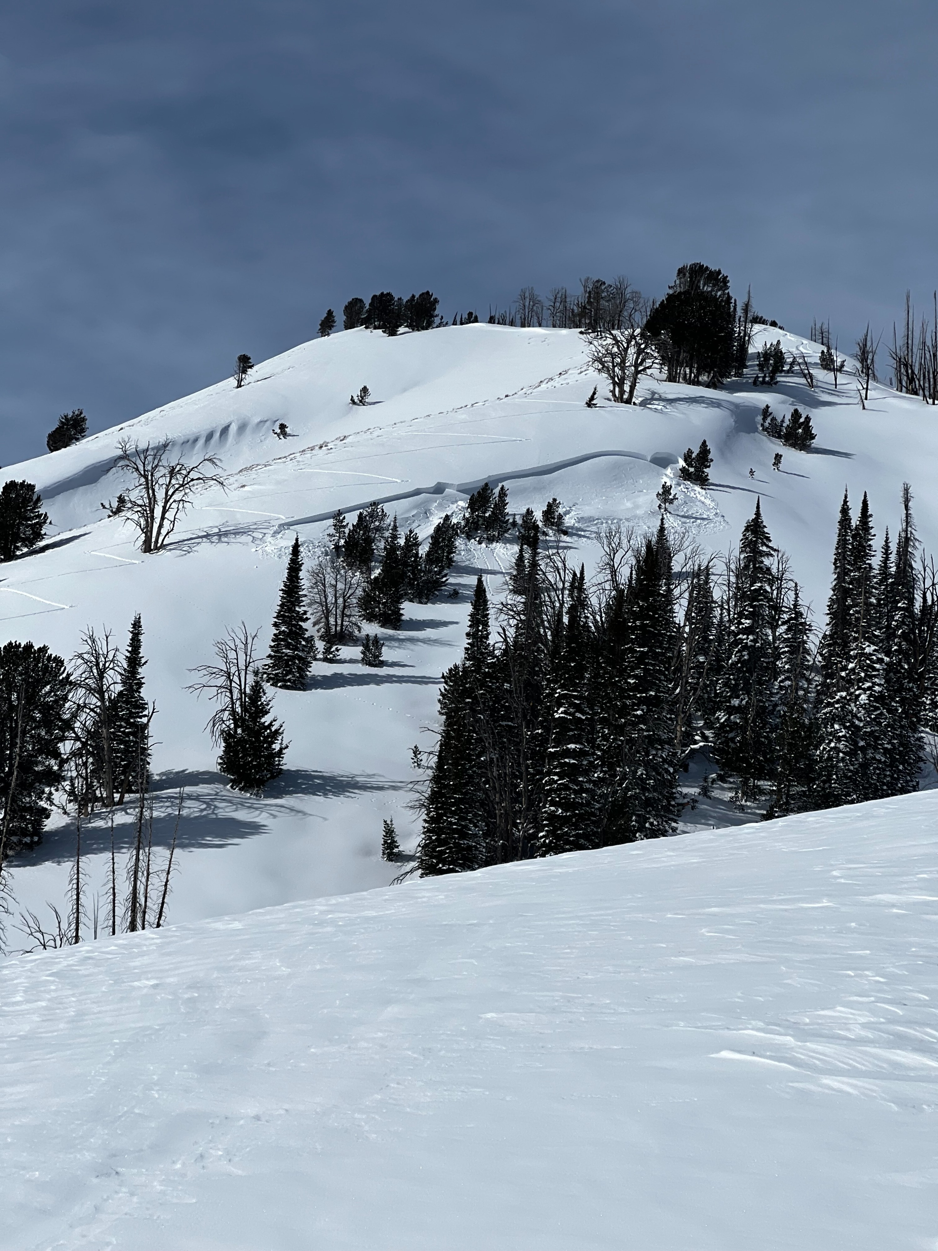
We remotely triggered a small D1 avalanche on an ESE aspect from far away while traveling on a flat bench below. This failed on the weak layer between the new snow and the crust approximately 35cm down. We also experienced whumpfing and collapsing almost everywhere we traveled today. Wind loading was evident on many upper-elevation slopes all around the area.
We remotely triggered a small D1 avalanche from far away in a flat bench below. There was collapsing everywhere we traveled, ranging from subtle whumpfs to booming collapses that traveled hundreds of feet.Weather
- Cloud Cover
- few
- Wind Loading
- previous
- Snow Avail For Transport
- moderate amounts
Winds were light to calm, and skies were mostly clear. Temperatures climbed into the mid 20s F.
Snowpack
There was 30-40 cm of new snow on sunnier aspects; the bottom portion of this new snow is a 4F to 4F+ (four-finger) slab that has formed on top of a 2-3cm thick crust. Below this crust is 10cm of small, moist facets lying on top of another 5cm thick crust. Under this lower crust was a slurry of freeze forms and mature facets that developed during our long draught.