
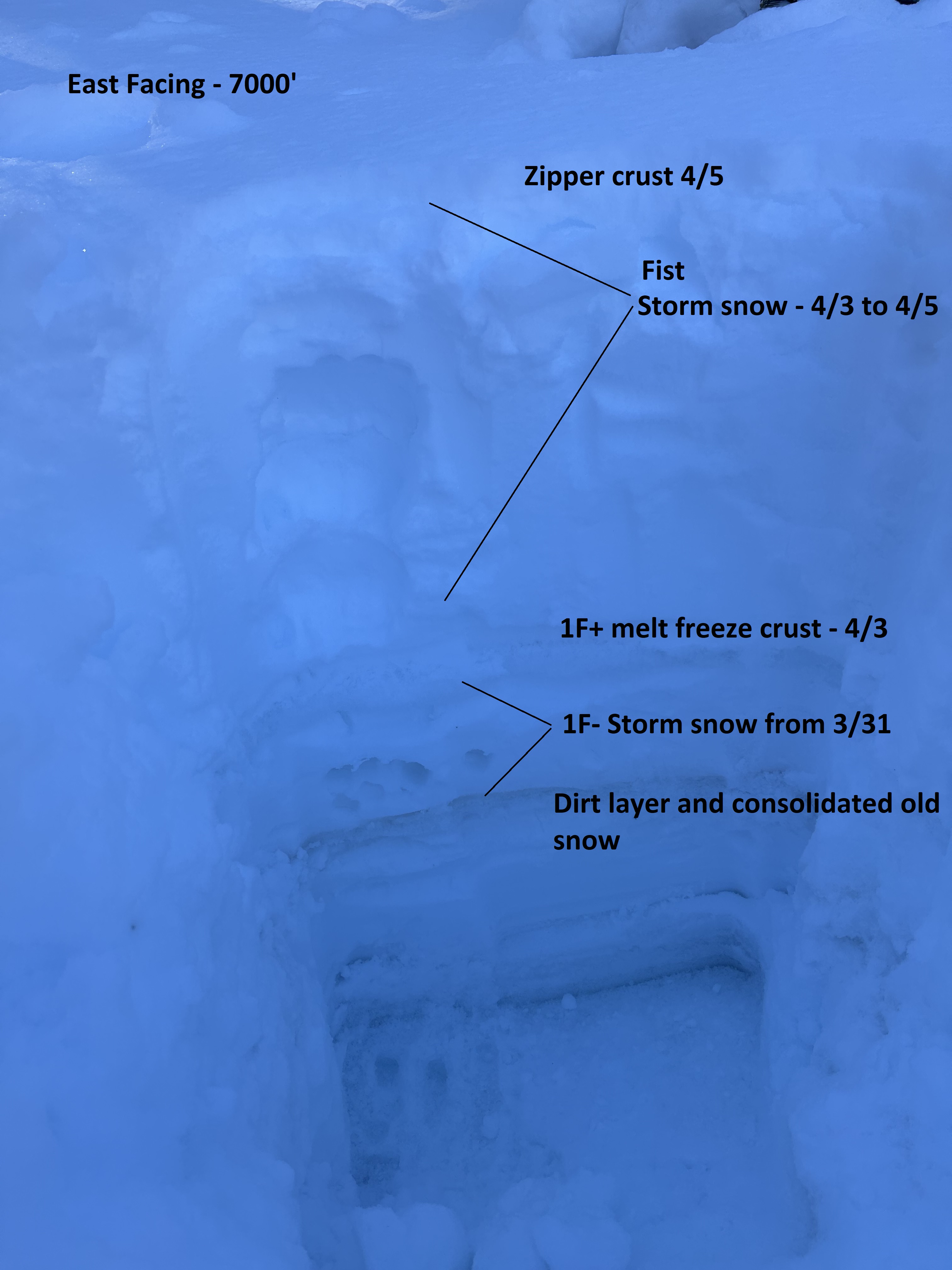
Quick report
- Aspect
- East
- Red Flags
- Heavy Snowfall, Wind Loading
- Elevation
- 2134 m
- Slope Angle
- 10°
- Red Flags Comment
- <p>Incredible amounts of new snow in the last couple days.</p>
In the hasty pit above, melt-freeze crust is noted below storm snow. Over the weekend and after the warm up on Saturday previous snow at this elevation was isothermal and very punchy. I also noticed little drainage runnels over the weekend. Since then, temperatures even at this elevation have been relatively cool for this time of year and by Monday the crust was supportable on skis but not in boots. Temperatures have largely stayed cool and are forecast to be cold overnight which has helped refreezing. No free water or new drainage channels were noted today.
Snowpack
- Instability Comment
- <p>Over the past weekend, warm temperatures caused snow to warm and subsequently develop a melt-freeze crust. On Monday and Tuesday I had some concern about this potentially creating a good bed surface on which the new snow could slide. I stuck to low angle slopes so didn't really test out this concern.</p> <p>As forecasted, winds picked up on Tuesday, however in protected areas snow was relatively unaffected. On more open slopes, snow was more characteristically dense.</p>
Protected slopes stayed soft but zipper crust formed during periods of sun.