
Quick report
- Aspect
- Northeast
- Elevation
- 2957 m
- Red Flags Comment
- <p>Rain on snow; plenty of size 1 and 2 wet loose natural and ski cut debris piles above 9500' on all aspects.</p>
Wet loose naturals off Superior
A break in the precipitation roughly 430pm
Snowpack
- Instability Comment
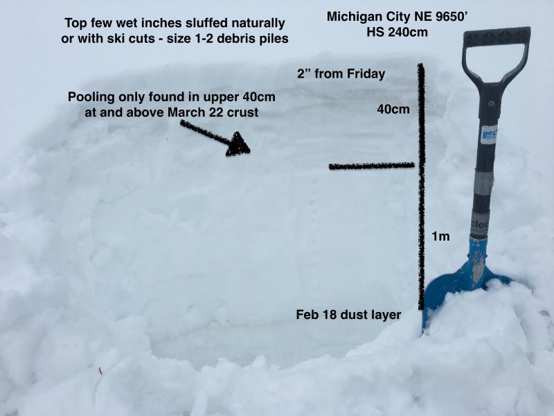
- <p>Loose wet affecting all the leftover dry snow above the March 22 crust, most particularly yesterday's couple-few inches. All aspects at mid and upper elevations. Should potentially lock up with cold front but much depends on the weather for tonight and tomorrow. </p> <p>No wet slabs noted today; however did see pooling in upper 40cm at 3/22 crust and at a couple interfaces above. 3/22 event greatly strengthened our snowpack otherwise. Can not rule wet slabs out for thinner snowpack areas, repeaters; etc. Again, much depends on overnight weather. Refreeze may only be superficial in nature. </p> <p> </p> <p>On southerly terrain, might expect better plumbing as evidenced by stream flows adjacent to SR 210 (LCC). </p>
Won't be pleasant tomorrow unless the post frontal snowfall over-delivers.