
Quick report
- Aspect
- Northeast
- Red Flags
- Collapsing, Rapid Warming, Poor Snowpack Structure
- Elevation
- 2682 m
- Slope Angle
- 25°
- Red Flags Comment
- <p>Collapsing: Our party heard 2 smallish collapses; the first a 20' diameter (crack around the edge made for easy measuring) and the second sounded a bit bigger. Warming: Since the March 4 through March 5 storm, average temperatures at the Mining Fork Snotel (in the Oquirrhs) have read 17, 19, 23, 33, 38, 37. That is to say, today was another very warm day but the first day since the storm that wasn't substantially warmer than the day before. Poor snowpack structure described below.</p>
Chose a relatively deep location (HS 75) with some wind loading because that is where we had a collapse.
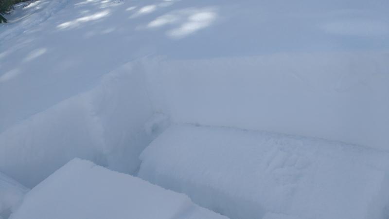
3cm wind crust above 40cm of 1 finger- 4 finger slab. Weak layer was 2 mm facets over a thin crust. Below that, larger facets--mainly dry--to the ground.
Snow tests: 8840' NE
ECTPV, ECTP11, PST 10/100END
2 columns and 1 extended column failed on isolation. Yikes, kind of shocking! Of course the one on video required a tap from the elbow (ECTP11).
A passing ski party (in the Oquirrhs??) commented on how brown the hillsides looked, given the Snotel reading of 30". Someone in our own party had said just the same moments earlier. Both knew well that Snotel sites are cherry-picked to be the locations that hold snow latest into the season. After all, snow hydrologists have methods to extrapolate area coverage using snow depth at a known location, but they can't do much with a bare patch of ground. Even so, the snotel-to-south aspect ratio is usually a bit higher.
Former USFS Snow Ranger Bob Piscopo told me in January "I doubt we're going to build a snowpack on South now. The sun angle will be too high, and unless there's a really deep storm the light will go right through to the ground". Seems he was right.
A few of the indignities of shallow snow: Checking the ski base for rock damage, and climbing rather than skiing over the fences.
Overall mostly Low danger with specific areas of Moderate for P-Slab - particularly in wind drifted terrain.
From another touring party to the north and east of us that day - checking out the starting zone and an old natural on the north facing
Snowpack
- Instability Comment
- <p>Columns failing on isolation, large grained sugary facets under a soft slab. Not much snow depth so any slide would be small; still we avoided a section of 35-40 degree NE facing slope on our way to the ridge.</p> <p>Boot pen, ski pen increased into the afternoon, and water rushed down the 2 track. Still, not very menacing since most the aspects steep enough and solar enough to be suspect were long since melted.</p>
Faceted loose grains on ENE through North elevations, between 8600' and 9400'. Other aspects housed the predictable range from melt-freeze crust (breakable, barely) to 2 cm of saturated snow-cone.
And that's just where there was snow.
Snow depths ranged from 0cm to 75cm. Elevations from 6800' to 9400'.