
Powerline - Pebble Creek Backside
Quick report
Poor overnight refreeze and rapid thaw this morning led to wet surface snow on S, SE, E aspects. SW aspects had softened by 1300 this afternoon and pleasant corn turns were had coming back down to Pebble Creek Ski Area. While we hope warm temps are helping to stabilize our many weak layers in the long term, we are suspicious of the potential for wet slides today lacking any solid refreeze overnight.
Weather
- Air Temp
- 45
- Cloud Cover
- clear
- Recent Snowfall
- 0
- Snow Avail For Transport
- none
Warm overnight temps have persisted three nights in a row, and daytime temps have been in the mid to upper 40s, even at high elevations. We had an inversion last night with temps at the base of Pebble remaining around 40F. Temps will remain warm tonight and we should get some precip starting tomorrow.
Snowpack
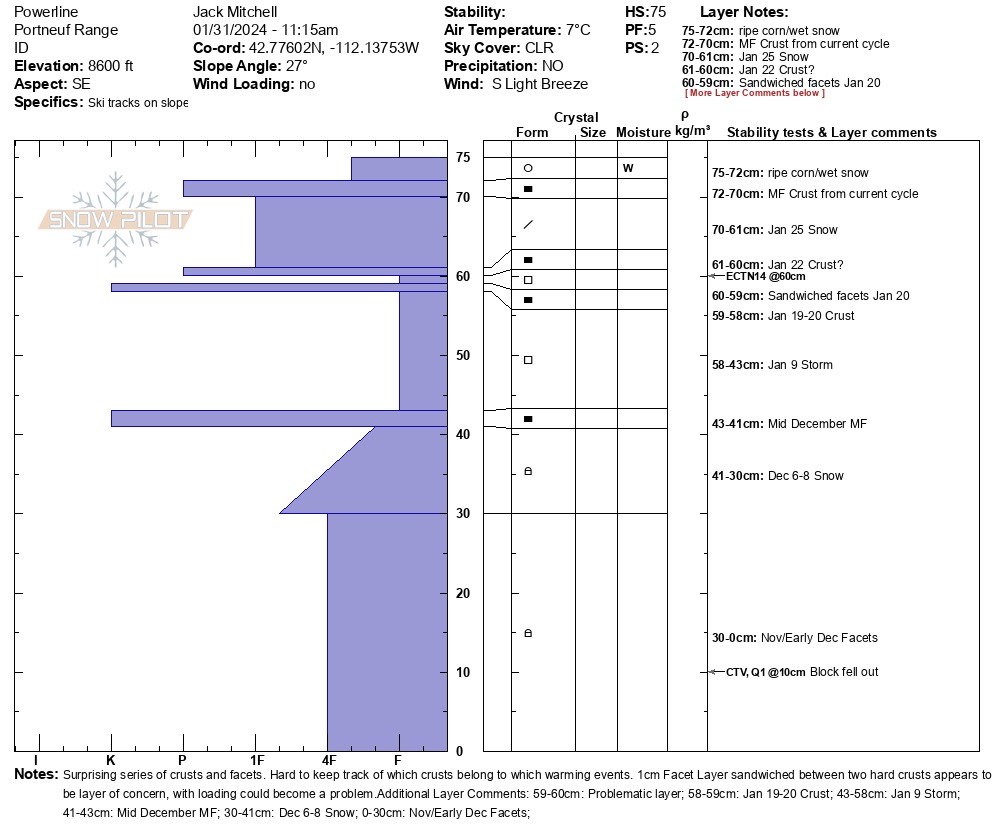
SE slopes have a surprising and complex mix of crusts and facets. Nov and Dec facets exist at base level and have gained strength although one CT failed on the ground on isolation. There is about a 1cm layer of facets sandwiched between two firm MF crusts about 15cm down which was failing but not propagating on ECT. It's possible where the slab is thicker that this could pose a bigger issue. Lots of rapid warming and melting observed despite strong winds on SE through SW aspects.