
Quick report
- Aspect
- North
- Elevation
- 2652 m
- Slope Angle
- 26°
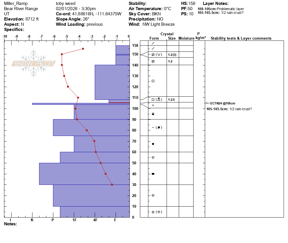
There's a weakening layer of faceted snow mixed with graupel on top of a rain crust formed on January 2 (I think)... A snowpack "lemon;" a thin layer of weak snow capping a very hard (almost translucent) rain-crust.
Despite the overall LOW danger, there are steep drifted slopes at upper elevations where a person might be able to trigger a wind slab avalanche up to about a foot thick.
A view of Mt Elmer from the north shows decent snow cover at upper elevations in the Central Bear River Range. The snow is much shallower at lower and mid elevations.
I unintentionally cracked out a small wind slab on a cross-loaded 30-degree slope as I skied. The somewhat stiff slab broke around my skis, and it was about 6 inches thick and maybe 12 feet wide. Although these wind slabs are easy to see and avoid, larger slabs are possible to trigger where drifts formed on a layer of sugary near-surface facets.
Snowpack
- Instability Comment
- <p>I unintentionally cracked out a small, somewhat stiff, wind slab on a cross-loaded north-northeast facing slope at around 8700' in elevation. </p>
Nice soft powder-like riding conditions in sheltered terrain