
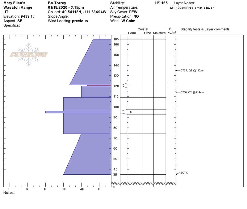
Quick report
- Aspect
- Southeast
- Red Flags
- Recent Avalanches, Wind Loading
- Elevation
- 2896 m
Snowpack
- Instability Comment
- <p> Strong ridge top winds continued to drift snow during the morning. Winds were calm after 12:00 PM. Our group saw a recent wind slab avalanche that appeared to have been triggered naturally by a piece of cornice that fell in the upper bowl of Mary Ellen's Gulch. Most likely occurred sometime yesterday or overnight. </p> <p> </p> <p> </p> <p>As the day went on, and the winds calmed down, the temperatures began to rise and the snow started to warm up. South-facing slopes had melted and already began to form a thin melt-freeze crust in the afternoon shaded areas. At lower elevation on our exit, we crossed fresh wet loose snow avalanches that had covered our tracks from earlier in the day. With warmer temperatures forecasted for tomorrow, I would expect these to become larger and run further. Pinwheels (pictured) are an obvious clue that the snow is starting to warm up.</p> <p> </p>