
Quick report
- Cracking
- specific
- Collapsing
- specific
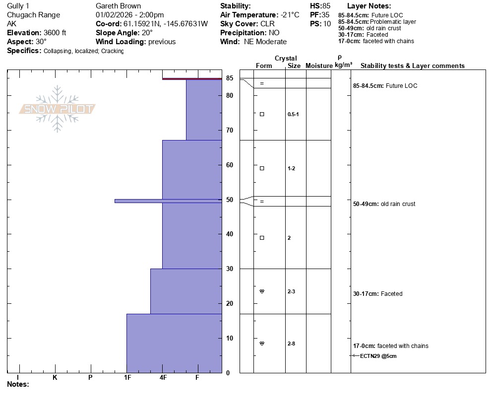
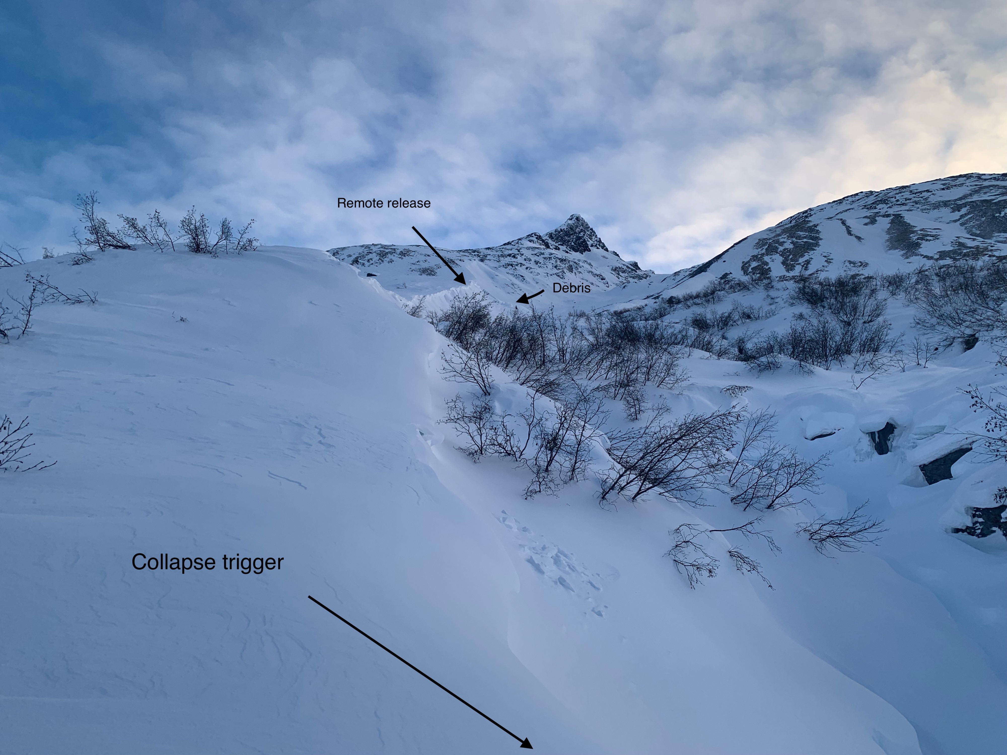
Found the wind slab problem that formed on 12/30-31 to be gaining strength and becoming stiffer and more stubborn to triggers. Despite this increase in strength, several very large collapses were noted were wind slabs overlie an undisturbed area of the 12/1 rain crust. Observed a notable remote trigger of a large wind lip 2-3' in depth over 800' away from collapse location. This scenario strongly points to a growing persistent weak layer issue. We have been watching this layer and expected an issue once stress from new snow was applied, however seeing this layer become reactive with a relatively thin wind slab is certainly noteworthy and points toward its weakness.
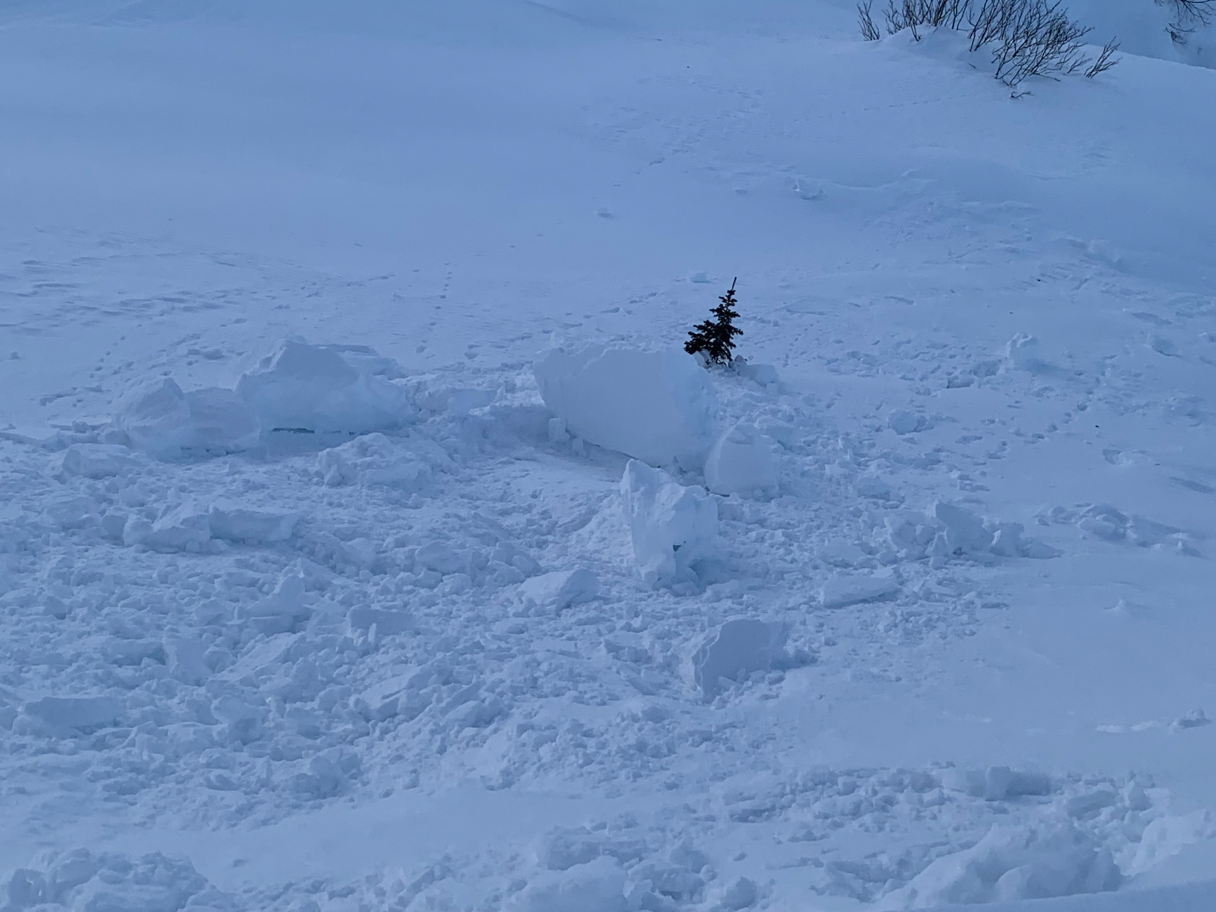
Very large collapse observed where wind slab overlies the 12/1 rain crust. Specifically, 1 collapse caused a remote release of a wind slab/ wind lip that was 800 feet away from collapse location. Failure consisted of a large block of wind lip 20' wide x 2-3' deep.Weather
- Air Temp
- -5
- Cloud Cover
- clear
- Wind Loading
- previous
- Recent Snowfall
- 0
- Snow Avail For Transport
- small smounts
Clear, cold, light to moderate NE wind
Snowpack
Mid and lower snowpack consists of facets and is in a state of equilibrium (stable). Upper snowpack below 3000' has a layer of concern that consists of a rain crust that formed on 12/ 1 and has faceted on the underside due to cold weather and thin snowpack that created a high pressure gradient over the last month.
Above 3000' weak snow exists as well, but is capped by a layer of very strong winslab that will bridge unstable snow longer than the rain crust below 3k. In other words, more load will be required to cause failures beneath the december windslab above 3k than the 12/1 rain crust below 3k.