
Quick report
- Aspect
- Northeast
- Red Flags
- Recent Avalanches
- Elevation
- 2743 m
- Slope Angle
- 20°
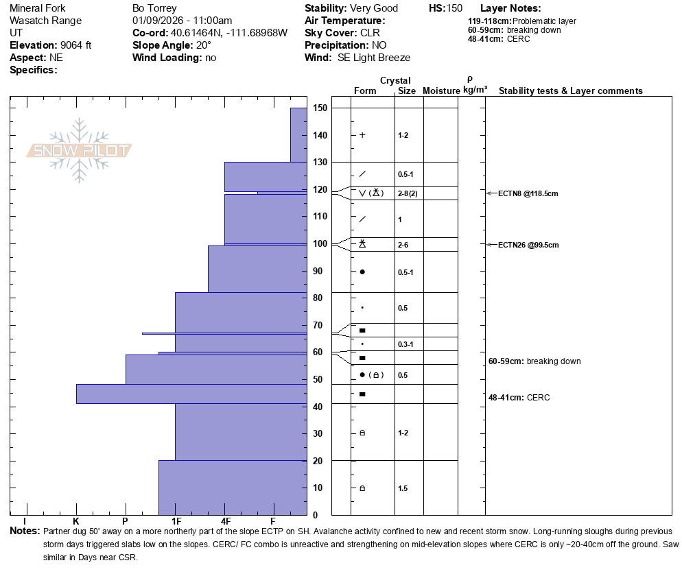
Intact Surface Hoar found in the pit wall 25cm below the surface.
Snowpack
- Instability Comment
- <ul> <li>Shallow soft slabs 6-8 inches deep and 20 feet wide. Failed on small grain near surface facets above a thin crust (potential rime crust from 1/7)</li> <li>Loose, dry avalanches on steep slopes; relatively slow-moving. Enough to keep you honest and avoid features where consequences are higher. </li> <li>Surface Hoar layer found a little more than 10 inches below the surface. </li> </ul> <p>A small cornice triggered a new snow avalanche 6 inches by 20 feet wide. </p> <p>Loose dry avalanche that ran down and triggered a shallow soft slab. D1. Likely ran yesterday,</p> <p>We targeted the CERC on mid-elevation west, east, and north-facing slopes. Both the north and east had snow depths of roughly 150 cm at 8500-9000 feet, and the CERC was 40 cm above the ground, and 2.5-3.5 inches thick. The layer of facets below was 1-Finger hard and unreactive in snowpack tests. On a west-facing slope around 8200', the snowpack was much shallower, roughly 90cm, and the CERC crust/ facet combination was notably thinner and weaker snow below the crust. </p>
Very little wind effect, right-side up. Not too deep for lower-angle slopes. Wests took on a little heat and may have a zipper crust tomorrow.