
Quick report
I went out to the Virginia Lakes area to visit the site of a skier-triggered avalanche that occurred on Mt Olsen on 11/30. Although it has been a week since the avalanche, there was still plenty to look at.
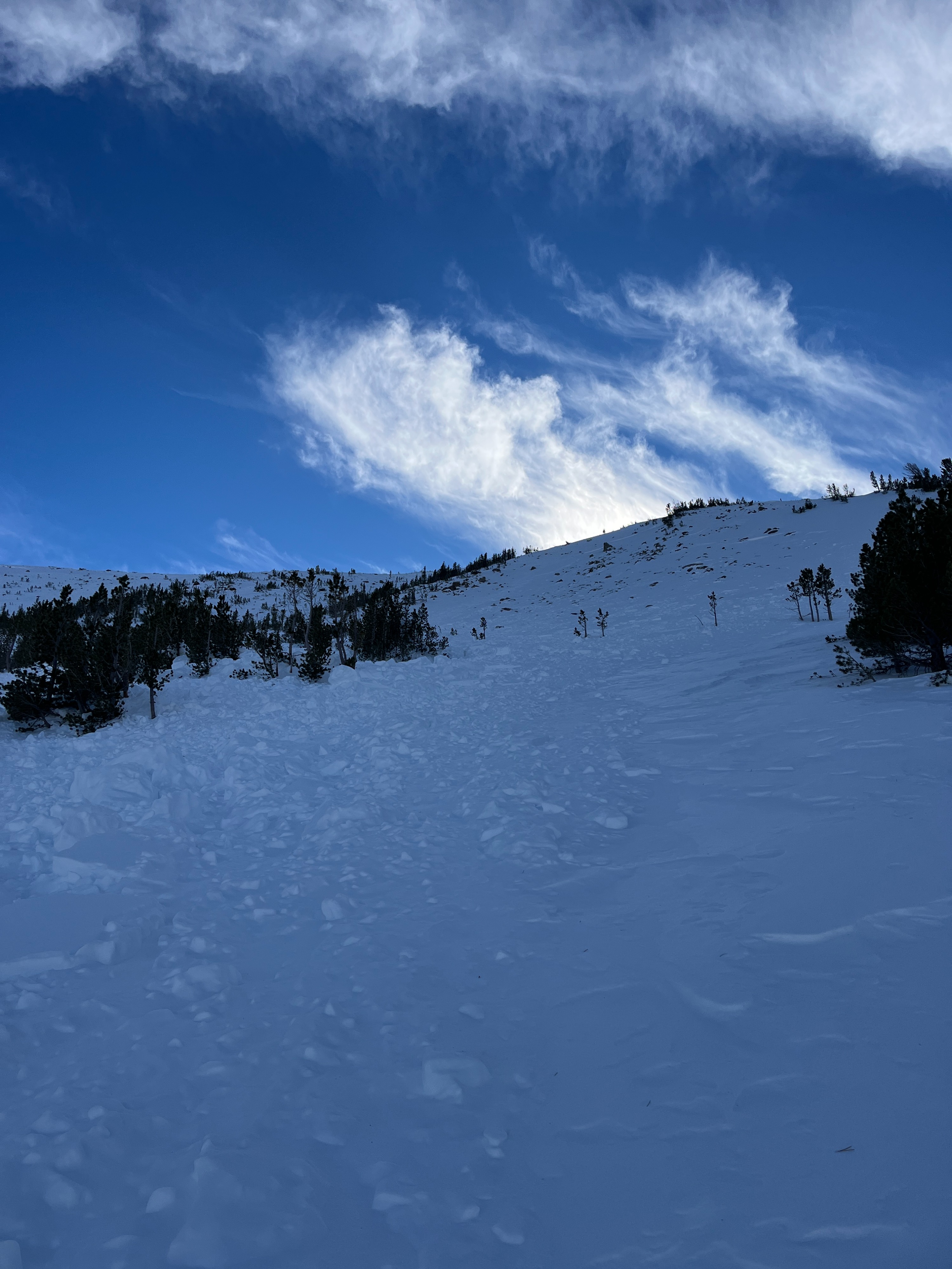
I skinned to the bottom of the northeast slope and then up to the toe of the slide. The deposition zone is still clear as day and made up of hard-slab blocks up to 4ft in size. The reporting party characterized the slide as D1.5, R2, 12-24" deep, which seemed accurate based on my observations. If they had called it D2 (large enough to bury, injure or kill a person), I would not have disagreed.
I proceeded directly up the track of the slide as it seemed to have the least remaining hazard, and checked out the bed surface along the way. Although partially blown back in, its obvious where snow had been gouged down to a rain crust along the track of the avalanche.
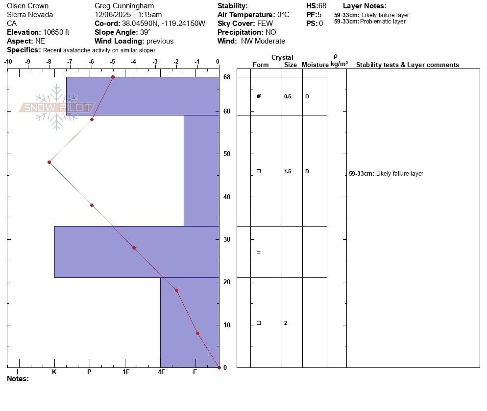
I reached the crown at 10650 feet on a northeast aspect. The slope angle was 39 degrees. The crown is still plainly visible, but has been partially blown back in by recent winds. I re-excavated the snow at the crown to see if I could gain some insight into snowpack structure and potential failure layers. Simply put, what I found was a very hard wind layer over a loose sugary mid-pack (facets), on top of a crusty rain layer near the ground. See the attached video and crown profile for more details.
I dug a second pit next to the flank of the avalanche at the same elevation and aspect. My goal here was to make a side-by-side comparison of the snowpack structure as well as to test current propagation potential. Structures from both pits were essentially identical, although my second pit outside of the avalanche track was considerably deeper (110cm). With some difficulty, I isolated a long column (ECT), and the column failed below the wind slab on facets as soon as I finished my cut (ECTPV).
...so what does this all mean? Well, I think what we can extrapolate with some certainty is that the snowpack structure is generally poor. We've observed this structure up and down the forecast area, and the Virginia Lakes area has a deeper snowpack than most. While isolated and likely stubborn, keep in mind that when you encounter stiff wind-affected snow, it's likely on top of weaker faceted snow for the time being.
Weather
- Air Temp
- 32
- Cloud Cover
- few
- Wind Loading
- none
- Recent Snowfall
- none
- Snow Avail For Transport
- small smounts
Mostly clear, temperatures around freezing and moderate NW winds gusting to strong at times.
Snowpack
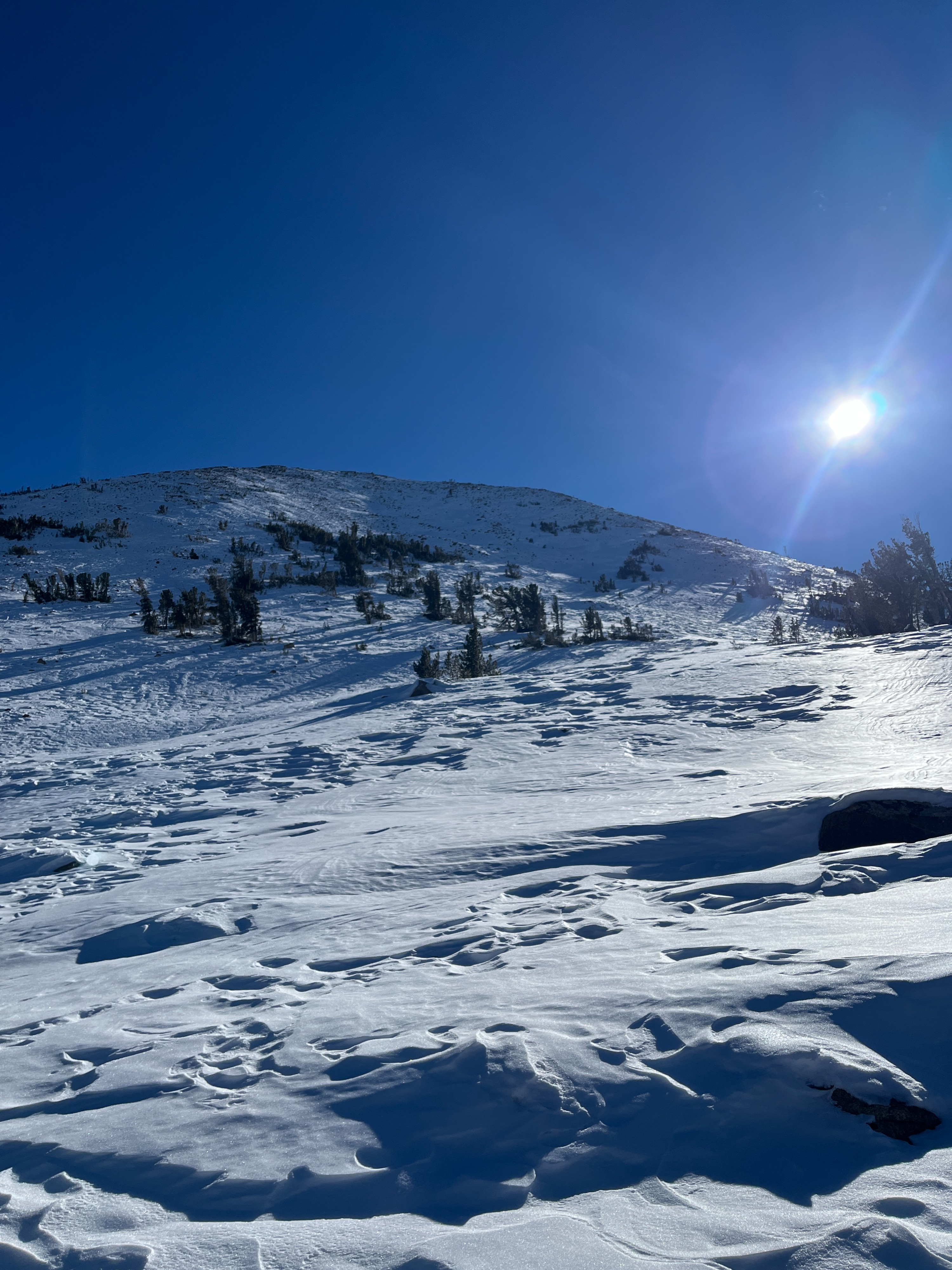
On the surface, the snow in the Virginia Lakes area has been heavily impacted by the wind.
Below the surface, the structure is poor to fair at best. In areas with the deepest snow, a stiff wind slab sits on top of a fully faceted mid-pack. A stout rain crust exists near the ground in most places. In the most exposed places, repeated wind events have scoured all snow except for this crust.
I dug at the crown of the 11/30 avalanche (see attached profile), as well as an adjacent slope that had not slid. I found a similarly poor structure in both pits.
In the adjacent pit, an extended column test failed on isolation in facets below the wind slab.