Minimal Crust, Maximum Range
Jan 23rd, 2026 3:00 PM
ghelgeson
Details
Type
quick
Coordinates
51.501080, -117.184450
Quick Observation
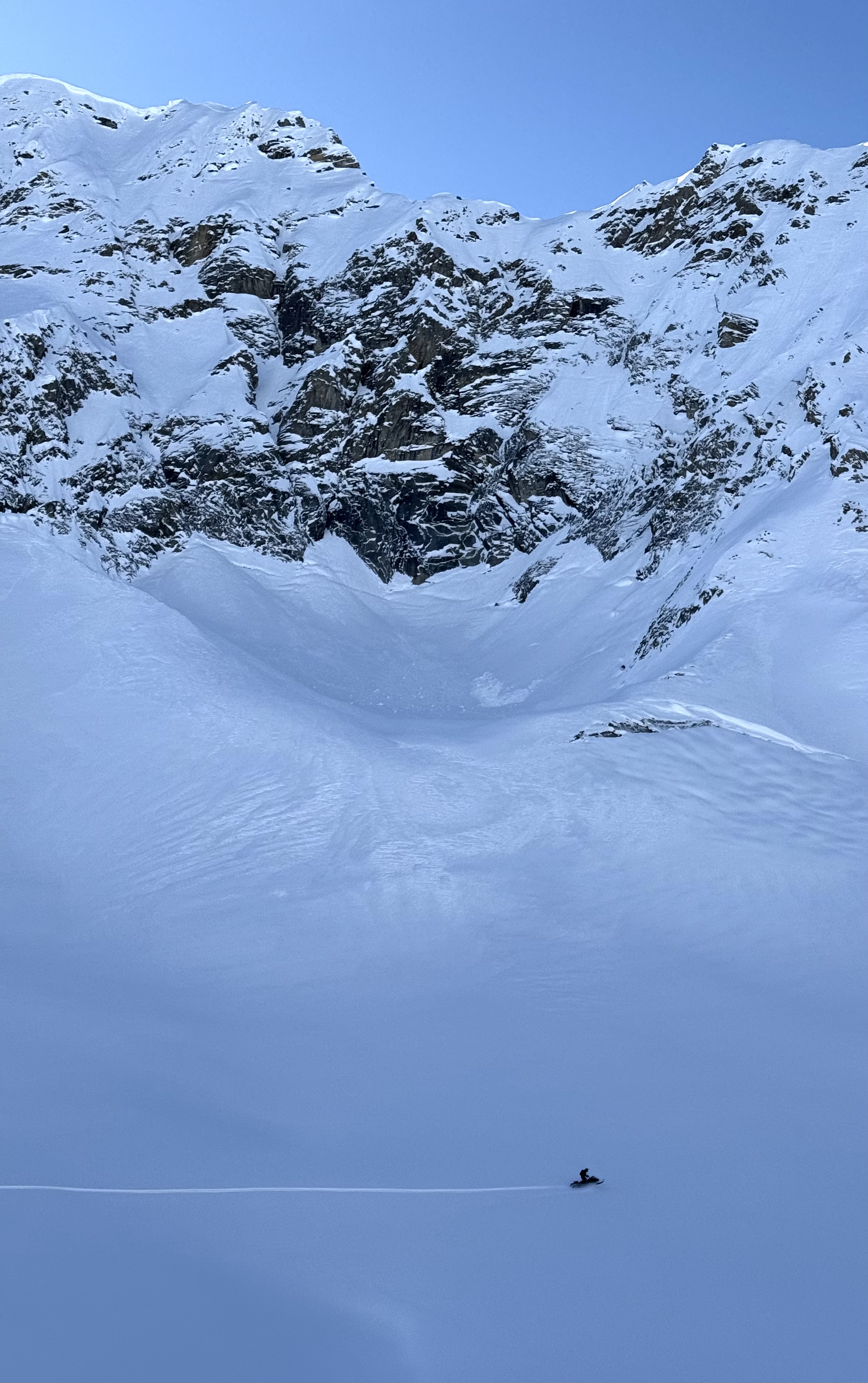
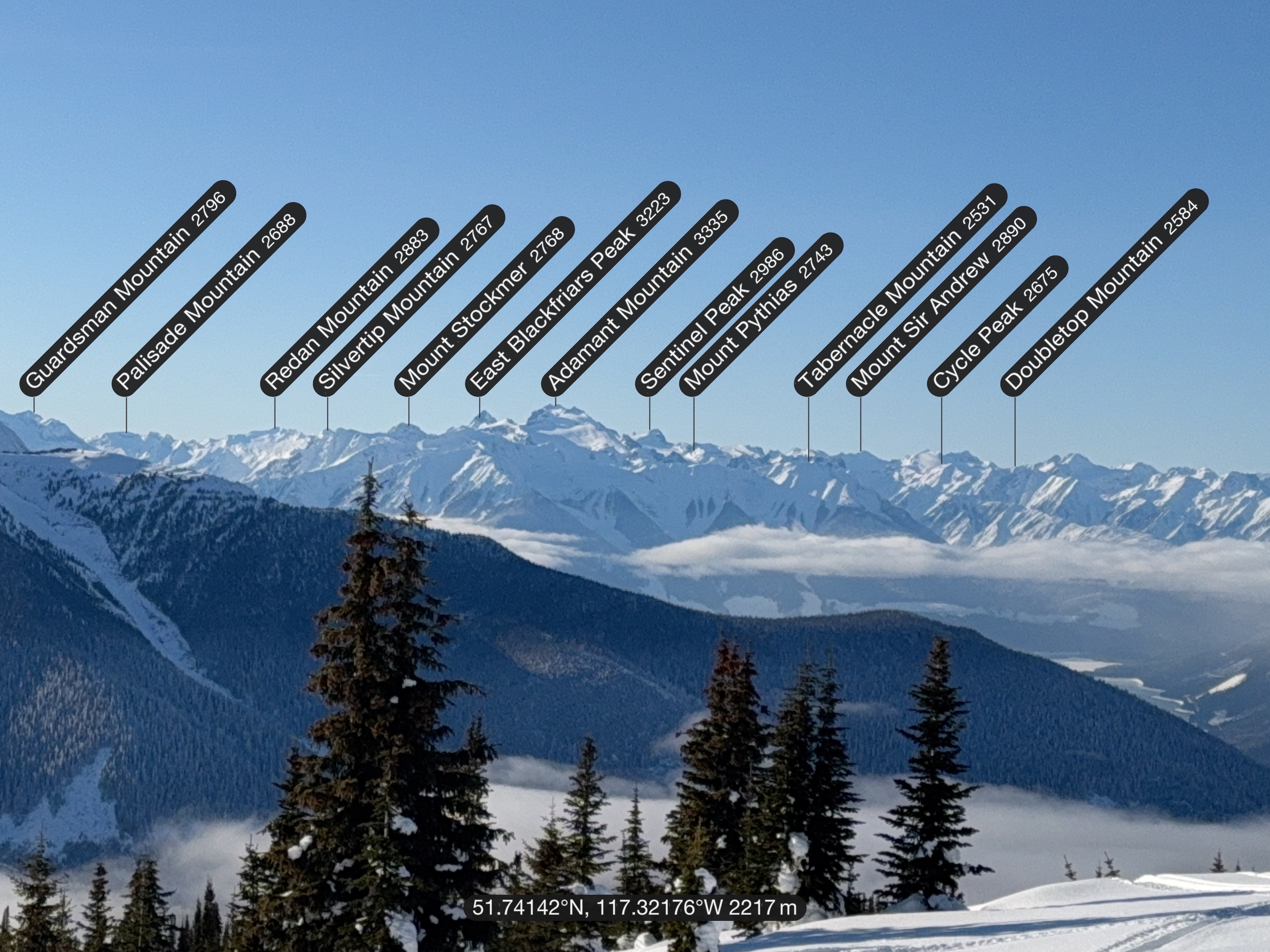
Today was wild. We travelled into the Rockies north of Donald and, once above the valley cloud, were treated to seemingly endless views: the Columbia Icefield to the north, Mount Sir Donald to the south, and Mount Sir Sanford and Mount Adamant to the west. One of those rare days where the scale of the place really hits.
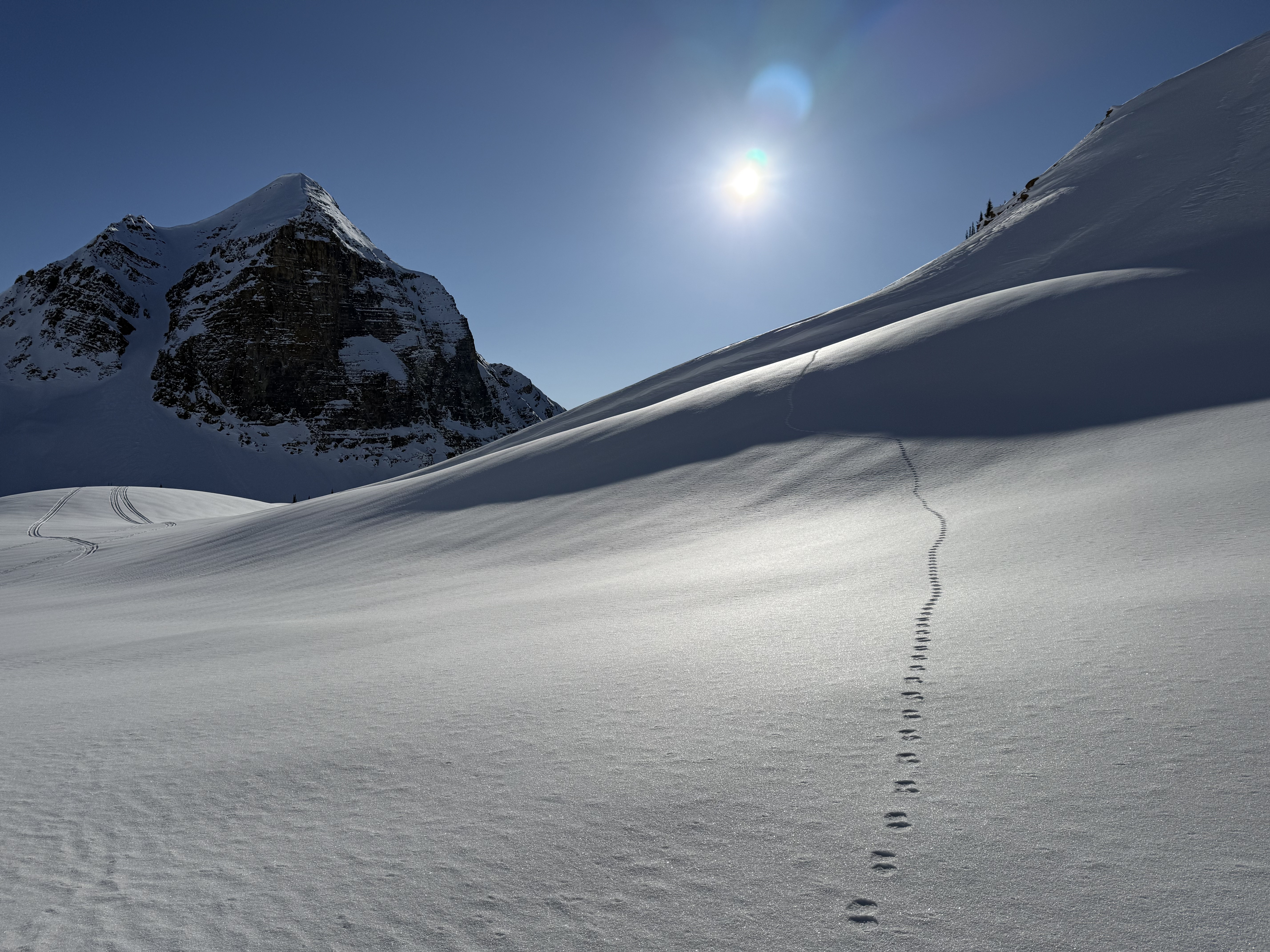
Riding conditions were excellent, with a deep and stable snowpack. In a sheltered treeline location, I was able to fully bury a 300 cm probe. We had no avalanche concerns today, and all observed avalanche activity appeared to be weeks old.
There is just a kiss of a crust in this neck of the woods, but it’s paper thin in most places and completely unnoticeable on sleds above about 1100 m.
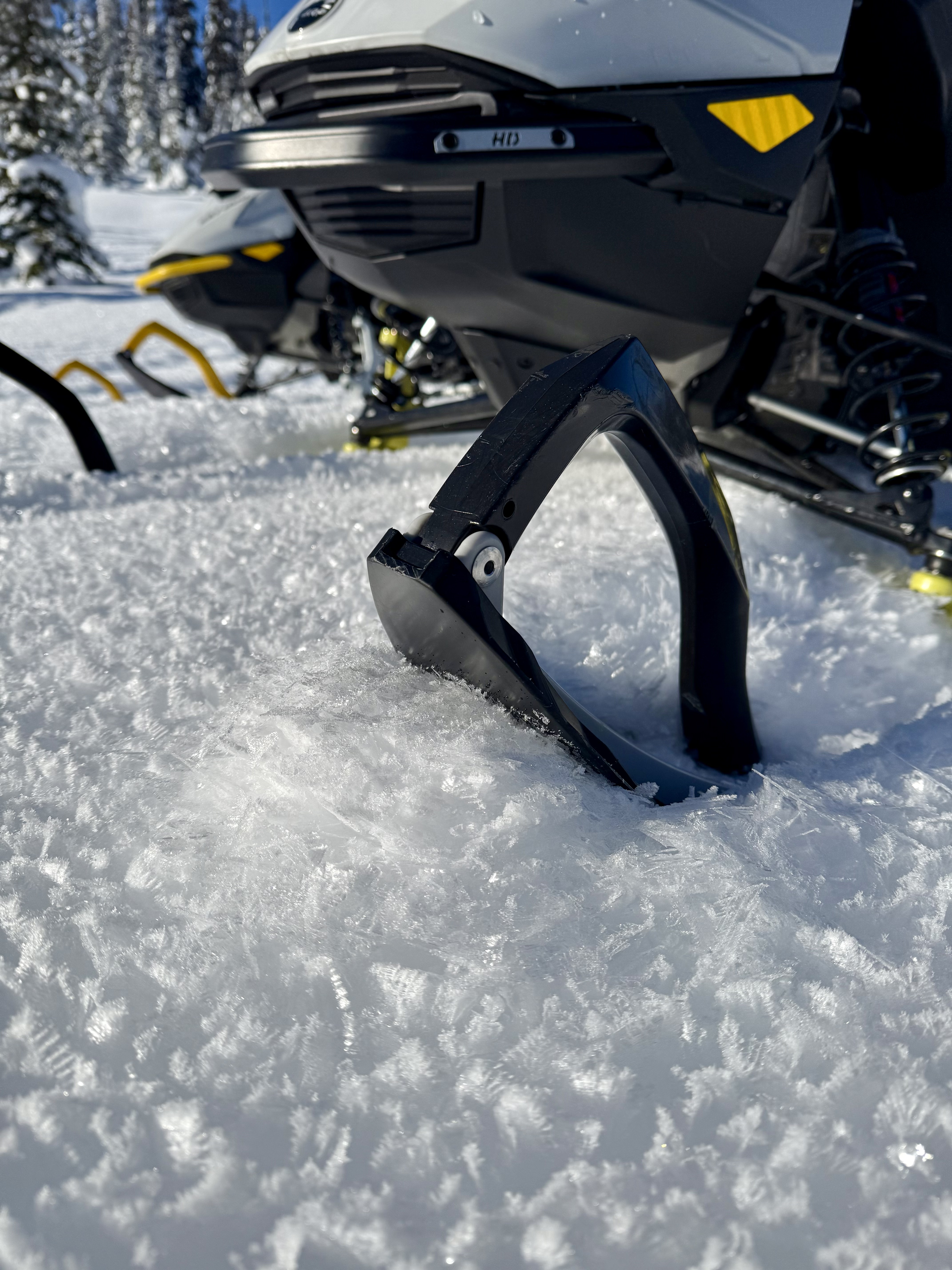
Surface hoar growth, however, is absolutely wild. It’s everywhere, and I mean, everywhere. Up to 4 cm in sheltered areas and 3–6 mm in the alpine. When this eventually gets buried, it’s going to be a nightmare. That’s a future conversation though, we don’t need to trip on that just yet.
For now, it’s glorious. Every turn sends surface hoar spilling in all directions, creating a surreal riding experience. Ski penetration is good, turns are very carveable, and traction is phenomenal. This is an excellent time to get out and explore, soak in the cold temperatures and alpine splendour, and travel far, wide, and thoughtfully with your crew.
Take sunscreen, look after each other and get out there and Go Further. (And please share the incredible places you’re visiting with us through the MIN!)
Photos (5)