
Quick report
- Cracking
- isolated
- Collapsing
- specific
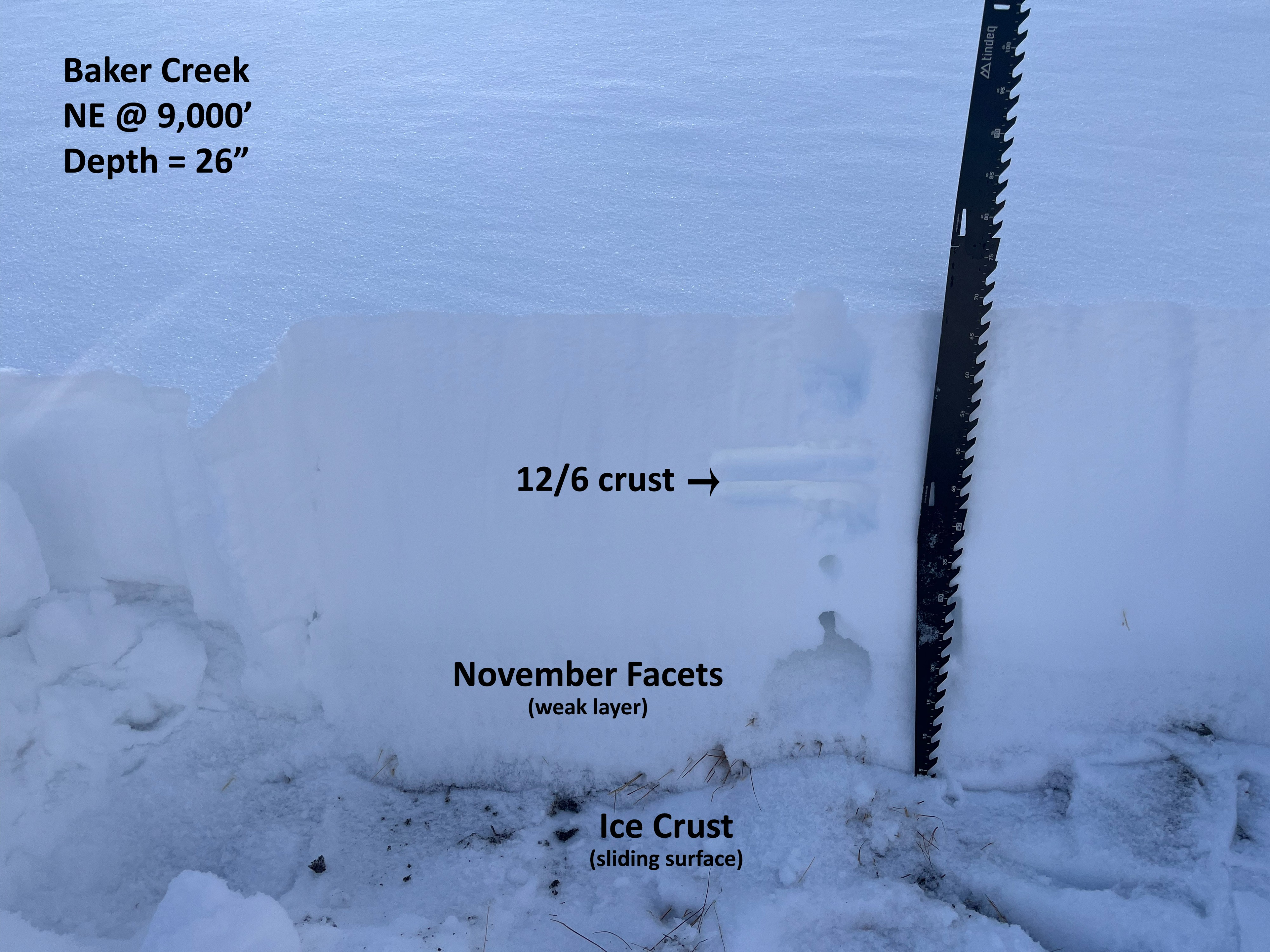
The snowpack is highly variable, changing from dirt to a slope that can avalanche over a short distance. Care-free off trail sled travel is a couple of good storms away. Thin snow cover (<30 cm) allowed for decent ski travel, given the melt-freeze crusts near the ground.
I experienced collapses in old facets/depth hoar near the ground. Primarily on E-NE-N aspects above 8,700'. Most collapses were muffled and small. One large collapse disappeared over the ridge into N-facing start zones of Brodie with no result.Weather
- Cloud Cover
- broken
- Wind Loading
- previous
- Rain Elevation
- 9,000' (12/6)
- Recent Snowfall
- 0
- Snow Avail For Transport
- small smounts
Sky cover swapped back and forth between clear and thin mid-level clouds allowing diffuse sun. It felt warm out there. Little to no wind.
Snowpack
The road out Baker Creek has seen some traffic but no one has ridden off trail. Snow cover adjacent to the road is very thin (0-30 cm) all the way to the Baker Ck TH. Shadier middle elevation slopes hold facets near the ground and enough of a slab to cause issues. Previous strong west wind scoured ridges and some middle elevation start zones. There was only a very thin snowpack, not likely to produce avalanches up to 9,700' on sunnier S and SW slopes.
Surface hoar was widespread in the shade. A funky half-frozen radiation recrystallization crust was present on S aspects. It appeared that at least some liquid precip fell to at least 9,000' here at the start of the 12/6 storm.
Avalanche
I saw no obvious crowns in the Baker Creek Drainage or surrounding mountains. Only a few D1-sized debris piles on E-facing slopes at around 9,500' along the Smoky Divide. My best guess is that they failed during the 12/6 storm.