
Quick report
- Aspect
- Northeast
- Elevation
- 2713 m
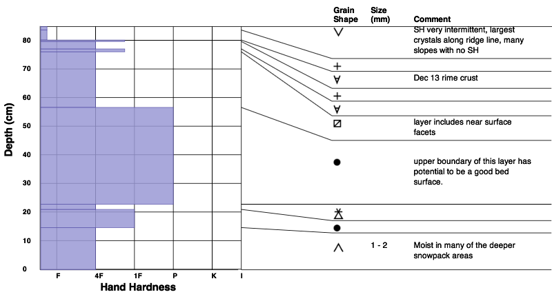
Lots of interesting layers...also the usual shallow snow pack variation, with lots of variation as you move across and up and down slopes.
Bottom line
- The weakest snow is the upper 20 to 30 cm snow pack - a mix of 1-2 thin crusts and low density snow. With another dry spell, and some clear cold nights, I expect this upper snow pack to weaken even more. Mainly NW-N-NE-E, ridge lines to approx 7,500'.
- Snow is available for transport, landing on a weak surface snow. With any significant wind, expect wind drifts to sensitive, even if shallow.
- Deeper snow pack areas - facets near ground are small, strengthening, and moist in places.
- Mid elevation, shady slopes have a shallower snow pack, weak throughout, though surface still the weakest.
Snowpack
Loose, dry powder above the rime crust.