
Quick report
- Cracking
- specific
Weather
- Cloud Cover
- obscured
- Wind Loading
- intense
- Rain Elevation
- 4000
- Recent Snowfall
- 20+
- Snow Avail For Transport
- large amounts
Omnious weather in the mountains with obscured skies. S2 to 5 snowfall throughout with strong winds creating white-out conditions near the treeline.
Snowpack
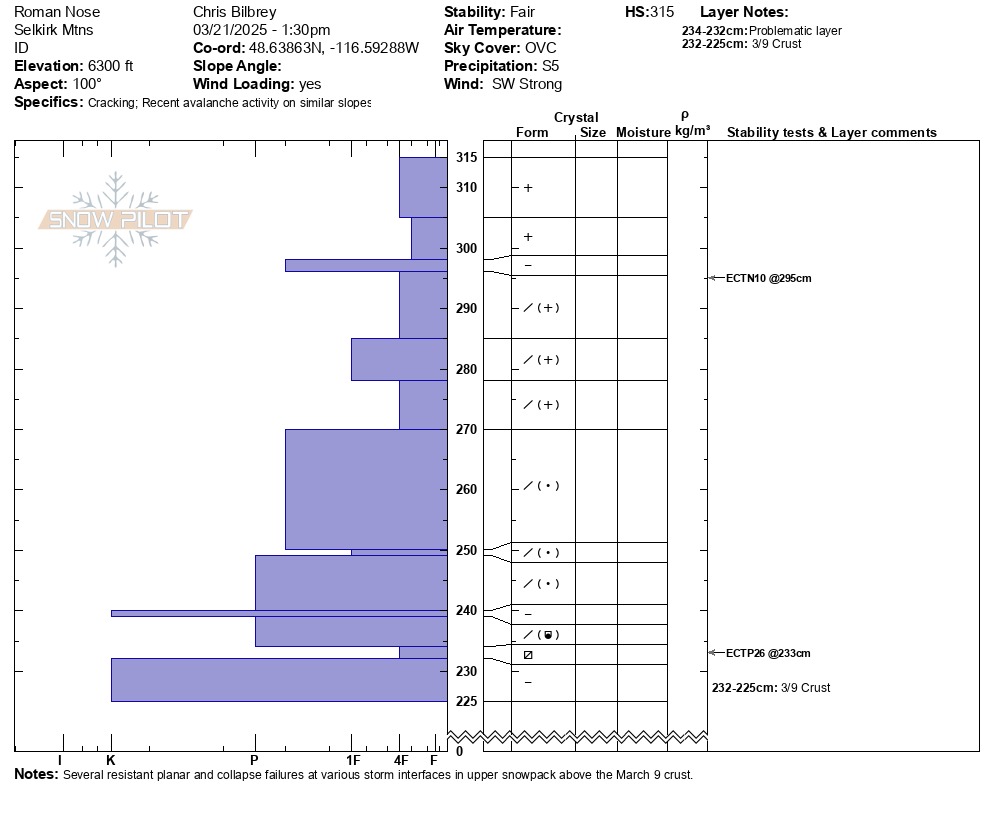
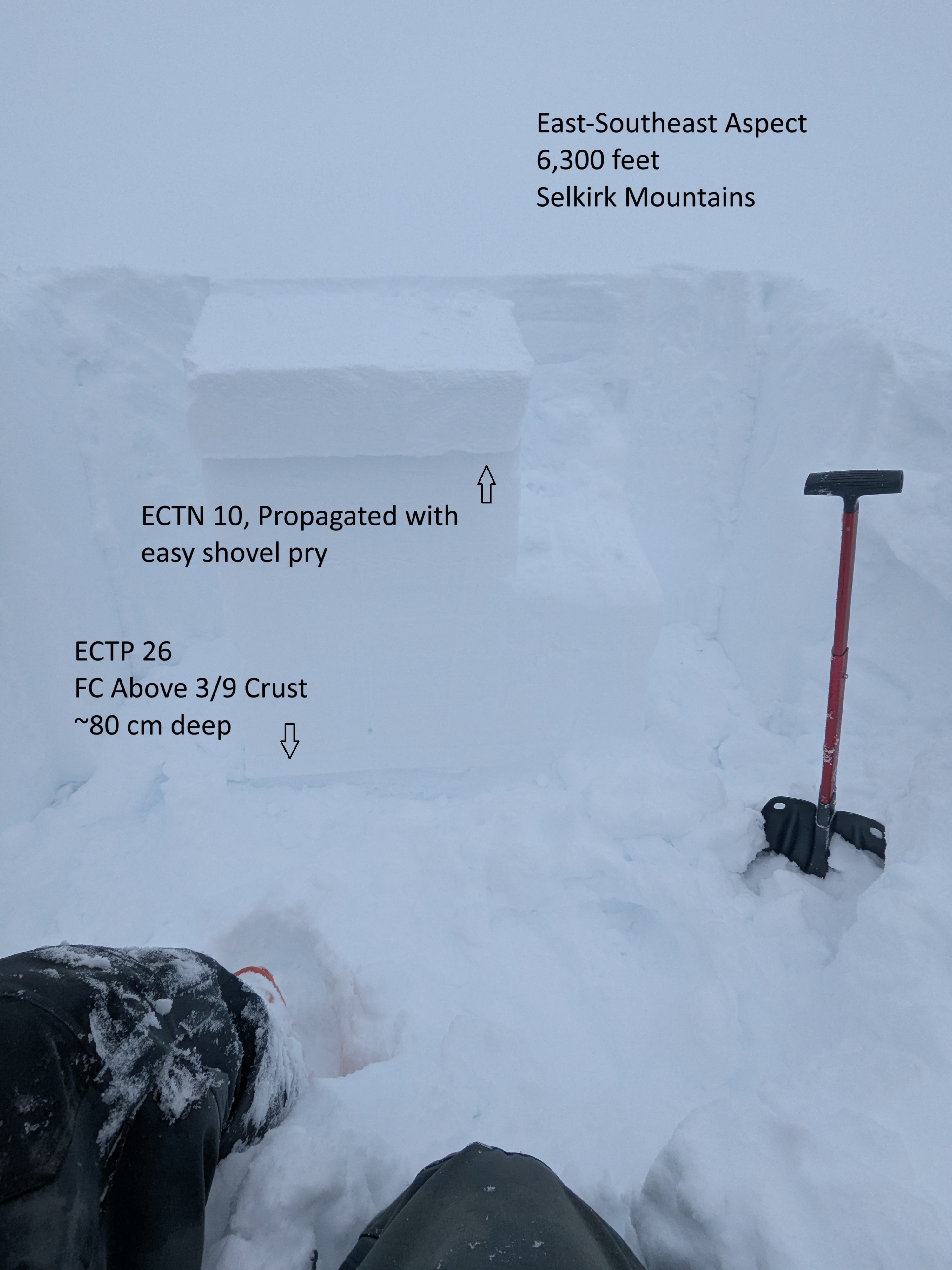
We found 10+ inches of new snow in the last 24 hours at elevations above 5,000 feet. Multiple snow pits identified several storm layers/ density changes/ differing storm grain size interfaces in the upper snowpack. One or many of these interfaces seems likely to fail from a person or machine if venturing into terrain over 30 degrees. While descending a few small convex rolls that approached 30 degrees, cracks shot outward from our skis. The couple of natural slides we spotted today are a clear indication the snowpack is having a hard time adjusting to the new load. Our upper most elevation snowpit was dug on an east-southeast aspect around 6,300 feet. Height of snow was 315 cm and the March 9 crust was down approx. 80 cm. A thin subtle layer of near-surface facets lurks above the crust, and we observed ECTP 26 - the failure occurred with a lot of pop. Closer to the surface, we observed an ECTN10 below the new snow and a thin, breakable crust. With an easy shovel insert behind, the failure propagated across the column. The new snow is denser than the snow directly above this thin crust and immediately below. Additionally, we observed varying resistant planar and collapse failures in numerous storm interfaces that have developed over the last week of stormy weather.
Avalanche
- Size
- D2
- Type
- SS
- Count
- 2
- Aspect
- E
- Trigger
- N
- Elevation
- 6800 ft
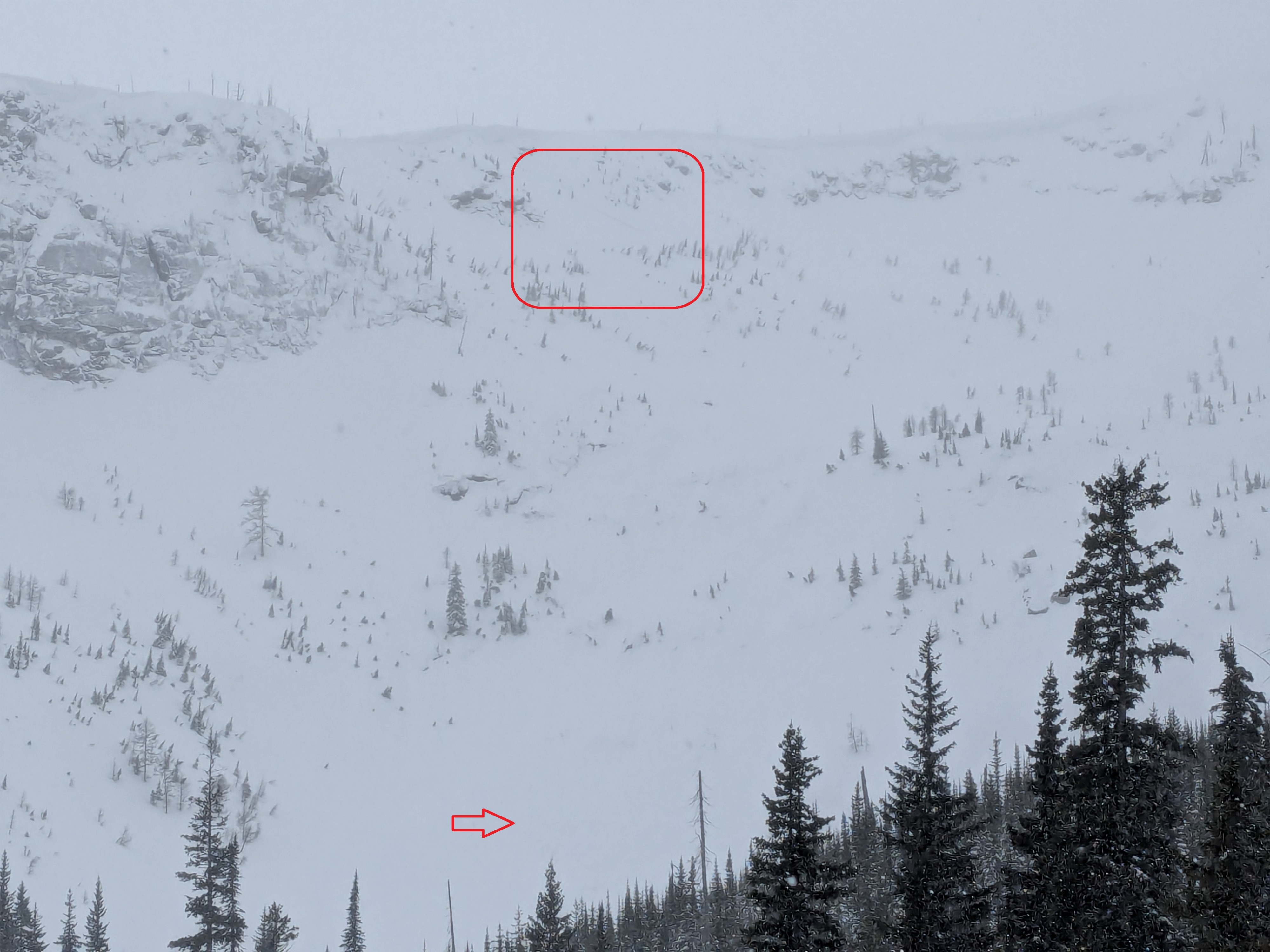
A few naturals that ran today on easterly aspects around 6,500 feet - one size 2 and the other a size 1.