
Quick report
- Cracking
- isolated
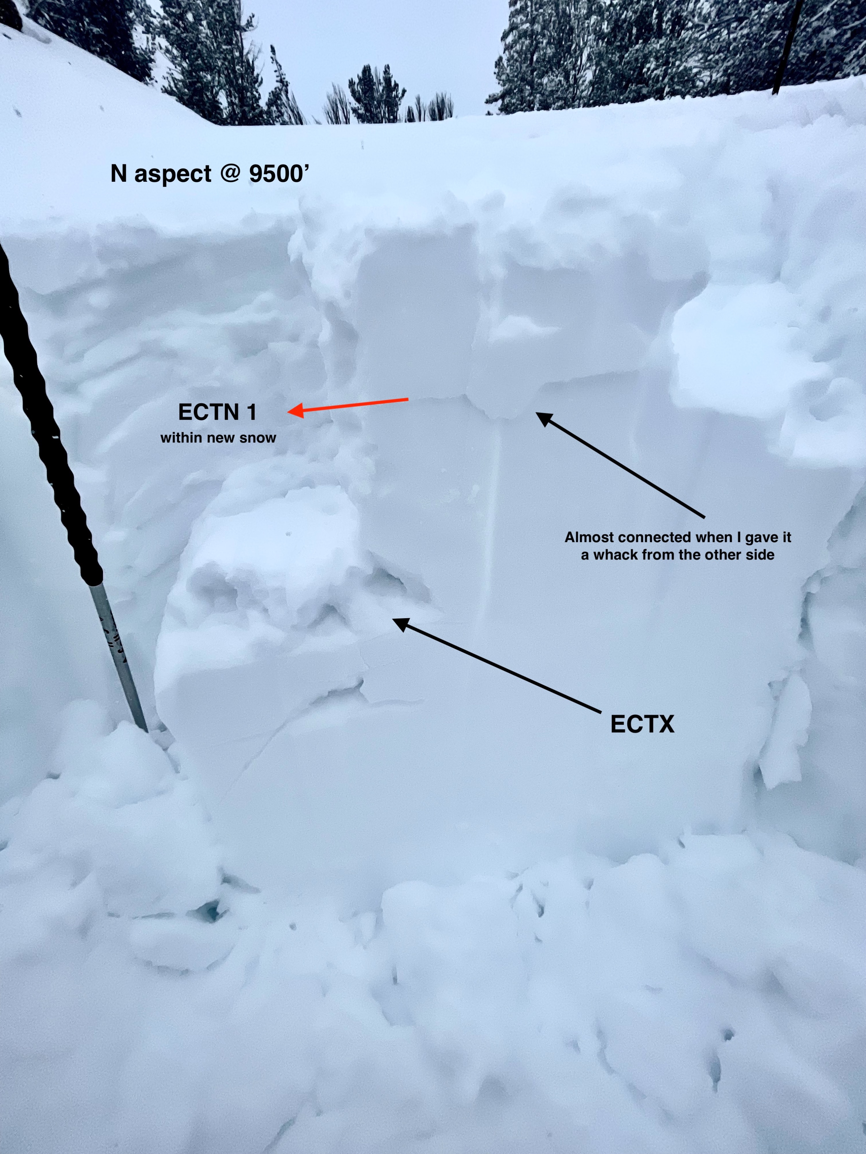
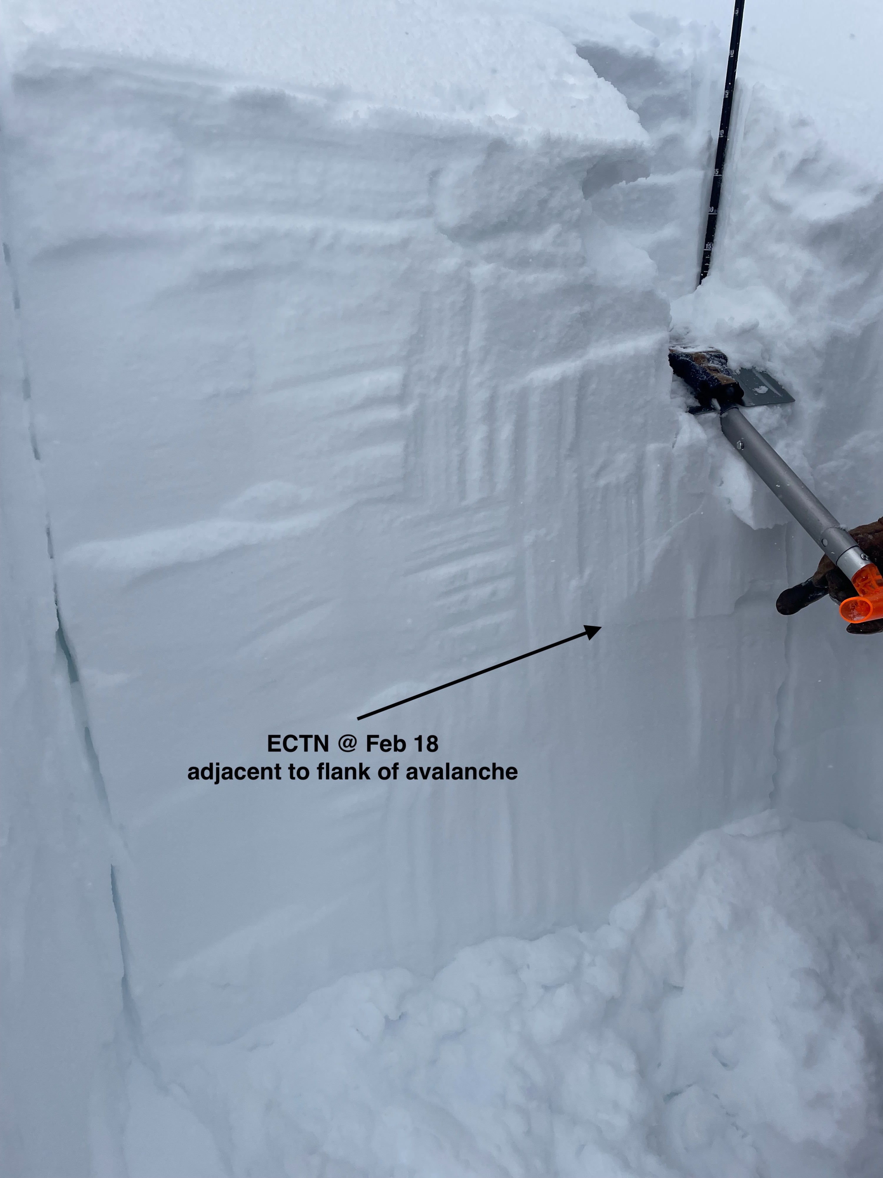
Up to Surprise weather station. 5.3 inches of SWE on the interval board since Feb 1st. Checked out a human triggered storm/persistent slab (that was reported, Thank You!) that failed on the Feb 18 interface. Dug a pit on a North aspect at 9500 feet and performed an ECT. No propagation within the new snow, on Feb 18, or on Jan 26. Fresh wind slabs were building, especially in the alpine where spindrift was playing a role on all aspects.
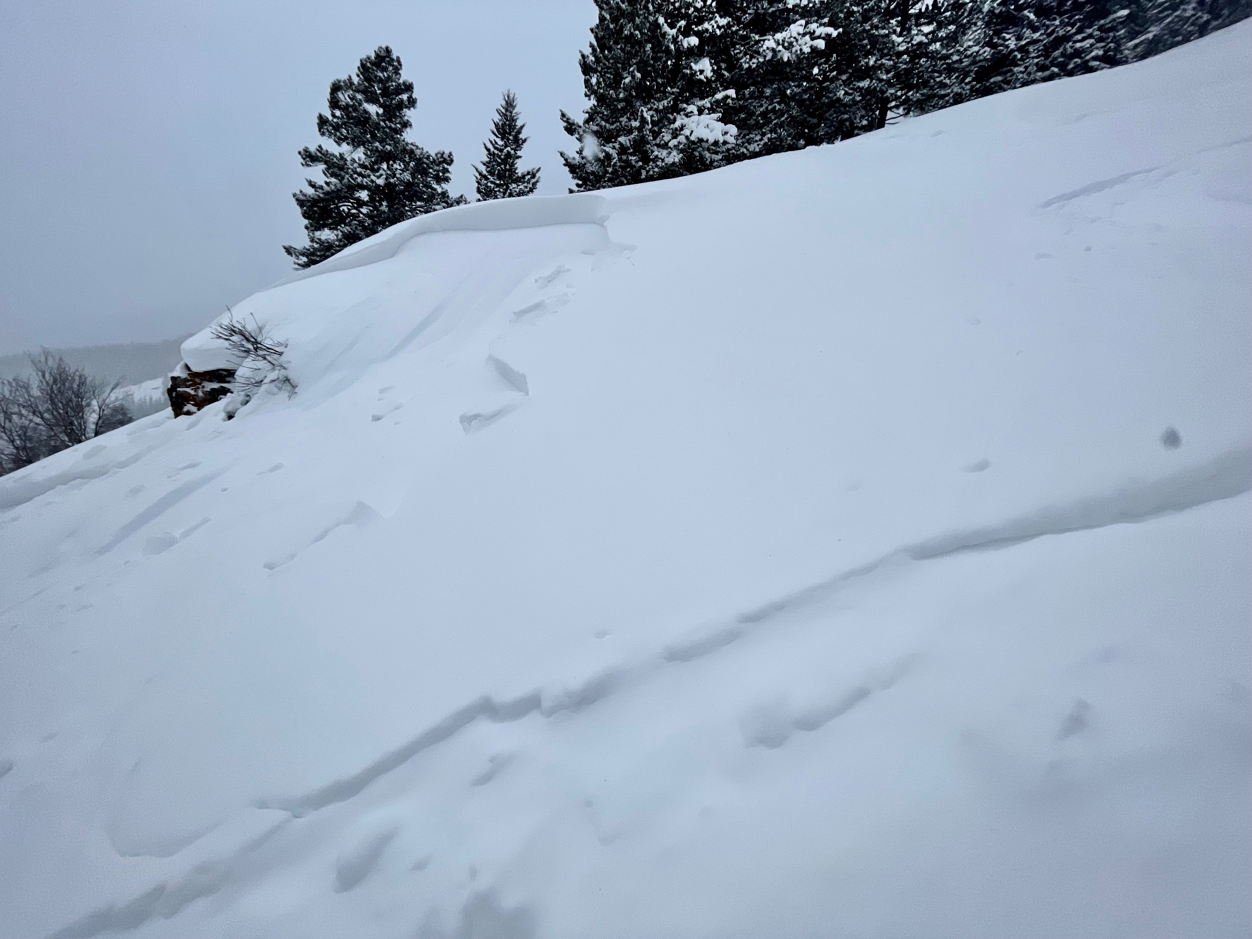
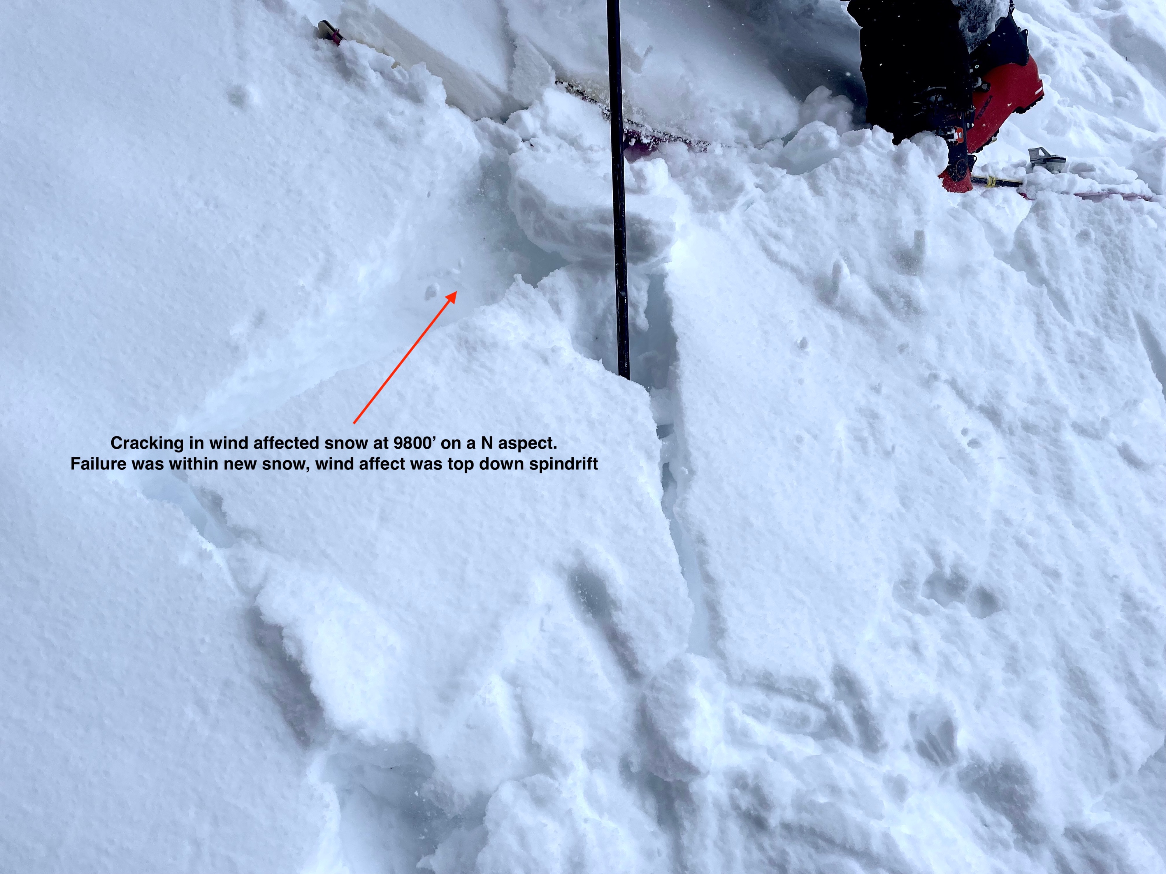
Observed an avalanche near Burned Wagon Gulch that was reported yesterday. Located at 7700 feet on a generally ESE aspect near a rocky outcropping (steep) with vegetation. D 1.5 confirmed. Some cracking within fresh wind drifts were observed on wind affected terrain above 9k'.Weather
- Air Temp
- 5-15 F
- Cloud Cover
- overcast
- Wind Loading
- moderate
- Recent Snowfall
- 1-2 inches of mixed forms and small graupel
- Snow Avail For Transport
- moderate amounts
Mostly cloudy and cold with increasing winds and precip rates in the S-1 to S1 range consisting of mixed formed (rimed) and small graupel.
Snowpack
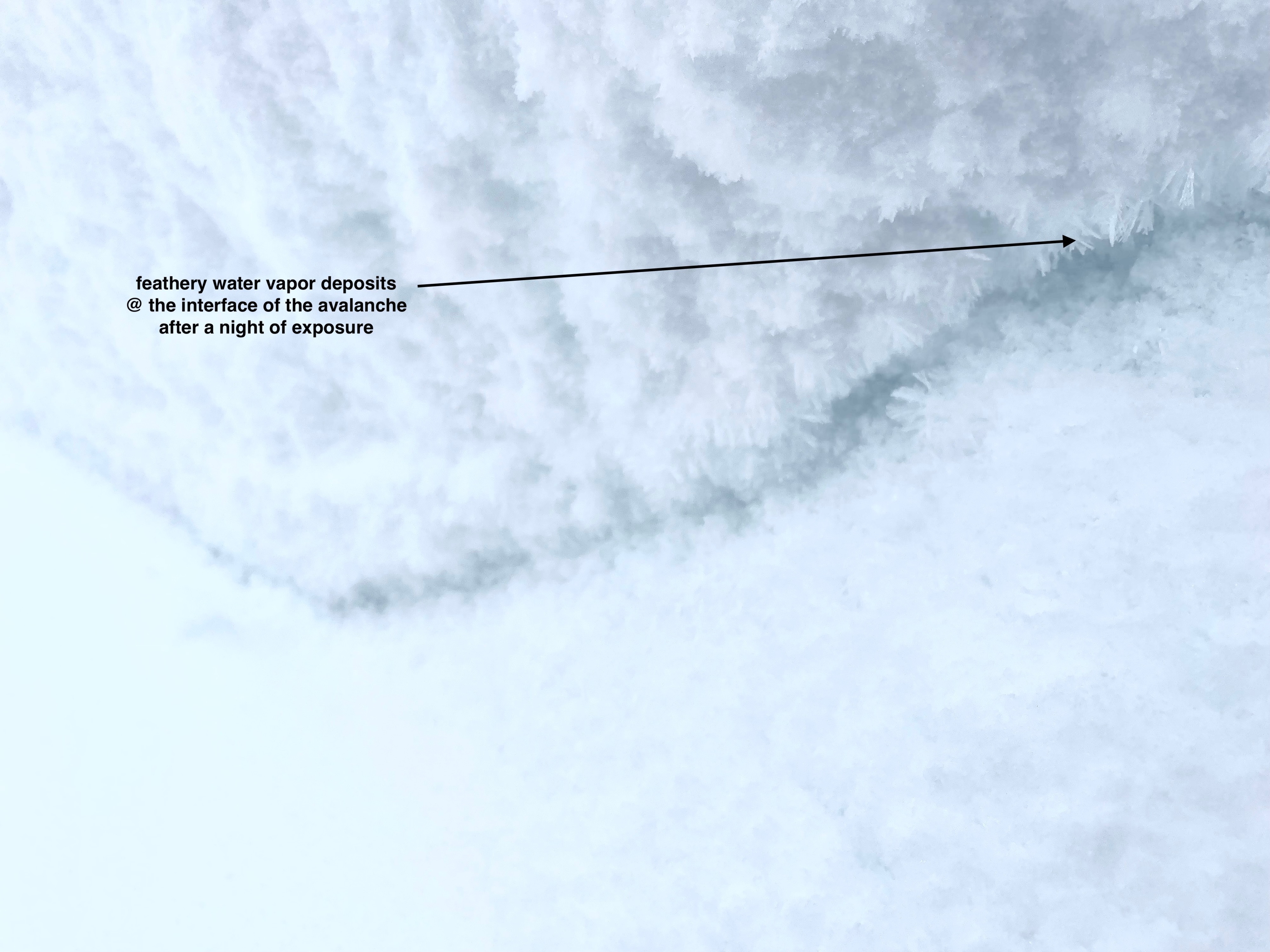
Did a crown profile of the avalanche at 7700 ft from yesterday. Slab was 4f, failure plain was the Feb 18 interface. Crust with facets on top on the left flank, well developed NSF on the skiers right flank. Triggered from the left side. Crown depth ranged roughly from 1-2 ft (up to 60+ cm).
Dug a pit on a North aspect at 9500 feet. HS was well over 2 meters, performed an ECT within the top meter of the pack. No propagation on the mid storm density break, Feb 18 (very small NSF) or Jan 26 (unidentified).
Spindrift down off of the south facing wall of Glacier Gulch was a common occurence in the late afternoon, and it seemed to be associated with down drafts associated with convective weather (hence the small graupel). Some small scale weather phenomena that I don't understand. Some spindrift on north but not like south.