
Quick report
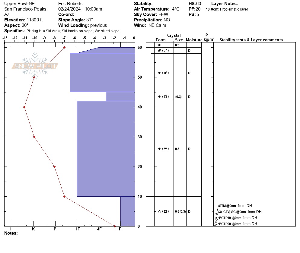
Instability tests reflected poor-moderate structure, Moderate strength and moderate propagation propensity due to repeated failures on isolation at base. Northern aspects continue to point towards advancing facets at the base and NSF in specific areas.
Weather
- Air Temp
- 29F
- Cloud Cover
- few
- Wind Loading
- previous
- Rain Elevation
- N/A
- Recent Snowfall
- 0cm
- Snow Avail For Transport
- small smounts
WSW Calm FEW with high cirrus clouds 27-29F No Precip, No Rime
Snowpack
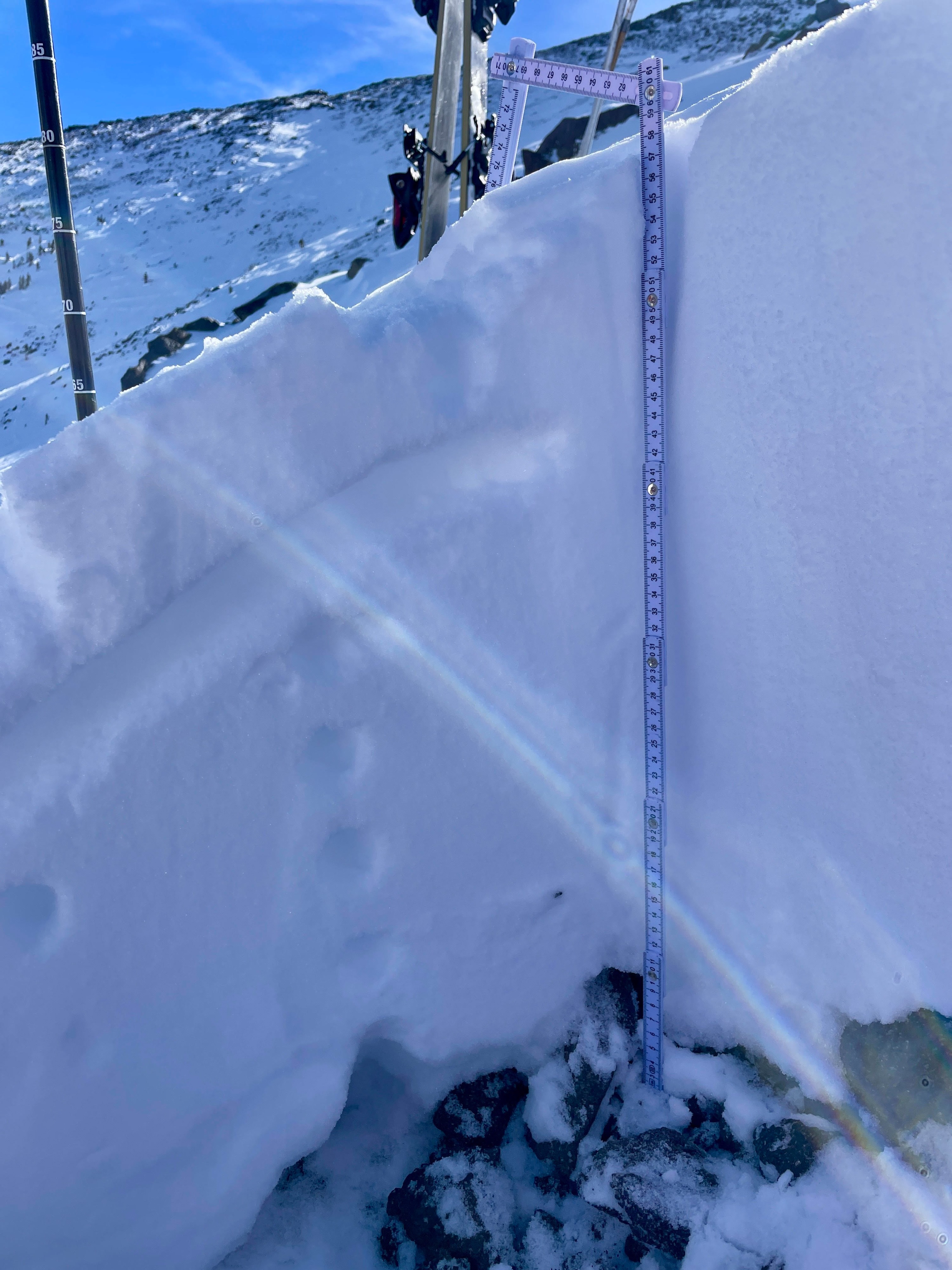
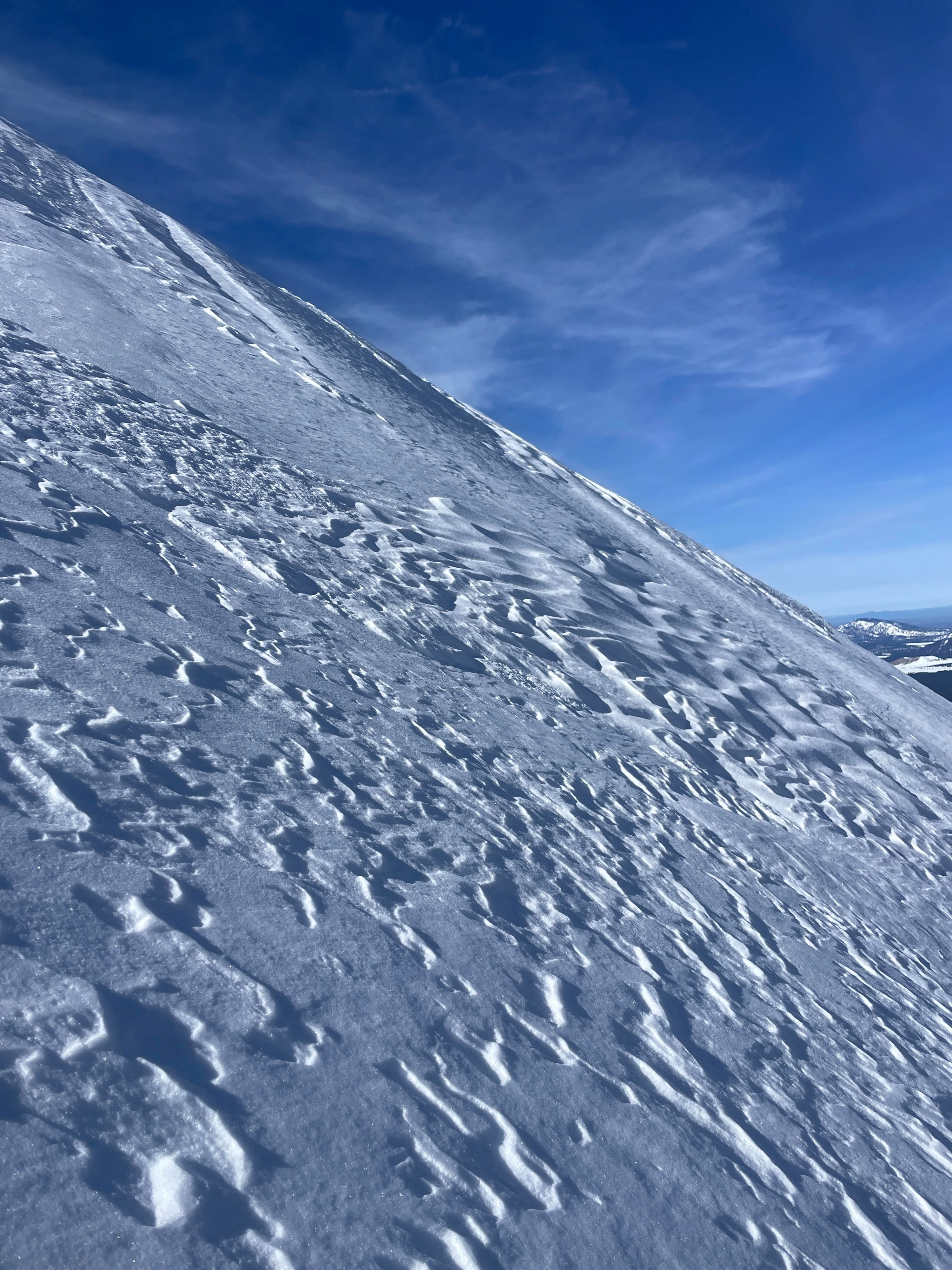
Snow Surface: 1F-4F wind stiffened surface on NW-N-NE aspects with MFcr (solar) hard in morning, softening by PM. Snowpack continues to be right side up throughout majority of snowpack on exposed Northerly aspects, down until the base, which is composed of our Depth Hoar (2-10cm in width). A Temperature gradient was present near base depth and NSF was found 15-17cm’s below surface. With the clear days and nights, I anticipate this recrystallization to occur in stronger cycles as days get warmer and nights more drastic in temperature change. Surface conditions consisted of 1F to 4F wind affected snow with sporadic pockets of F hard, low density snow in wind sheltered areas. Snowpack is right side up with our 1-4mm Depth Hoar (F hard) still present in most E-N-W aspects at base. Height of snow is variable ranging from 60-80cm in most N aspects with 120-200cm in loaded micro-drainages and wind loaded aspects.) Surface conditions may present with the most risk in early morning hours when melt-freeze crusts and stiff conditions are supportable and slick. As solar effect occurs into the afternoon, saturated surfaces might enable penetration to go further or may grab at ski tails if not careful.