
Quick report
•The morning started bright and sunny, which quickly destabilized the recent snow on east facing slopes. Late morning cloud cover developed and persisted for the remainder of the day. This kept things cool and prevented a widespread shed cycle. • The Northern Flathead Range received about 12 inches of recent snow at upper elevations. The recent snow had some interesting layering to it depending on what aspect you were on. On south and west facing slopes, this snow had already been through a freeze thaw on Thursday. The recent snow presented as a supportable crust with dry snow sandwiched between the old stout interface. On east and north, the new snow was less settled out and still dry in places. •On east, from top to bottom, we saw about 3 inches of dry/moist snow, 6 inches of dry powder, 3 inches of moist/wet. Our ski turns were impacting the wet snow at the bottom of the recent snow, which wanted to unstitch steep slopes. •Later in the day, we moved over to a steep north facing slope and found 12 inches of excellent dry consolidated powder down to about 6500'. • Skied my last run of the day at 400pm with a west facing run that skied pretty well considering the time of day. Thanks clouds!
Avalanche
- Size
- D1
- Type
- WL
- Aspect
- E
- Trigger
- AS
- Elevation
- 7200 ft
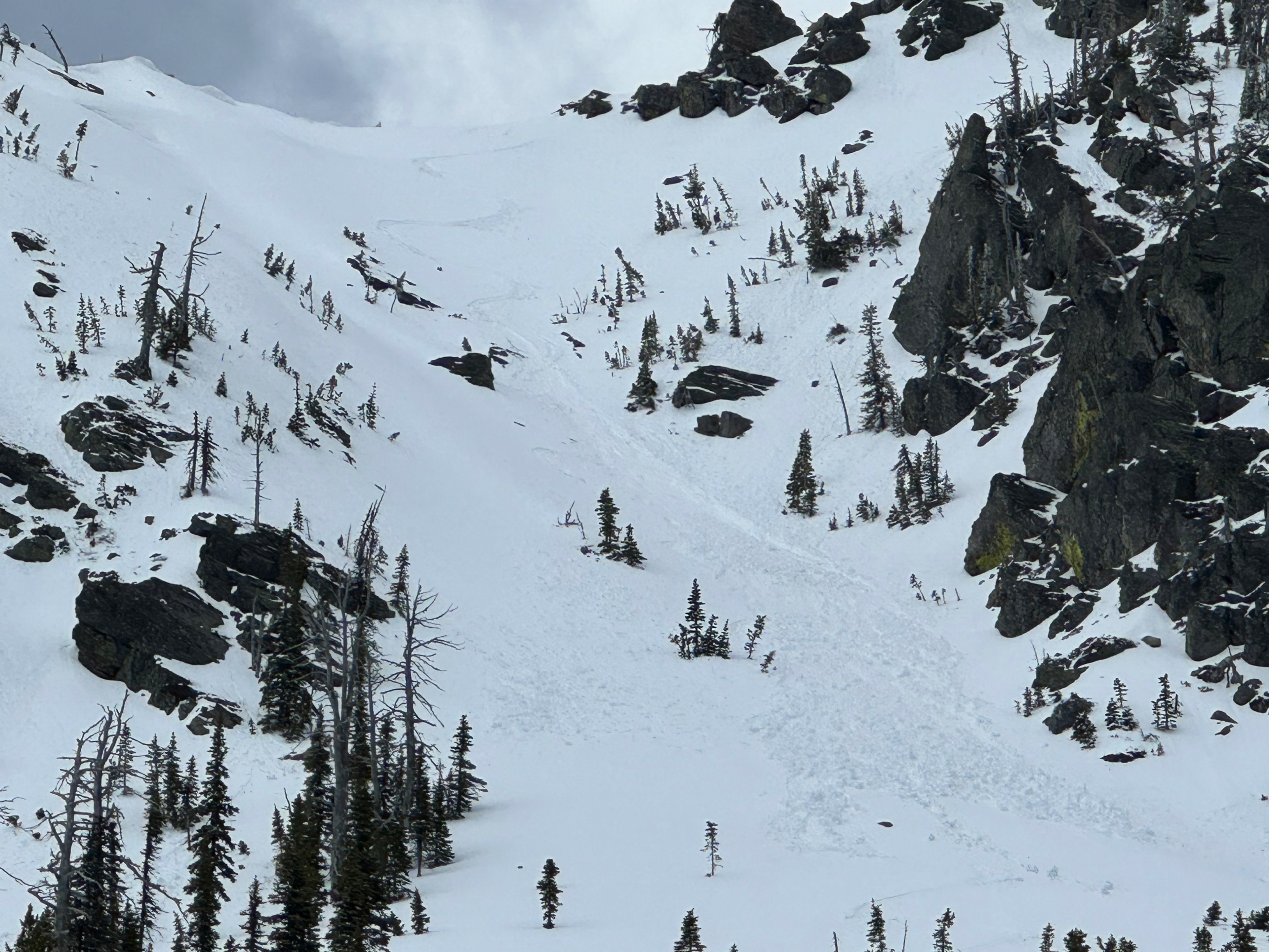
WL-AS-R1/D1-I Skier triggered at wet loose at ~7200' in a steep east facing chute on Triangle Peak. The avalanche was relatively small (D1) and only ran for about 250' before losing energy.