
Quick report
- Cracking
- specific
- Collapsing
- widespread
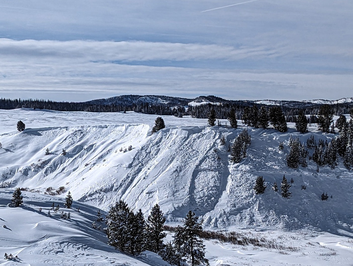
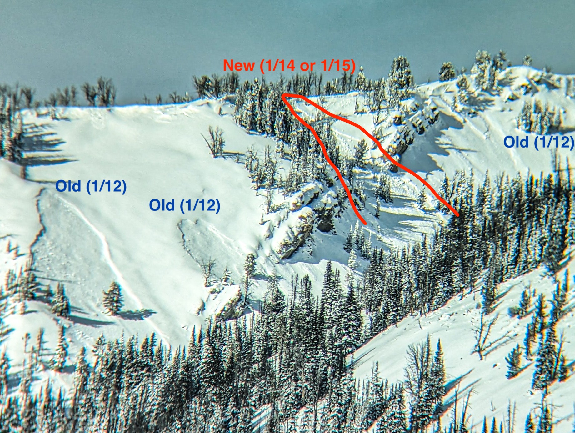
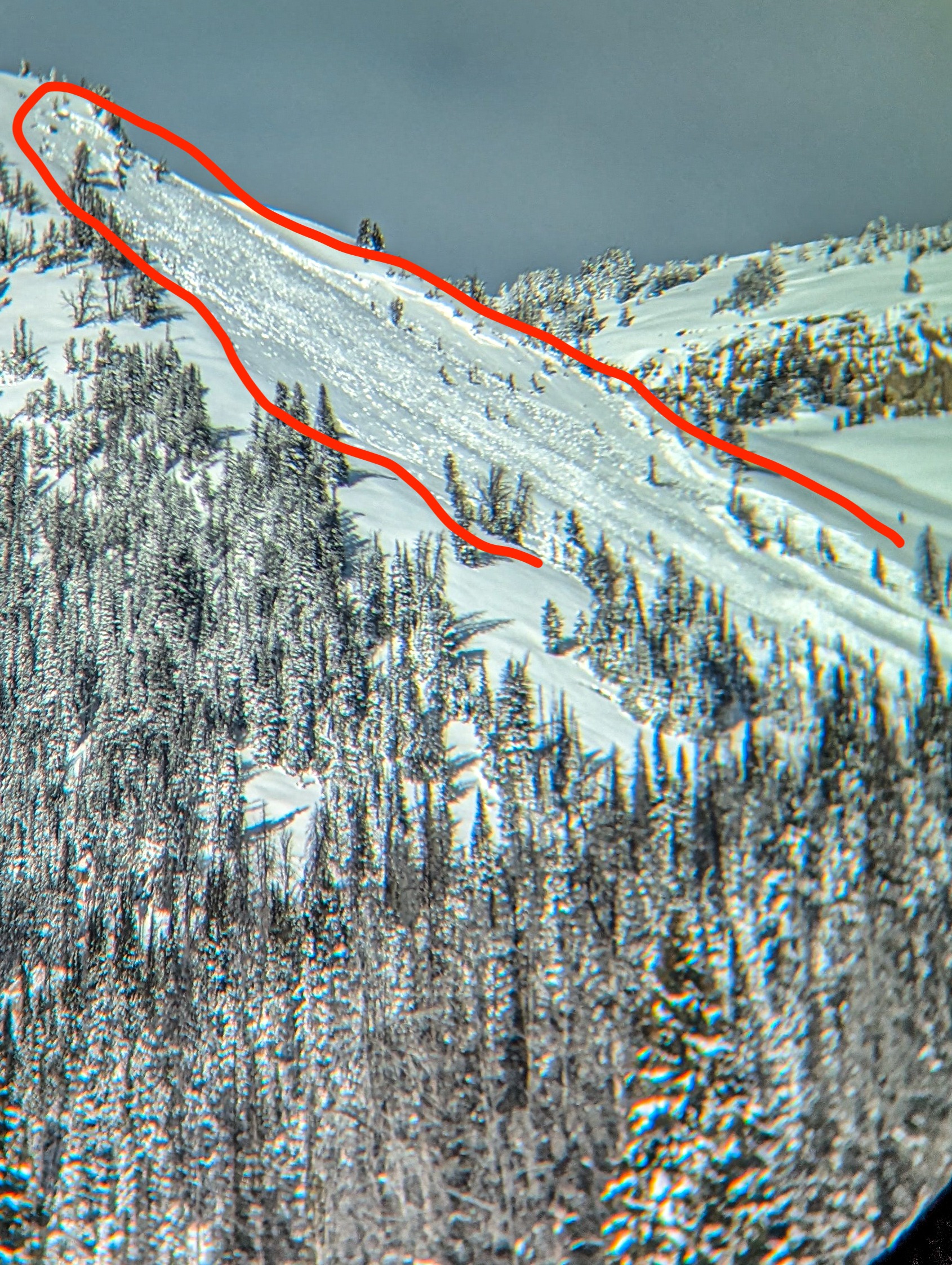
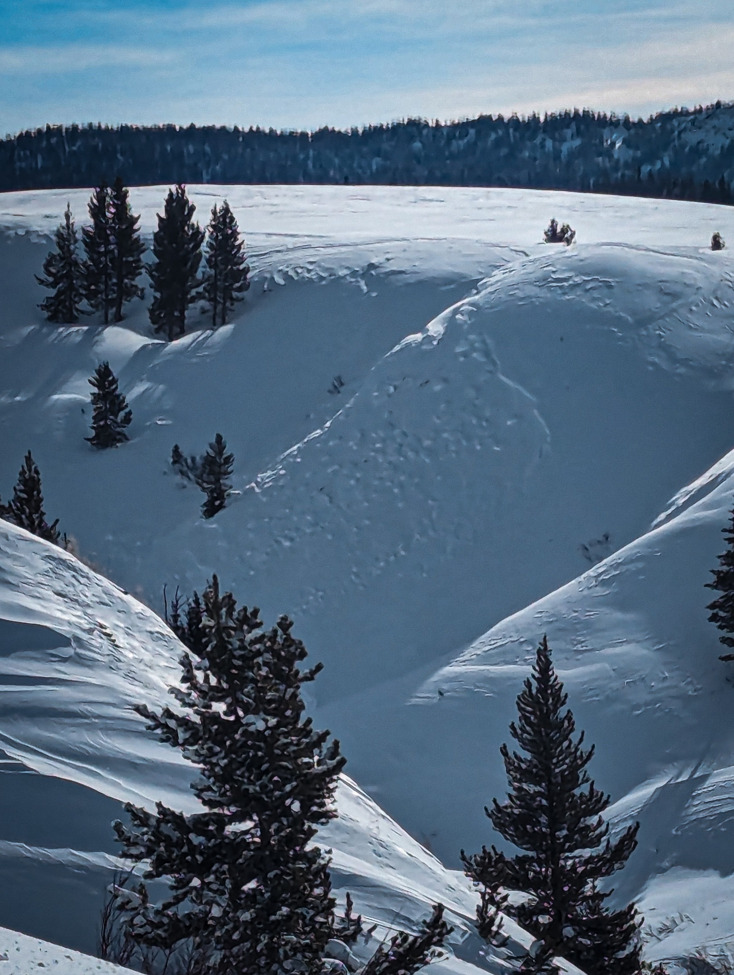
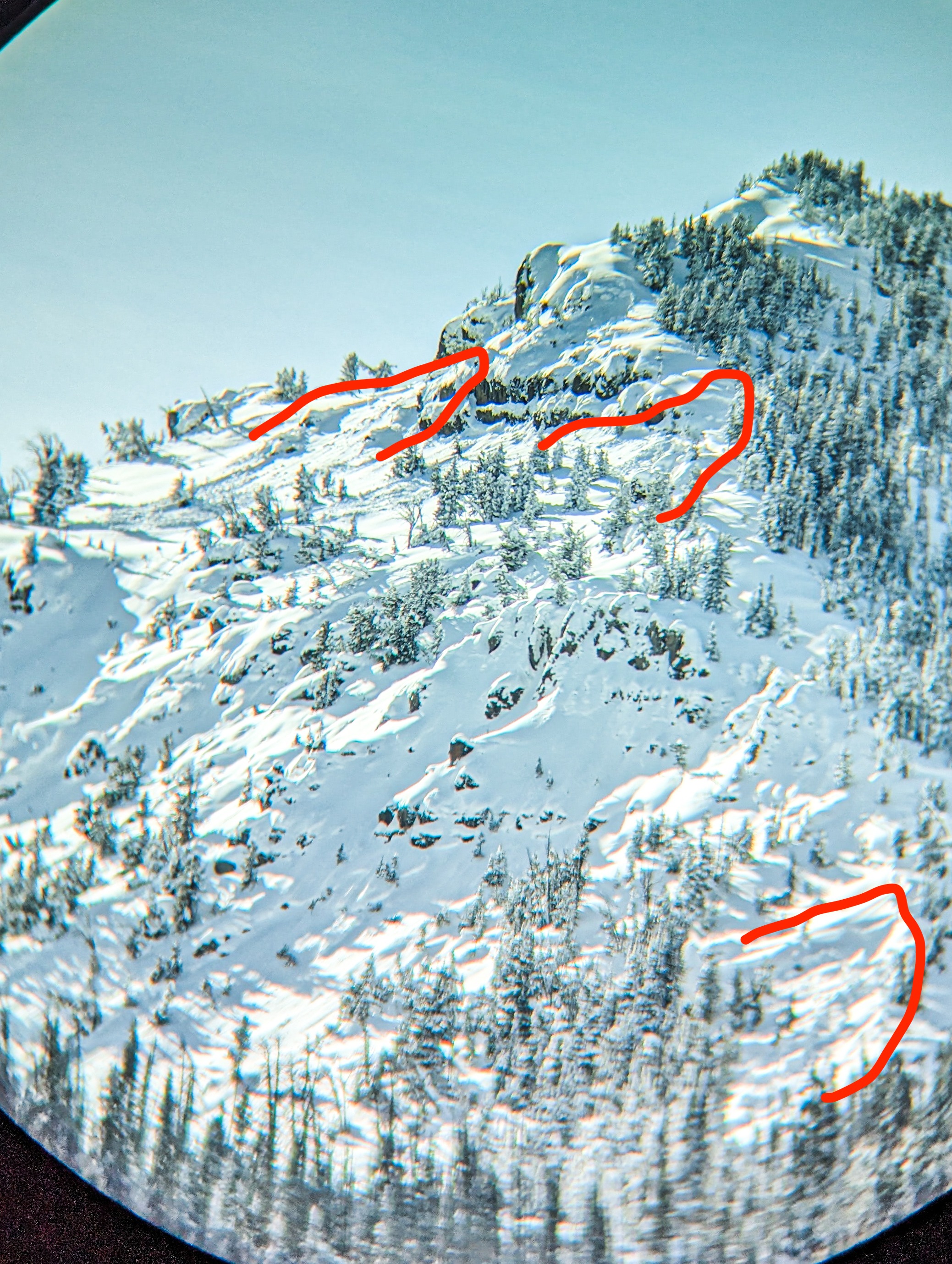
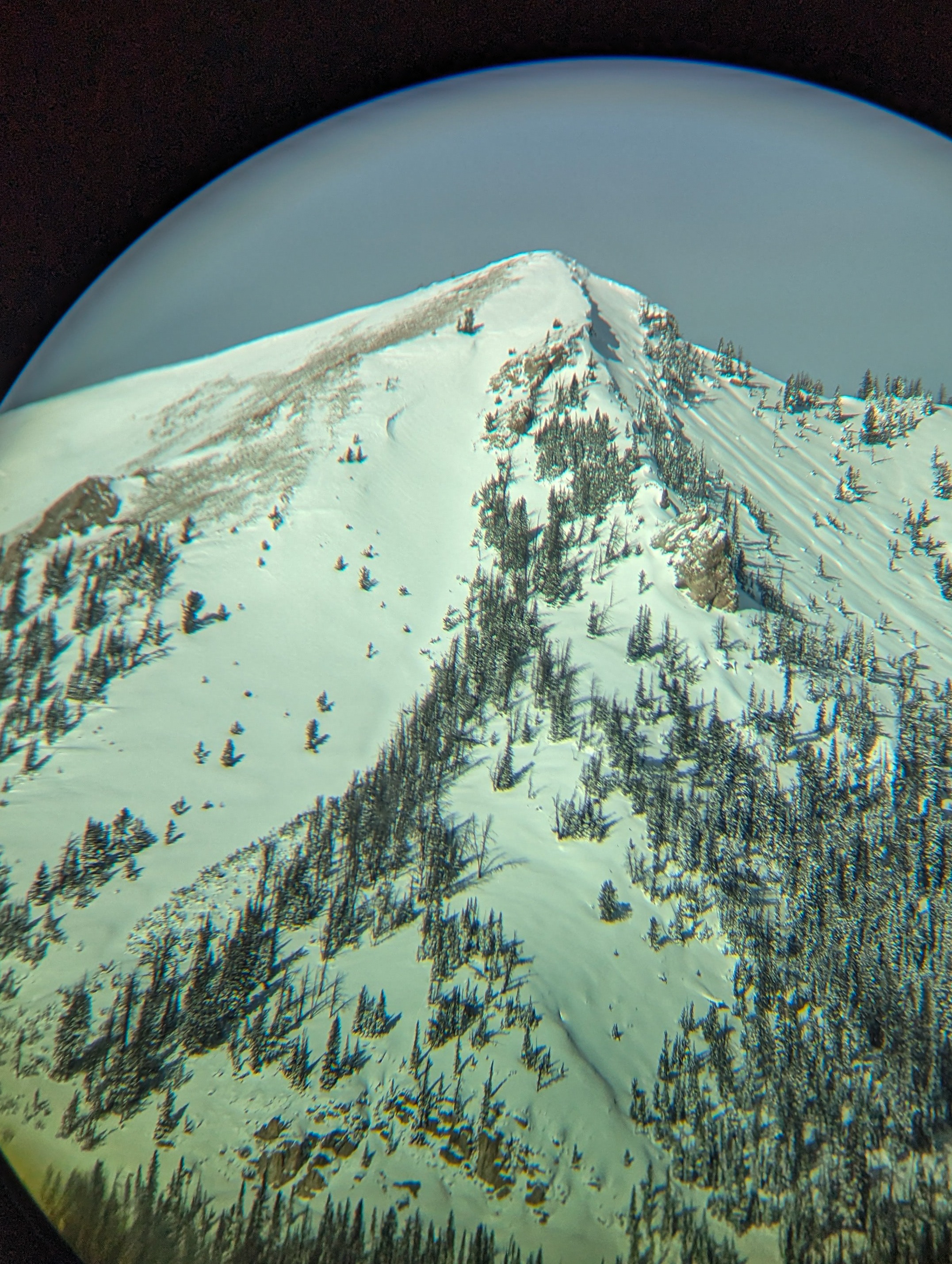
Togwotee was hit with several rounds of sustained moderate winds gusting high out of the S, SW and W since friday - about 34 hours worth. This has stripped high elevation SW slopes almost bare and redeposited snow on lee aspects. With last week's snow readily available for transport, this created thick wind deposits that overloaded the weak December snow and caused a natural avalanche cycle over the last couple days. Start zones from this cycle were all in wind loaded zones near ridglines or crossloaded terrain features. The largest of these avalanches observed was D2.5 at 10,100 on a SE aspect.
Also observed today -
Significant warming on steeper southerly slopes with small rollerballs while touring.
7 inches of snow on the Angle Mountain weather station and 0.9 inches SWE. Last cleared 1/10.
Widespread Snowshoe Hare tracks, the Togwotee population appears to be thriving.
Widespread collapsing while touring from 8500 to 9500 feet on SE-E-NE aspects. Cracking was more localized to 3-4 meters. See below for avalanche activity.Weather
- Cloud Cover
- broken
- Wind Loading
- none
Cold, partly cloudy, light SW winds
Avalanche
- Size
- D2.5 R3
- Type
- SS
- Count
- 3
- Aspect
- SE
- Trigger
- N
- Elevation
- 10100 ft
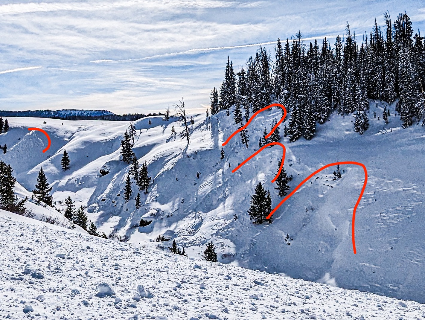
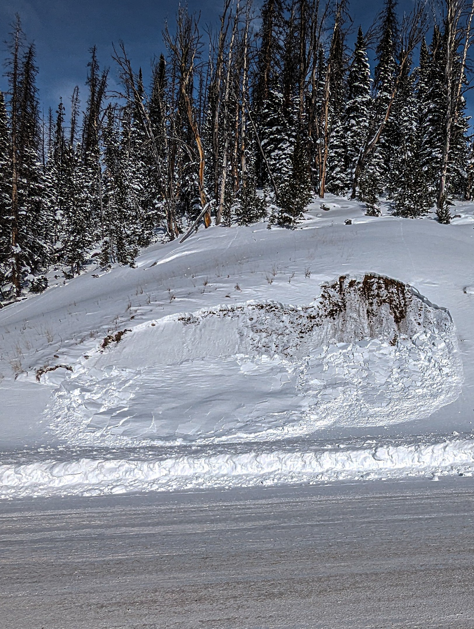
1. Multiple small (D.5-1) SS natural avalanches in steep creek drainages along the road, 8700-9000 feet along steep north and northeast facing slopes failing on 1/4 interface. 2. 3x D.5 SS avalanches on east face of Two Ocean Peak 10,000 to 10,400 feet 3. 9800' East aspect, south shoulder of Angle SS-N-R2-D1.5-I 4. 10,100' SE aspect, sub peak to the south of Angle SS-N-R3-D2.5-I