
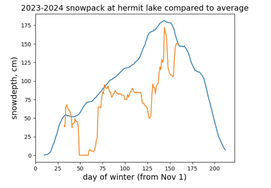
Quick report
An analysis of Hermit Lake snow plot data demonstrates that we have achieved an 'average' April 6th snowpack. The variability in the snowpack driven by significant precipitation events during winter 2023-2024 is clear. This makes sense, given the strong El Nino and the ability for a warmer atmosphere to hold more moisture compared to baseline. In summary: 1. December was great, until the MWV received 5+ inches of rain atop a sizable snowpack. 2. January saw a parade of big storms. 3. February was extremely dry. 4. Miracle March was followed by a 'torch' 4. April saw the biggest late season snowstorm since 1982 Special thanks to the MWAC staff who records observations every day to keep us safe (and also to assuage our desire for data!)