
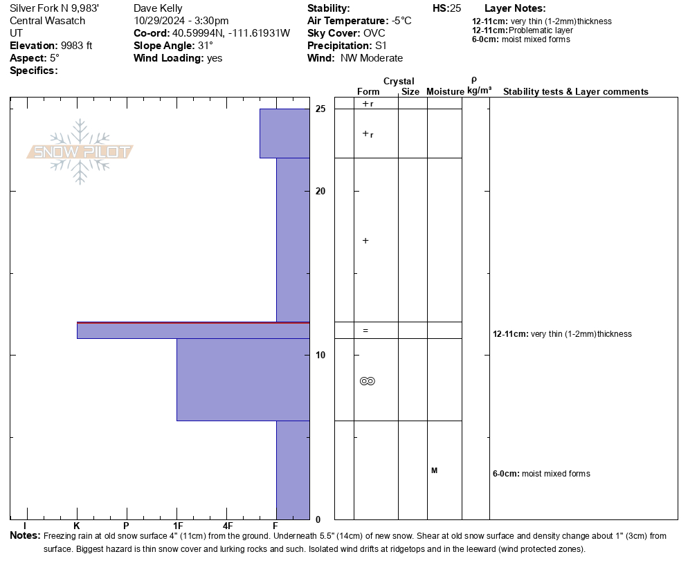
Quick report
- Aspect
- North
- Elevation
- 3018 m
- Slope Angle
- 31°
Shear at old snow surface 4" from the ground and density change 1" from the surface. Photo (2) below of isolated wind drift with a short fracture at 10,000' on an east facing aspect. These wind drifts were up to 2' deep and maybe 10' wide isolated to ridges and the leeward side of terrain features. Crystal card in the photo (1) below marks the old snow surface and the top of the rain layer.
Photo 3- west and southeast facing terrain 10,000'
Photo 4- west and southwest facing terrain 9,100'
Snowpack
Took a walk without the skis to see how the new snow bonded to the old snow surface on high north facing slopes. I found 5"-6" of new snow with more drifted in (up to 2') in isolated areas near the ridgetops. The last 1"-2" of new snow was more heavily rimed stellar crystals. In most places this is the only snow on the ground. On north facing aspects above 9,500' there is some old snow on the ground. Prior to the start of the storm there was a freezing rain event and there is a hairthin rain crust on the top of the old snow surface and on rocks starting at 9,000' and upwards in elevation.
Photo of rimed stellar on the surface (west facing aspect 9,400')