
Quick report
Mixed conditions depending on elevation. We found winter-like conditions from 6,500 to 5,500 feet, and a supportive snowpack. Below that, conditions transitioned quickly to more of the liquid flavor. The lower we descended in elevation, the more wet and trap-door conditions became.
Weather
- Cloud Cover
- obscured
- Wind Loading
- light
- Rain Elevation
- 5,500 feet to start, lowered to 5,000 feet in afternoon
- Recent Snowfall
- 2 cm
Skies became obscured around 11 am, shortly after start of precipitation. Westerly winds were light at mid and lower elevations, but increased to moderate and strong gusts along exposed ridgelines around 6,000 feet.
Snowpack
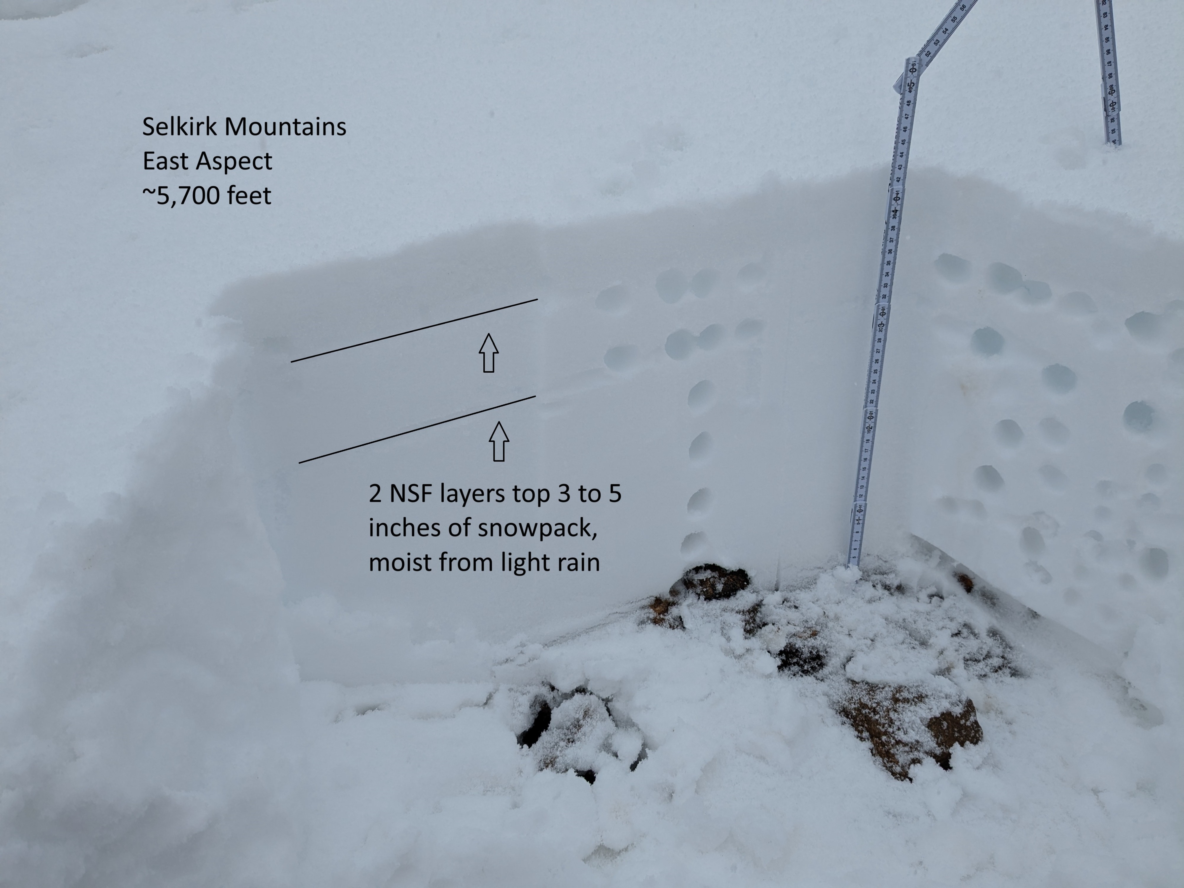
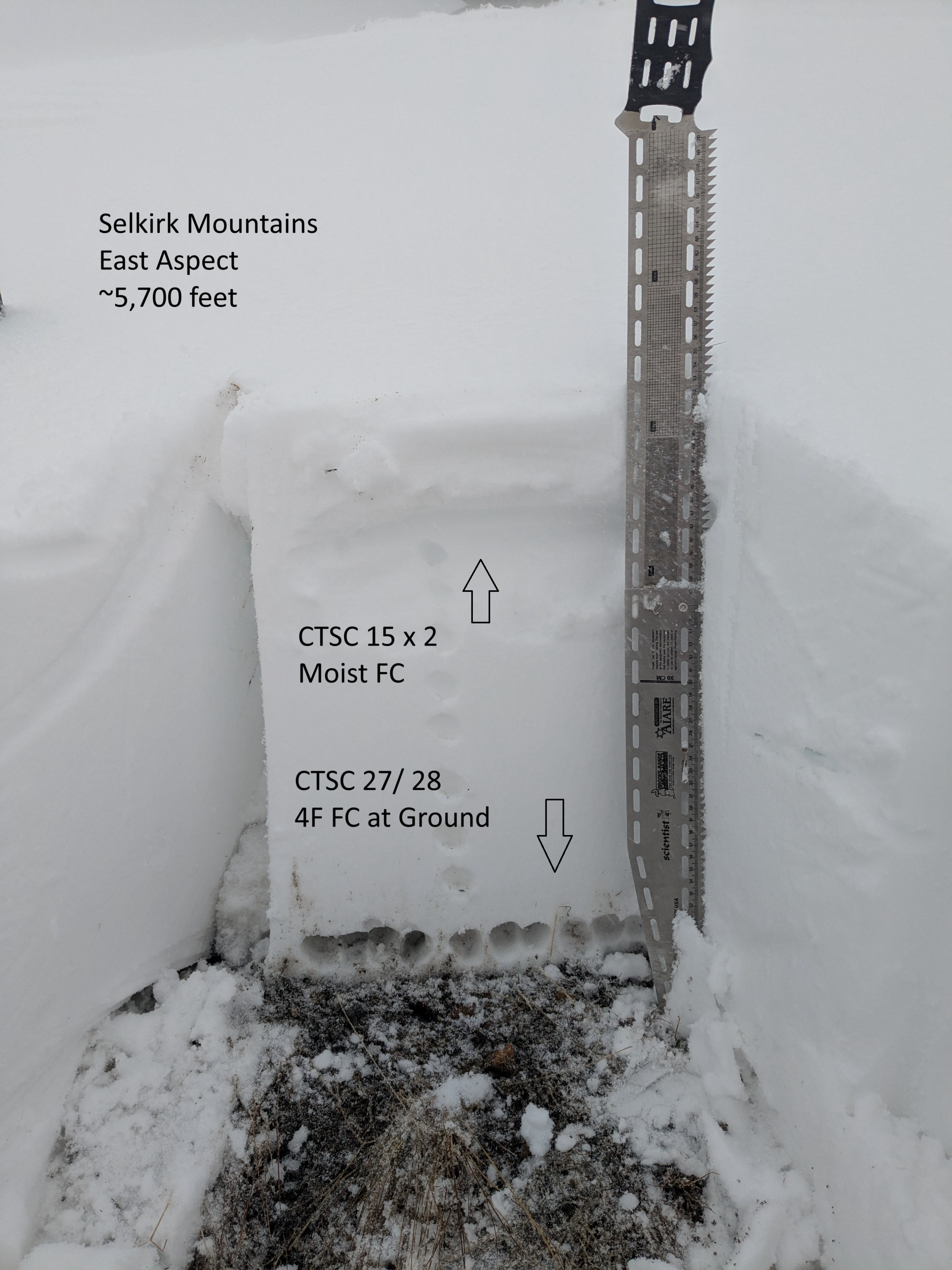
Total snow depth ranged 10 inches around 4,000 feet up to about 20 inches around 5,500 and higher. Light rain at the start of our tour transitioned to frozen precipitation just above 5,000 feet. Despite generally shallow snow depths, the snowpack has mostly staved off extensive faceting and weakening since the early-November storms. This is likely from general mild temperatures during the most recent dry spell. The most problematic weakening observed was found in the top 3 to 5 inches - either small grain facets or facets below a surface crusts. The snowpack still has decent integrity and the main body remains mostly 1F. Light rain over the last 24 to 36 hours slowly wetted the upper snow layers with rollerball activity confined to steeper slopes and cut banks. Liquid rain at lower elevations has made the snowpack more trap-door. Above the snow line, Compression Tests only revealed sudden collapse failures in upper snowpack weak layers with moderate force and hard force in similar tests at the ground. The main question over the next couple of days is how well will the new snow bond to the old snow surface. Places where the old snow surface re-freezes quickly may create a more reactive new storm slab. As the new snow load incereases, we should anticipate upper snowpack weak layers becoming more suspect to failure from added weight of a rider or machine.