
Quick report
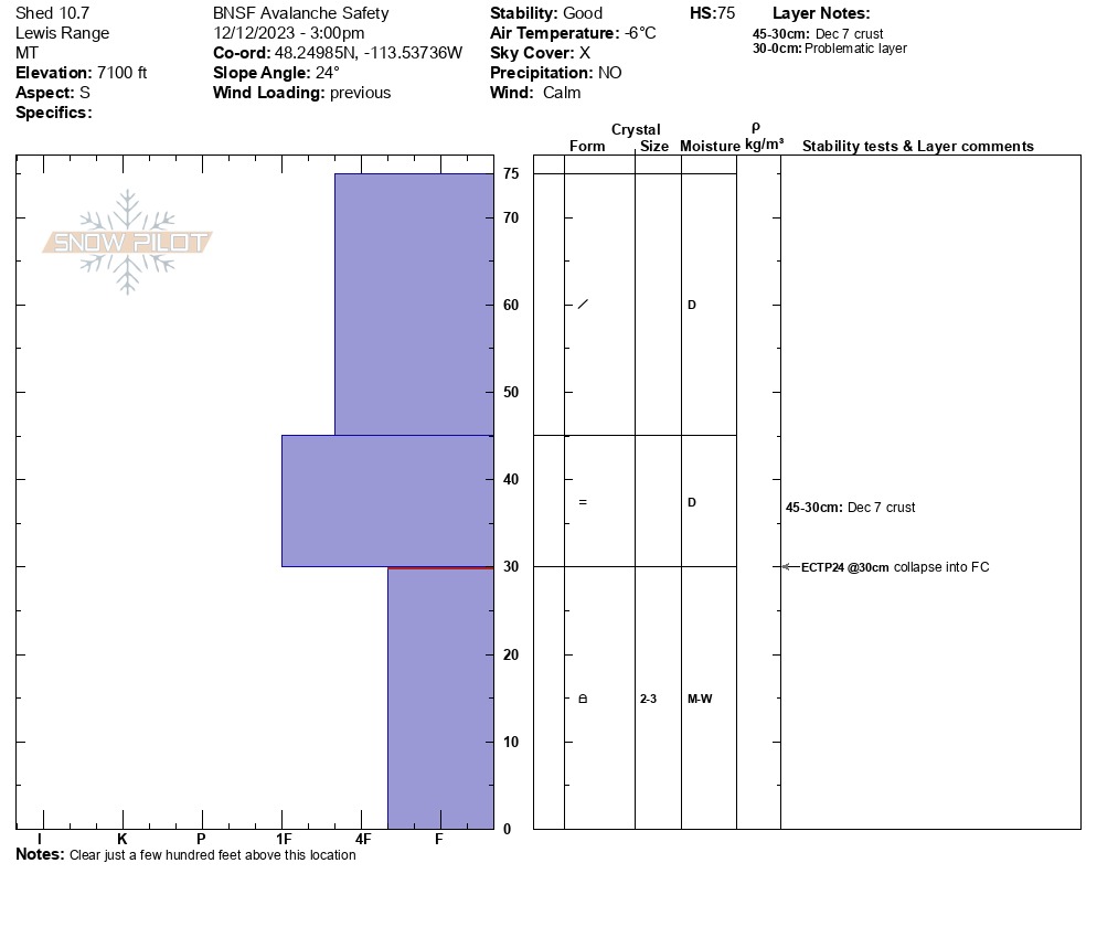
• No avalanche activity observed. • Not much snow. 3-5” total snow depth on the Canyon floor, about 8-10” at 5000’, 12-18” at 6500’. Snow depths increased quickly above here with typical depths of 2-3’ around 7000’. Deeper snow exists on the shaded aspects. • Above-freezing temperatures and rain last week extended to at least 7200’ and likely much higher. • No signs of instability observed save for one propagating result in an Extended Column Test (see pit profile below). This occurred in a layer of moist facets below the Dec. 7th crust • The snowpack basically consisted of 5-10” of soft powder, newer snow on top, then the 2-4” thick Dec. 7 rain crust below that, then moist, rounding facets below that to the ground (pit profile). • The more recent snow resting on top of the Dec. 7th crust seems to be mostly stable. Ski cuts on some wind slabs atop the crust did not produce any cracking or slab releases. No fractures in this layer with ECTs.
Weather
- Cloud Cover
- overcast
- Wind Loading
- previous
- Snow Avail For Transport
- small smounts
• A sometimes-broken stratus deck of clouds hung around 6500-7500’ elevation band all day with clear skies above. No precipitation. • Calm to light westerly winds with daytime high temperatures ranging from the low-20s°F above 6000’ to right around the freezing mark on the Canyon floor.