
Quick report
Our goals for the day were to look for recent natural activity, see how much the wind was moving snow around, watch for wet loose activity driven by strong sun and warm temps, and to check in on our persistent weak layers and see how they are behaving as you travel through the snow.
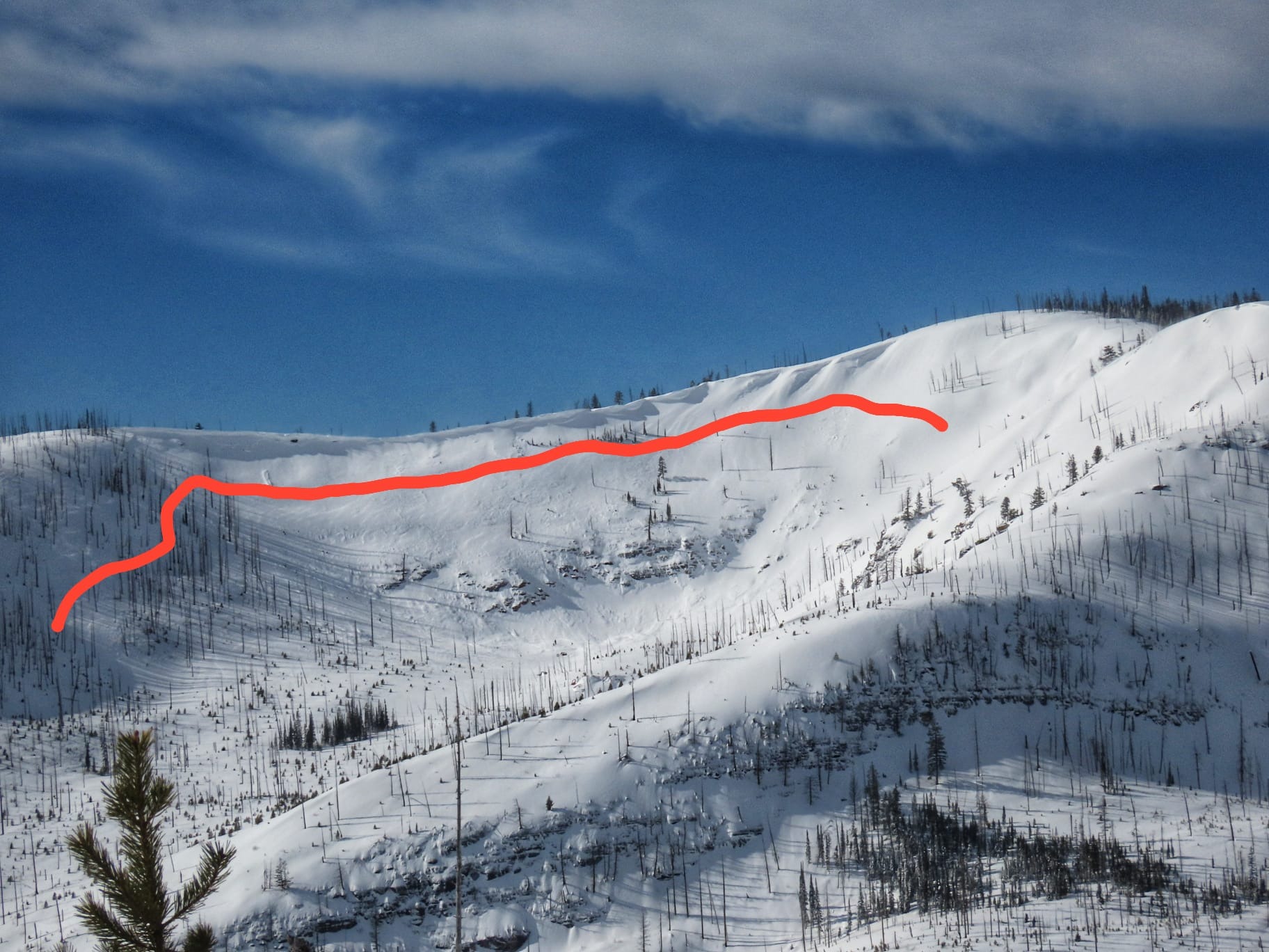
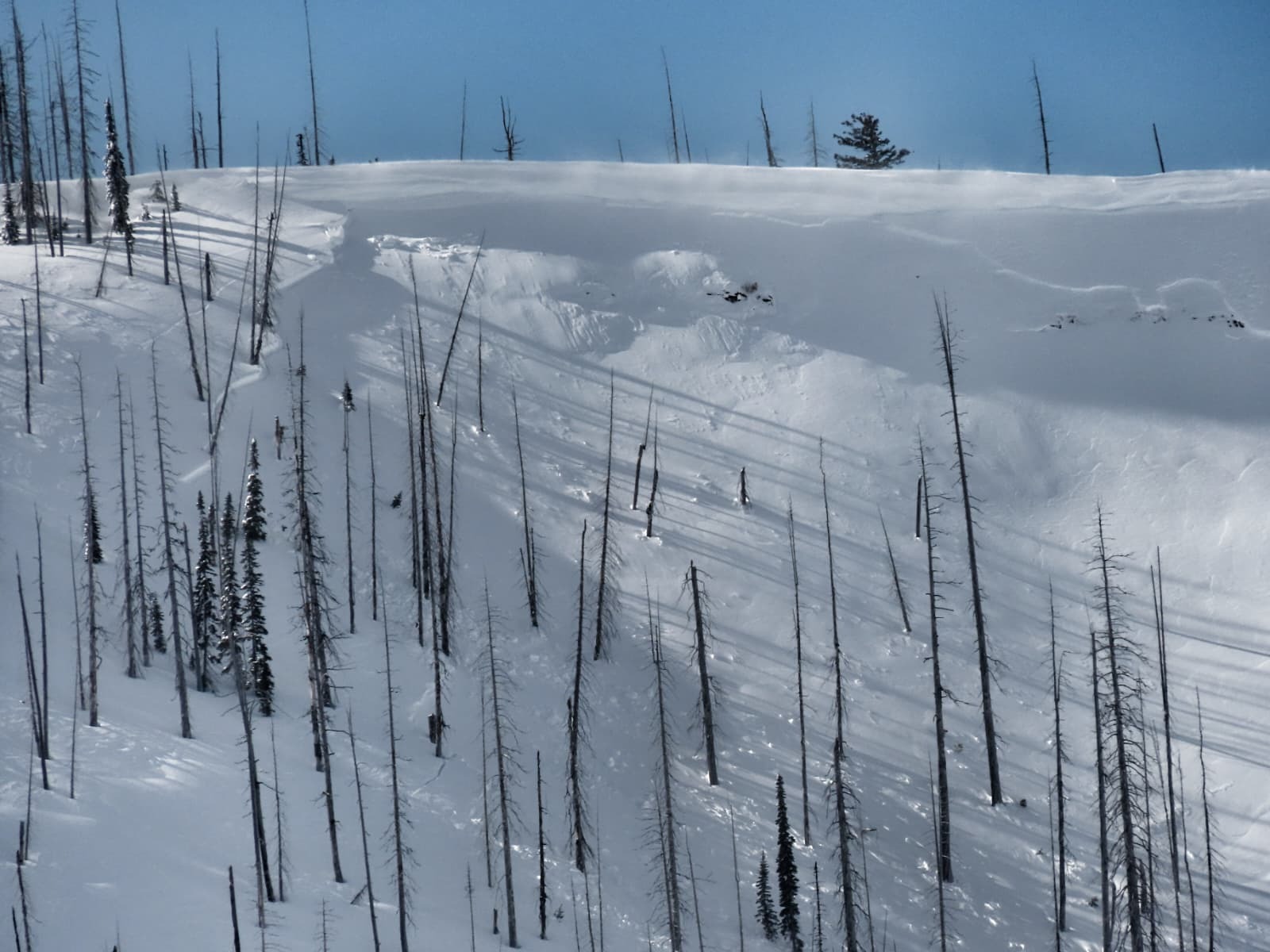
AVLANCHES: We observed two large slab avalanches that had released in the past 36 hours. Timing was hard to gauge due to the amount of wind transport. One broke 1,500' wide and produced a substantial debris pile at the base of the slope. We talked to other riders who observed several other recent large slab avalanches in the area. We did not get up high to look around for more avalanches, but it's a safe bet there are more to be found.
PWLs: We dug in a number of places, looking at the two persistent weak layers buried in our upper snowpack. We dug on both shaded and sunny aspects at middle elevations. Snowpack tests produced propagating results on these layers in both shaded and sunny terrain. The natural avalanches we observed likely involved these layers.
WIND: Winds were a bit erratic today, but there was a lot of snow in the air in exposed upper and middle elevation terrain. Winds had shifted to blowing out of the NW (was more westerly in previous days). The wind was doing a good job covering up evidence of recent avalanche activity.
WET SNOW: We spotted one wet loose slide that released today. It started in rocky terrain near the middle/upper elevation transition near cliffs that face S-SW, and ran onto a S facing slope below. Based on how the debris looked, it seemed that the snow on the lower angle apron was a bit drier and the slide stalled out partway down.
Aside from the observed avalanche activity and unstable snowpack test scores, the snowpack was "quiet" in our travels. We did not experience cracking or collapsing in the new snow, even when we were off our sleds, digging around. Importantly, a lack of obvious signs of instability is very different from a sign of stability! We traveled cautiously and conservatively, avoiding steep slopes and the terrain exposed to avalanche hazard from above. Unfortunately, the weak snow producing our current instabilities will not heal quickly. Even as the likelihood of triggering a slide slowly decreases, the consequences remain high.
We rode through a fair bit of terrain and did not feel any collapses or see shooting cracks; but we were on sleds and we would have missed more subtle collapses.Weather
- Cloud Cover
- few
- Wind Loading
- moderate
- Recent Snowfall
- 45-50
- Snow Avail For Transport
- moderate amounts
Lots of sunshine today, with warm but not hot temperatures. High clouds were stacked on the high peaks, moving rapidly from NW to SE. Winds were erratic and gusty, seemed relatively calm at times, and then you'd see big plumes of wind-blown snow up in the air.
Snowpack
We found a few inches of new snow on a moist snowpack at lower elevations. As we climbed, new snow depth increased substanially. It appears that it rained up to around 6300' during the middle of the storm, probably on Tuesday afternoon. We found a subtle rain/wet snow crust about midway through the storm snow. Above this, we found 18-20 inches of new snow.
On sunny aspects we found several crusts with associated facets in the upper 1-2 feet of the snowpack. These produced unstable ECT scores (ECTP 21 and 24) on facets sandwiched between crusts.
On shaded aspects, we found layers of facets in the upper 1.5-2.5 feet of the snowpack. These produced unstable ECT and PST scores. ECTPs were observed during hits from the shoulder (ECTP 20-28 in numerous tests, PST 28-40/100 END). We did not find buried surface hoar, despite looking for it. However, even in the absence of SH, the snow at the January drought layer and the Valentine's Day layer was concerning.
Avalanche
- Size
- D2.5
- Count
- 2
- Aspect
- N
- Trigger
- N
- Elevation
- 6300 ft